The History and Mystery of the Pound or Pinfold - a feature of rural England fast disappearing from the landscape
- Home
- What are Pounds and Pinfolds?
- Register for Cumbria
- Register 1
- Register 1a
- Register 2
- Register 3
- Register 4
- Register 5
National Register of Pounds and Pinfolds ---- Part 1a
This is a WORK IN PROGRESS as I am gradually replacing the one line entries with more information and, where possible, images. If you know of a pound or pinfold listed or not listed please get in touch with me so that I can complete the Register entry. Please see my comments at the start of Register 1 to help you navigate these Registers.
Grid references: Grid reference X and Y coordinates given. For a 6 digit grid reference read e.g. 317391, 5506847 as 173506. Or enter 12 digit references in www.old-maps.co.uk or www.streetmap.co.uk. Contributions from other than the author are given for each entry.
Cheshire Pounds and Pinfolds
Harthill, Cheshire
Grid ref:
Seeking more information please
Norton Canes, Watling Street, Cheshire
Grid ref: 401354,307183
The pinfold is shown on the 1884 OS 1:2,500 map. Update requested please.
Poole Bank, Cheshire
Grid ref: 363935,35580
Grade II listed in 1973 this pinfold is describes as constructed of hammer-dressed red sandstone blocks, 1 mtr high and 3mtrs square. One wall appeared to have been lowered. It is at the junction of Poole Old Hall Lane and Wettenhall Road and is named on the 1875 OS 1:2,500 map.
Contributed by Roger Birchall June 2018
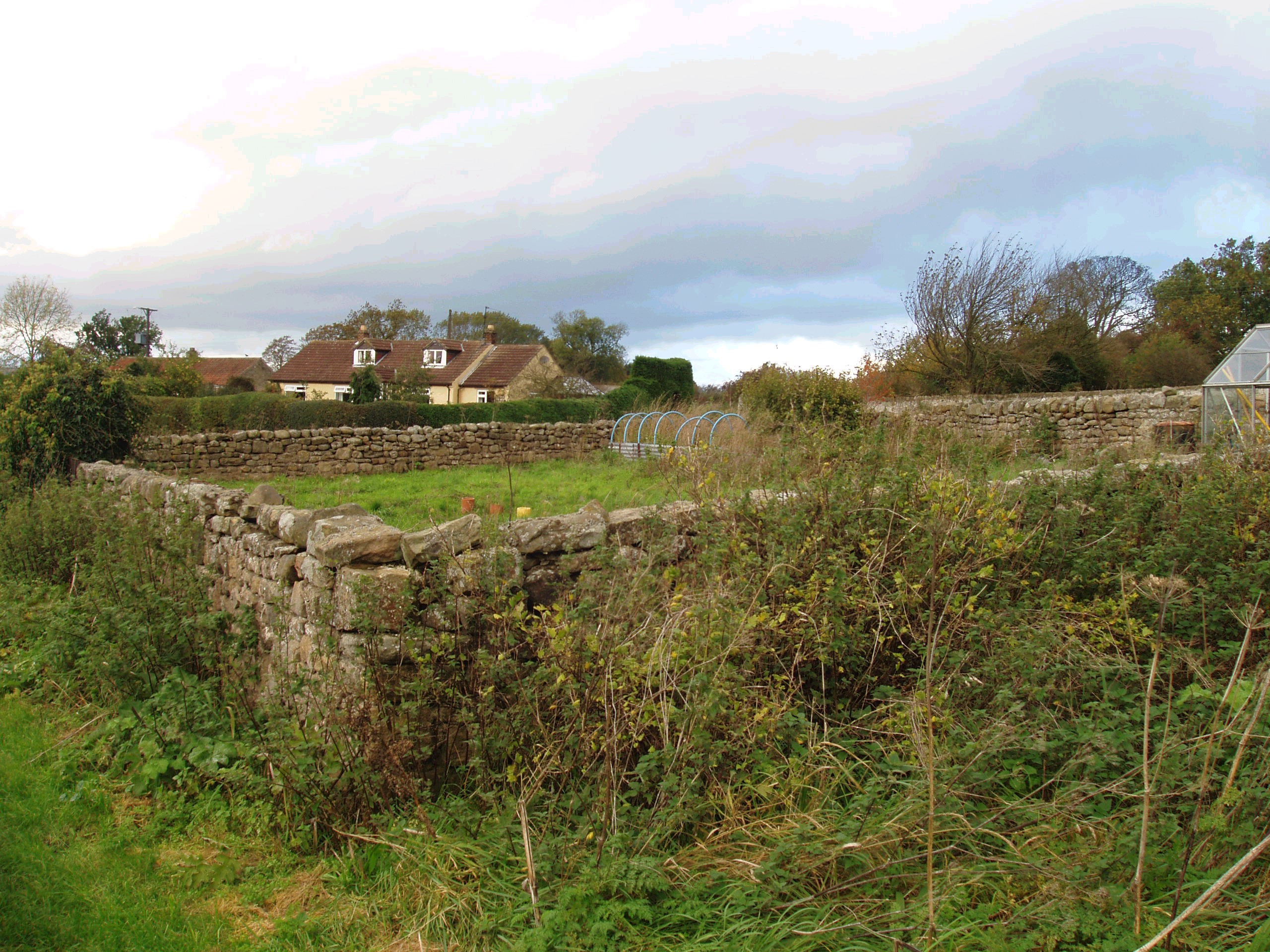
Tarvin, Cheshire
Grid ref: 349124,366916 (approx)
The Pinford on Church Street was exposed when the Parish Council removed an old wooden shed, a sycamore tree and copious amonts of rubbish from the site. Only the remains of the walls are visible but is being maintained by the council as part of Tarvin's history. It is shown on the 1875 OS 1:2,500 map next to Ducker's Well. Contributed by John Lindop January 2014
Cornwall Pounds and Pinfolds
Chasewater, Cornwall
To do
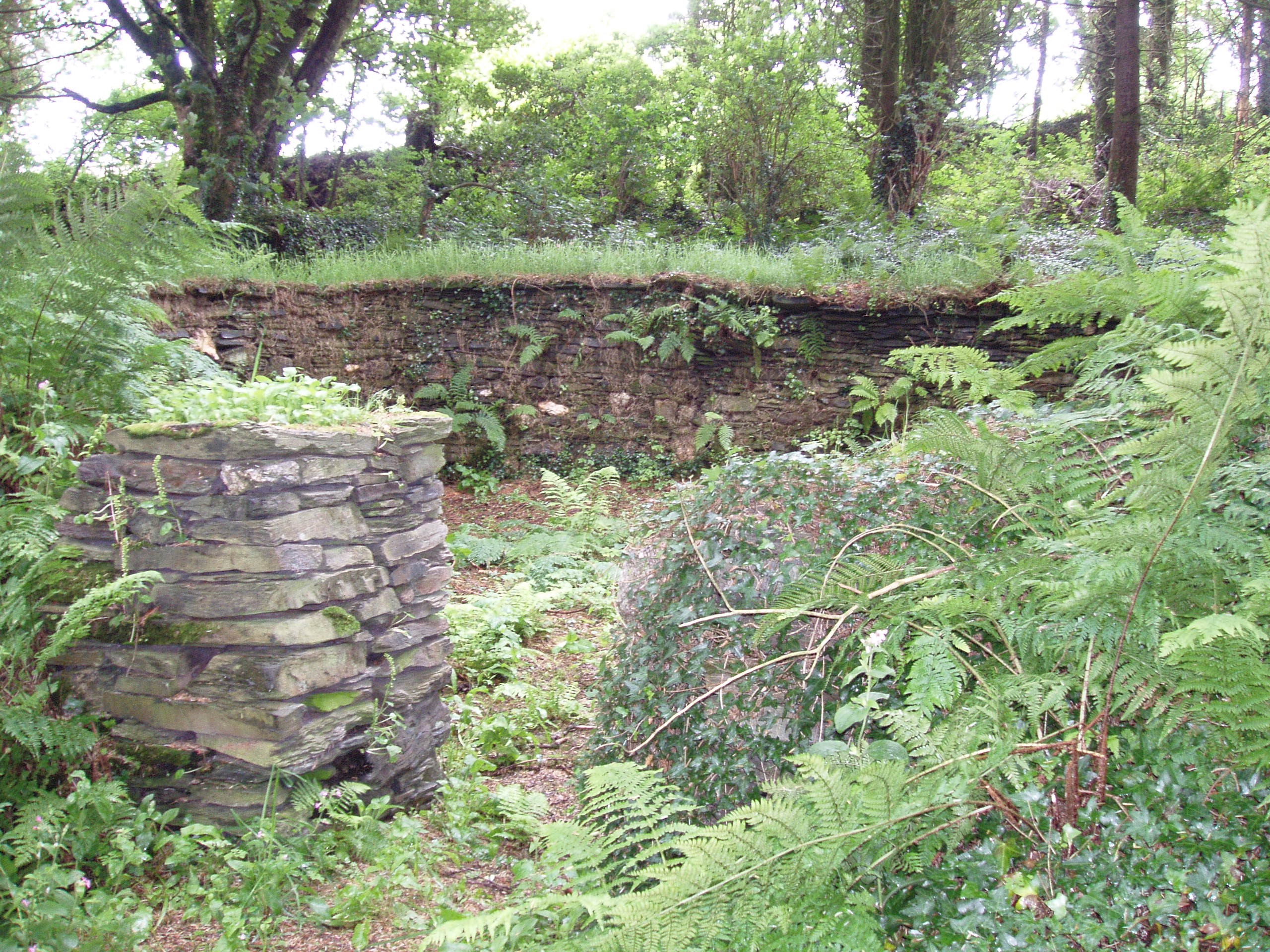
Lesnewth, North Cornwall
Grid ref: 213066,090307
This pound is remote and hidden away in the woods planted around 1940. It is approx. 100mtrs NE of the Old Rectory. It is an oval shape approx. 10 mtrs diameter and rivetted into the bank. Rubble and stone construction with walls approx 1mtr high. Not shown on OS maps but is Grade II listed.
Nigel Mills January 2014
Derbyshire Pounds and Pinfolds
Alstonefield, Derbyshire/Staffordshire border
Grid ref:
More likely a sheepfold.
Nigel Mills, May 2006
Bakewell, Derbyshire
Grid ref: 421266,368298
The site of this pinfold now houses a new Derbyshire stone house in Monyash Road. Conributed by Michael Trolove, October 2022
Biggin, Derbyshire
Grid ref:
To do
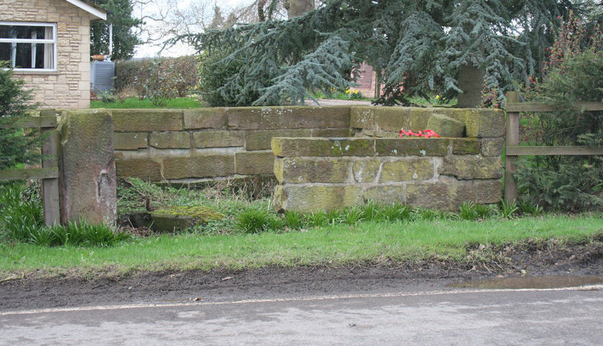
Curbar, Derbyshire
Grid ref: 425022,374574
On the 1898 OS 1:2,500 map this structure is named uniquely as a Penfold. It is circular, situated in Curbar Lane at its junction with Pinfold Hill. Walls are approx. 2 mtrs high and a smart white painted farm gate secures the entrance. The space inside houses several buildings and the surrounding overgrown foliage make it easy to miss.
Nigel Mills May 2006
Eyam, Derbyshire
Grid ref: 421336,376715
The village of Eyam is historically the Plague Village and has much to see on this subject as well as other historical aspects of this significant village. A commemorative plaque explains that the village pound was sited where the garden wall to several properties now stand in Tideswell Lane. The Pinder was Marshall Howe, the sexton. Shown on the 1898 OS map but it is now difficult to identify the original site. Contributed by Michael Trolove, October 2022
Dorset Pounds and Pinfolds
- Lost Dorsetshire Pounds and Pinfolds.xlsx
- Click here to see lost Dorsetshire Pounds and Pinfolds not included below.
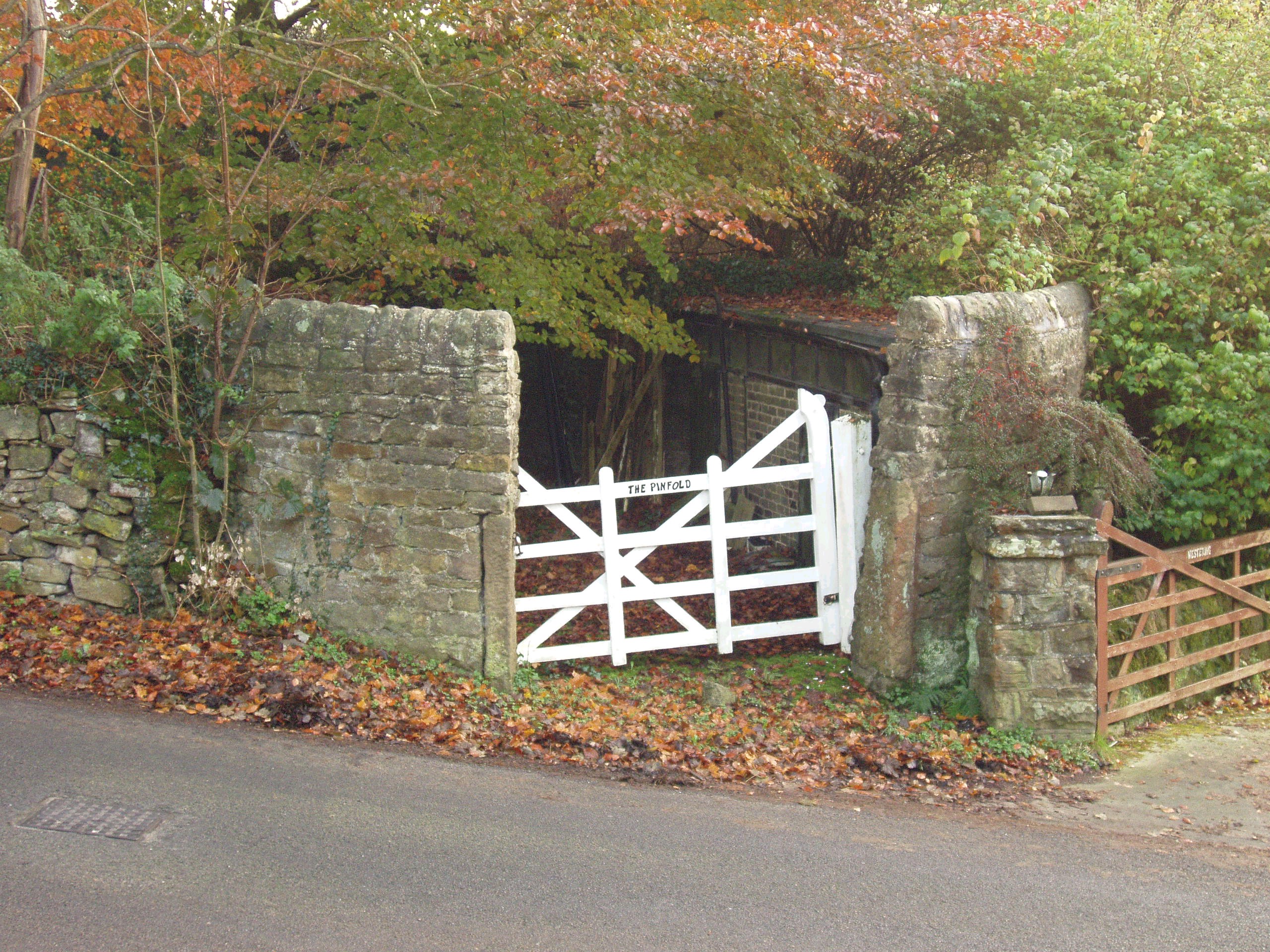
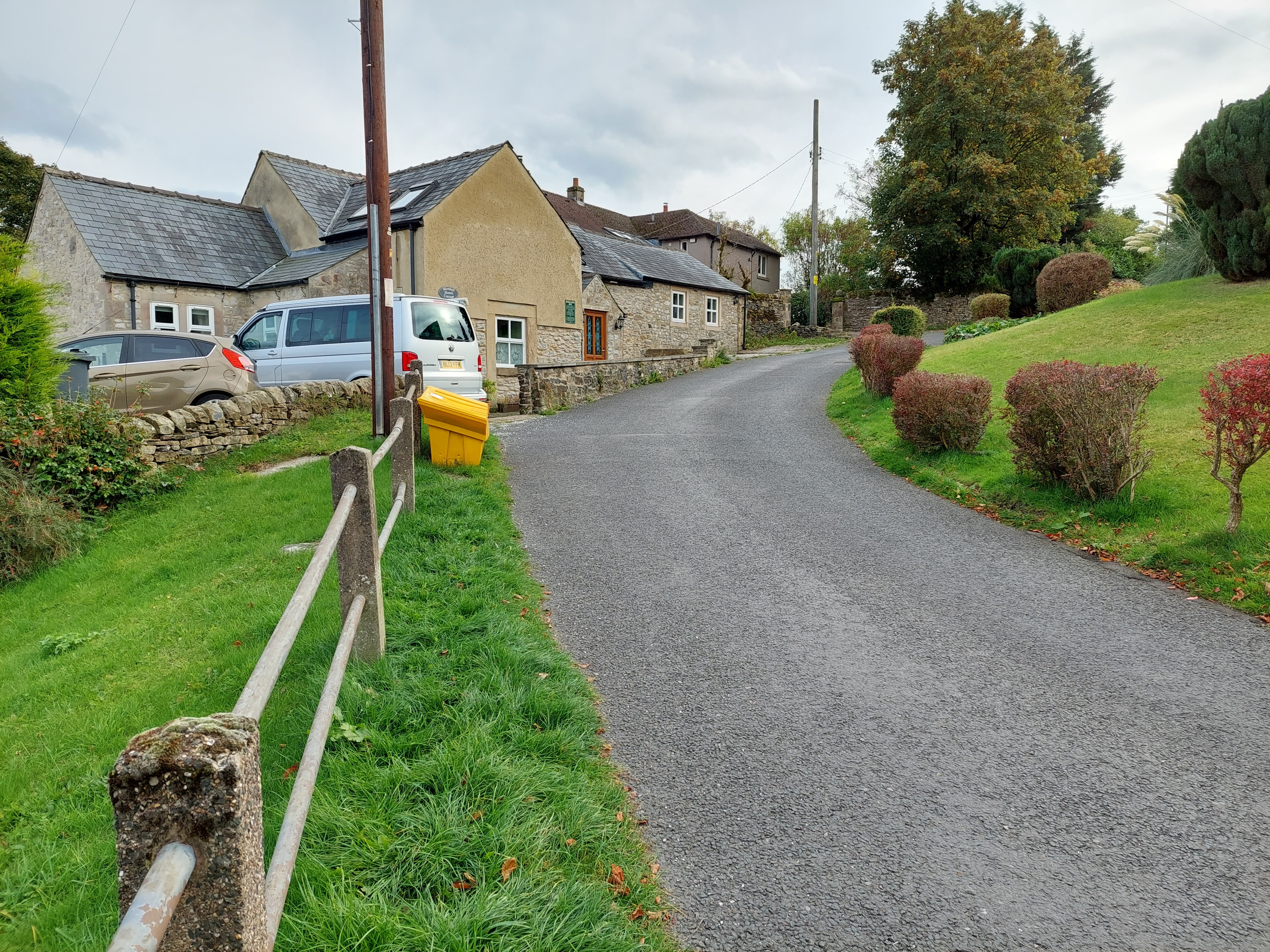
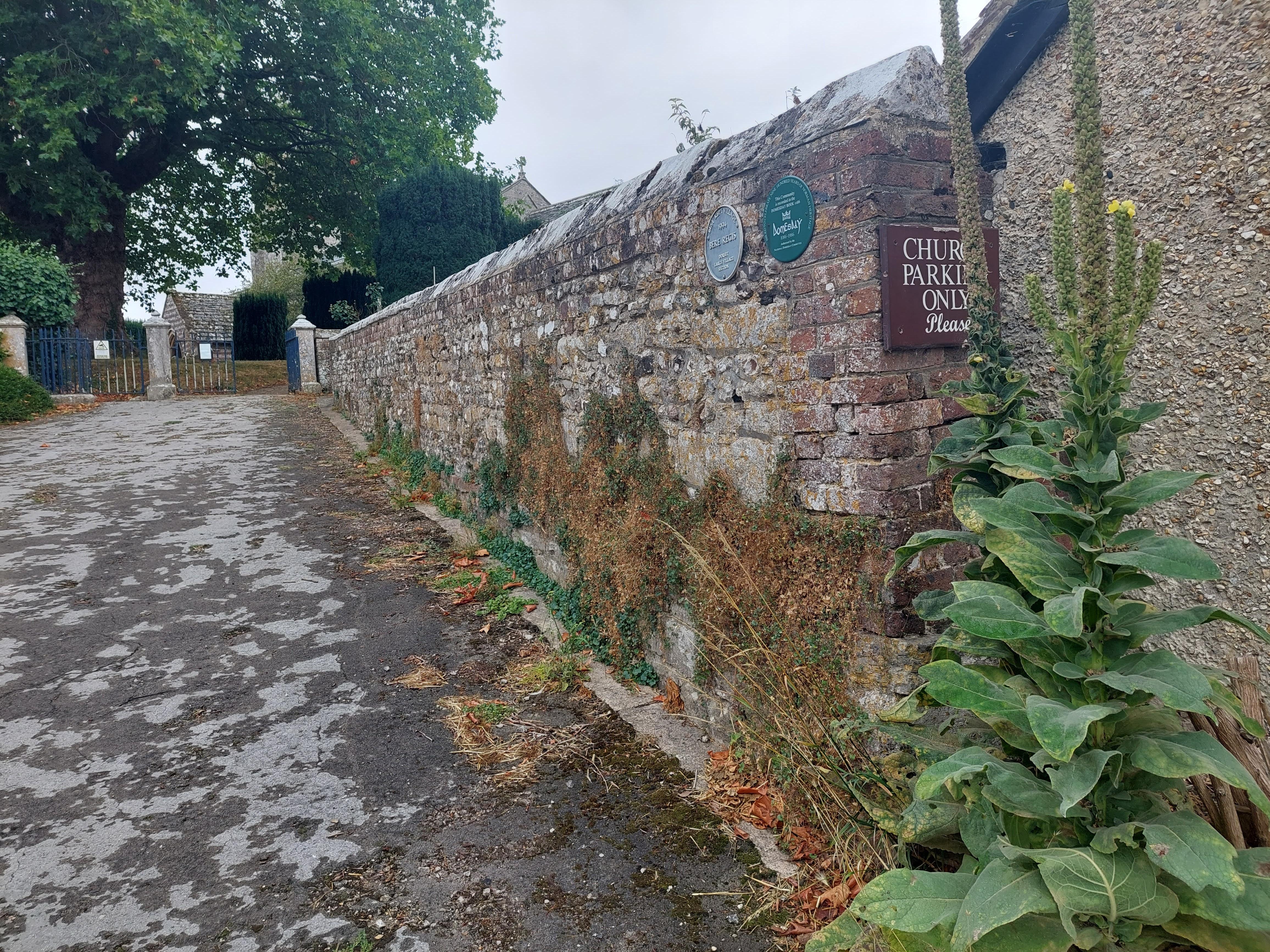
Bere Regis, Dorset
Grid ref: 384774,094734
Now part of a private garden the 2 mtr high walls still stand as shown on the 1887 OS map. Close to the church on Southbrook. Contributed by Miachael Trolove, September 2022
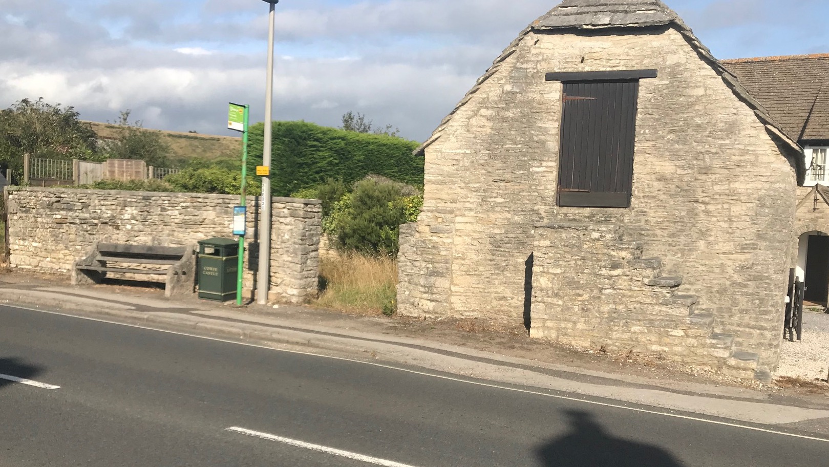
Corfe Castle, Dorset
Grid ref: 396278,081672
Situated on the southern end of East Street alongside the road this open well kept pound still remains in its 1901 OS map location and kept in great condition. Approx. 12 ntrs by 12mtrs and 2 mtrs high the interior is overgrown but the walls in good condition. Adjacent house is named The Pound. Nigel Mills.
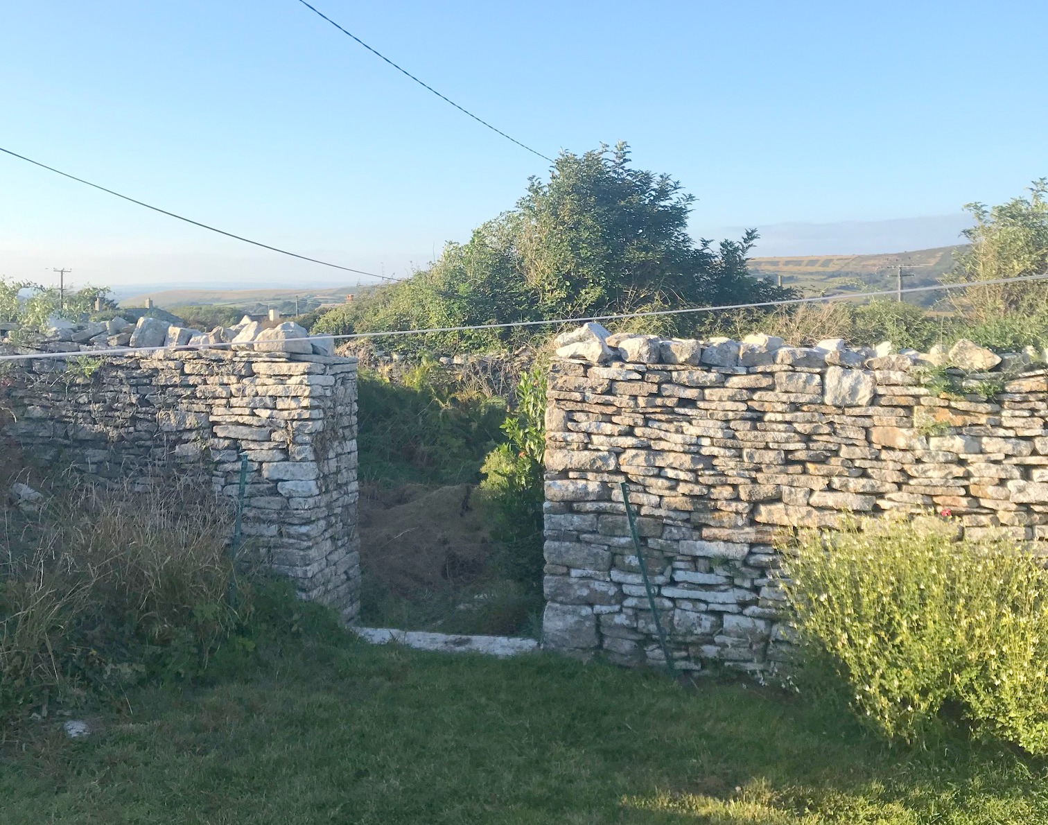
Langton Maltravers, Dorset
Grid ref: 399192,078792
Shown on the 1901 OS map as a pound, with several compartments, in an area known as Court Pound. Research needed to clarify this naming. Located to the west of Langton Matravers on the lane named Castle View. Contributed by Michael Trolove, September 2022
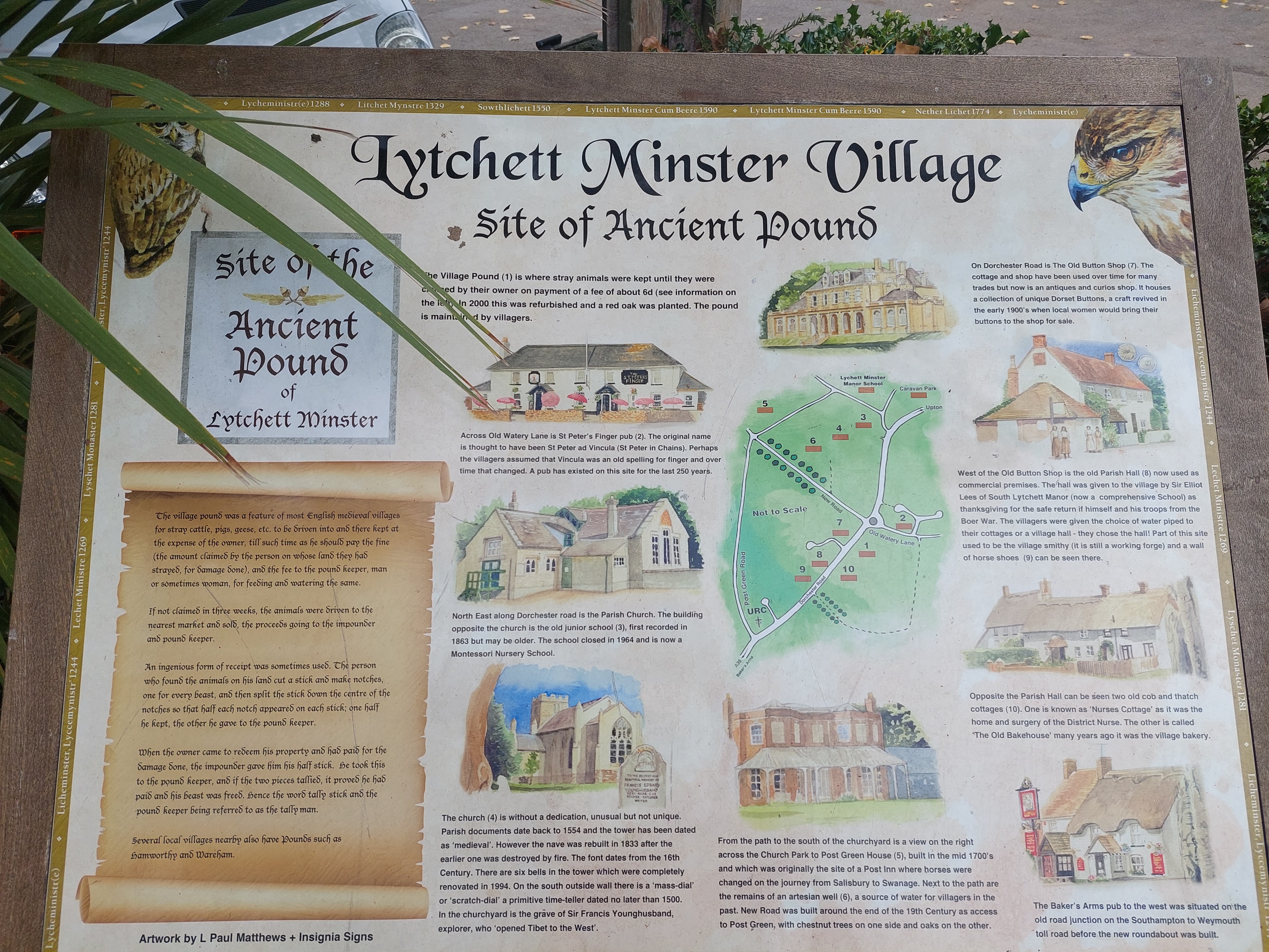
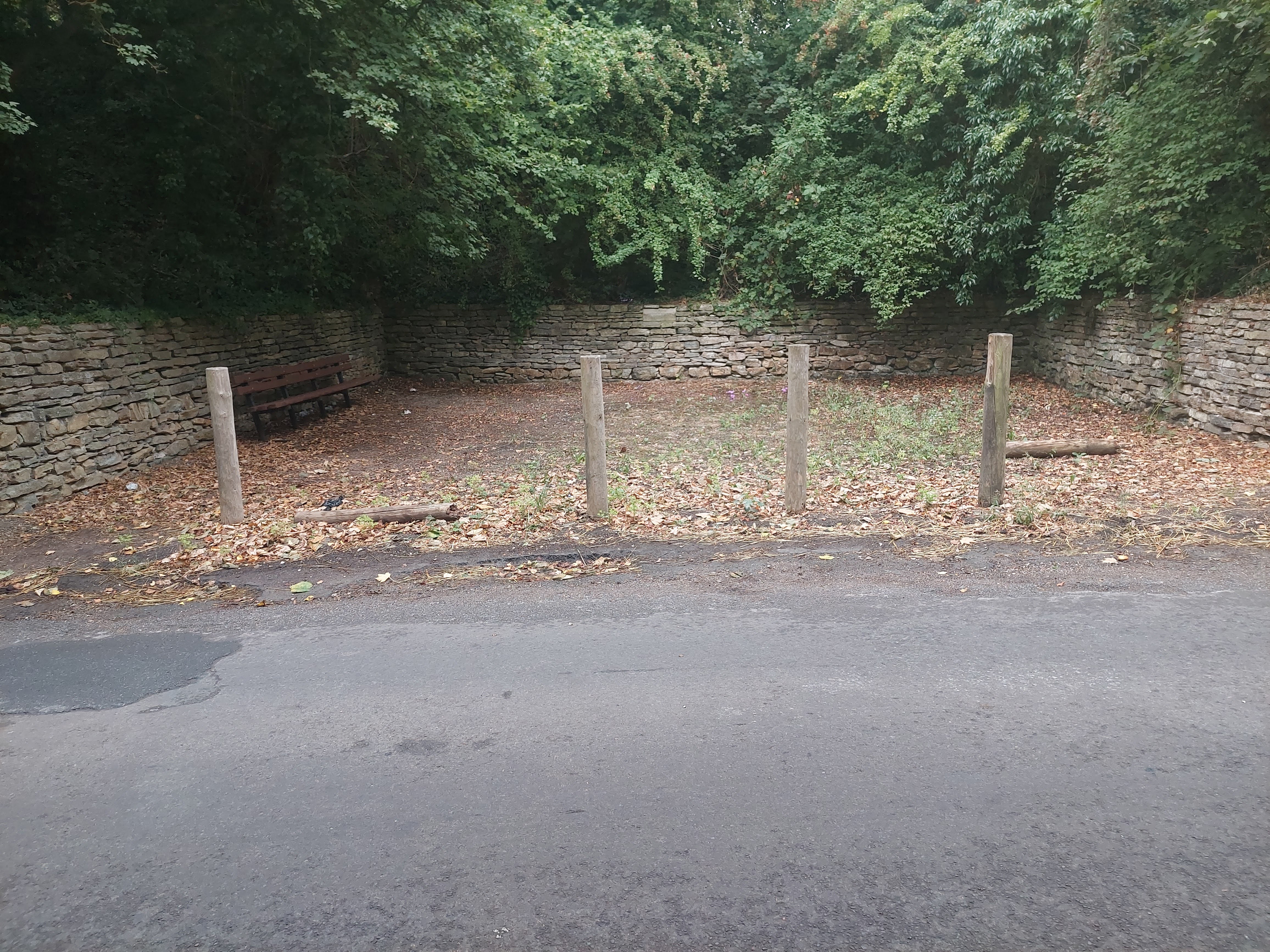
Lytchet Minster, Dorset
Grid ref: 396077,092890
The site is preserved and contains an interpretive board and an area open to the public. Named as a pound on the 1924 OS map. Contributed by Michael Trolove, September 2022
Okeford Fitzpaine, Dorset
Grid Ref: 380514, 110607
A rebuilt pound in memory of the original on the 1902 OS map and measures approx. 14mtrs by 12mtrs. Made of Purbeck stone it has one wall removed, a memorial stone in one wall and a seat placed inside the pound. Sited to the south end of Higher Street. Contributed by Michael Trolove, September 2022
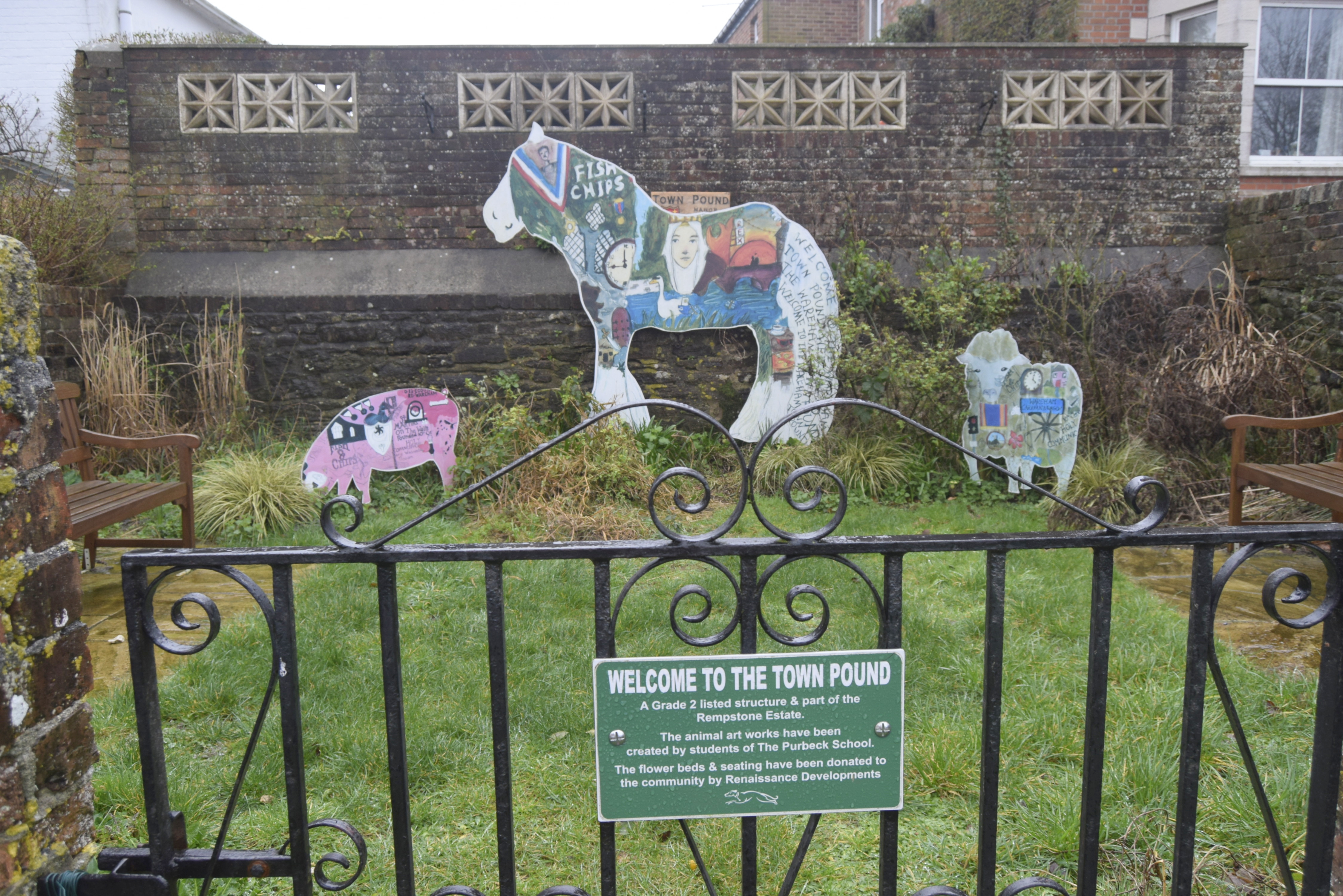
Wareham,
Dorset
Grid Ref: 392102,087251
A well used pound site by several community interests. Changed and rebuilt over the years but good to see it as a prominent feature and some historical notes of the notice attached to the modern gate. It is on the corner at the Pound Lane junction and West Street. Contributed by me, Pat Rowland and Michael Trolove.
-------------------------------------------------------------------------------------------------------------------------------------------------------------------------------------------------
Durham Pounds and Pinfolds
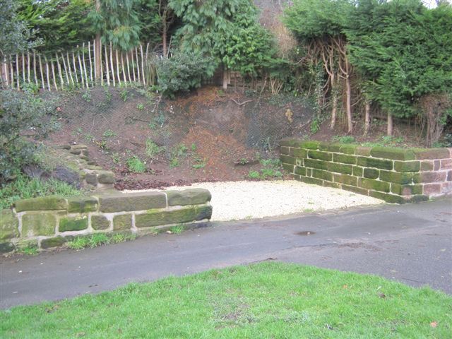
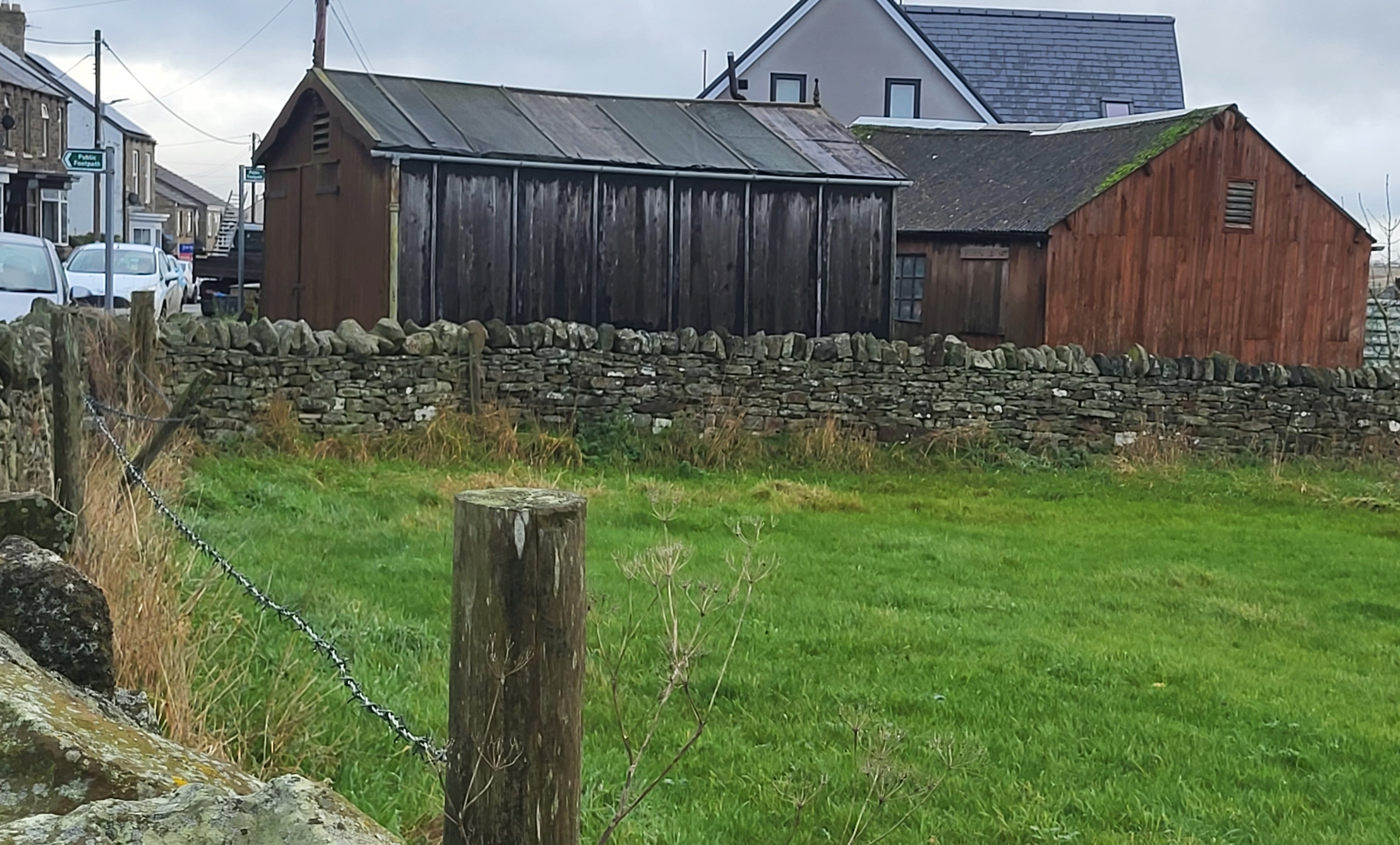
Butterknowle, Bishop Auckland, County Durham
Grid ref: 410162,525831
This site is named on the 1898 OS map as a pound and rectangular in shape. It now houses a stable and a shed, is owned by the Parish Council and let out to local residents. Contributed by Ray Willett November 2022
Headlam, Teesdale, County Durham
Grid ref: 417891,519000
This large low walled structure is in the centre of The Green, close to the site of Dumb Nanny's Well, a useful water source for the pinder. It is marked but not named on OS maps but has been recognised as a pinfold by gaining Grade II listed status. Currently used as a very productive garden.
Nigel Mills October 2006
--------------------------------------------------------------------------------------------------------------------------------------------------------------------------------------------------
Essex Pounds and Pinfolds
- Lost Essex Pounds and Pinfolds.xlsx
- Click icon to download sites lost and not listed below.
Messing, Essex
Grid ref: 589774,291061
On the 1892 OS map as a pound but its exact location could not be verified and no obvious signs were visible. Contributed by Michael Trolove, June 2022.
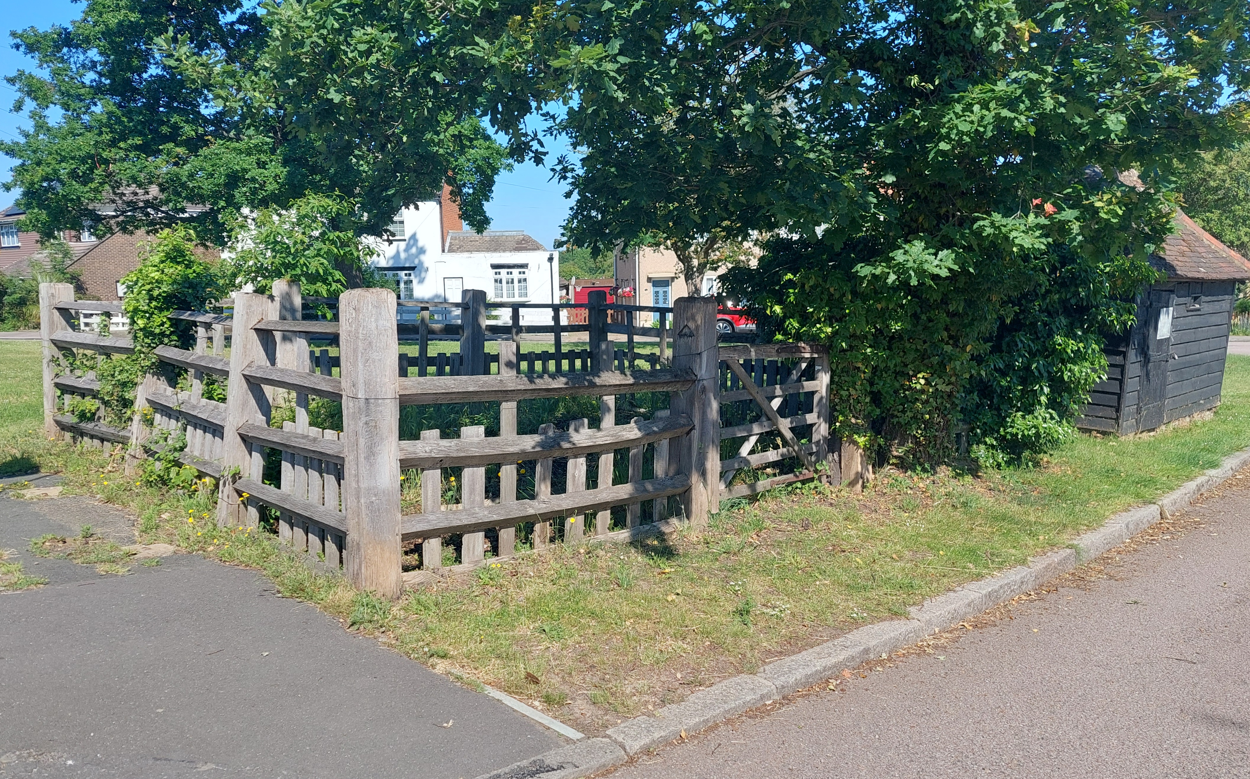
Orsett, Essex
Grid ref: 564270,181920
A large square pound on the 1867 1:2,500 OS map and now represented by a wooden structure at the junction of Pound Lane (formerly Maltings Lane) with High Road. Early pounds were made of local material like wood if stone was not plentiful. This pound has even made it as a Francis Frith postcard! Contributed by Michael Trolove, June 2021
South Ockenden, Essex
Grid ref: 559510,183020
On the 1866 and on later maps as recent as 1960 this square pound is marked and named at the north east corner of The Green. Today it is difficult to identify from the additional brickwork on the site. Contributed by Michael Trolove, June 2021
Tolleshunt D'Arcy, Essex
Grid ref: 592725,211558
A pound is shown at the junction of Maldon Road and Church Street on the 1881 OS map but no trace found. Conributed by Michael Trolove, June 2022