Pounds and Pinfolds
National Register of Pounds and Pinfolds ---- Part 5
This is a WORK IN PROGRESS as I am gradually replacing the one line entries with more information and, where possible, images. If you know of a pound or pinfold listed or not listed please get in touch with me so that I can complete the Register entry. Please see my comments at the start of Register 1 to help you navigate these Registers.
Grid references: Grid reference X and Y coordinates given. For a 6 digit grid reference read e.g. 317391, 5506847 as 173506. Or enter 12 digit references in www.old-maps.co.uk or www.streetmap.co.uk. Contributions from other than the author are given for each entry.
--------------------------------------------------------------------------------------------------------------------------------------------------------------------------------------------------
Yorkshire Pounds and Pinfolds
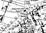
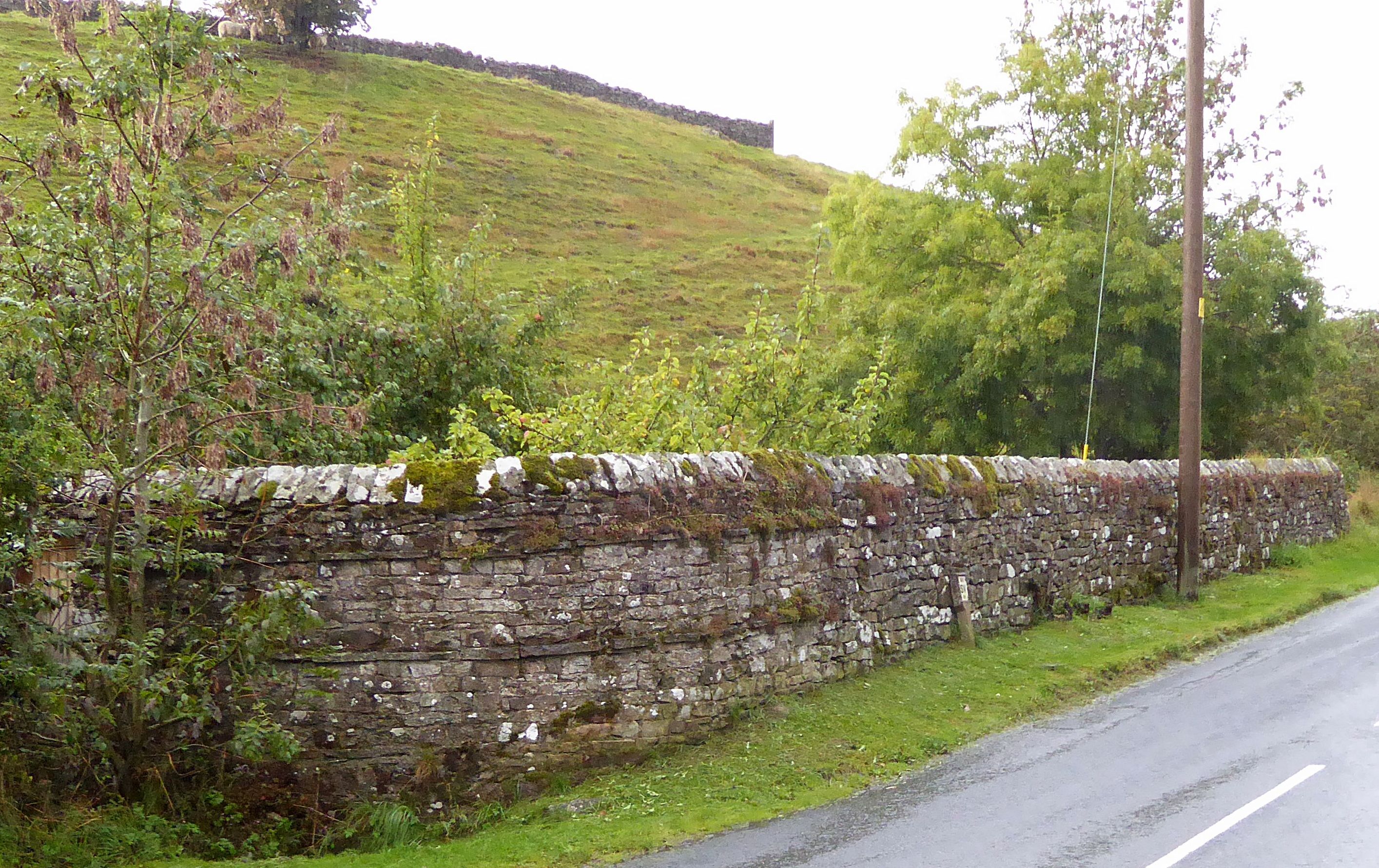
Austwick, Settle, North Yorkshire. C
OS ref: SD766684 Grid ref: 376661,468414.
Located on the main street through the village adjacent to a stone bus shelter built on part of the original footprint of the pound. It is much altered but maintains its identity within the village. It is shown and named as a pound on the 1893 1:2500 OS Map. (Visited May 2019)
Bainbridge, North Yorkshire
Grid ref: 393438,490102?
Shown as a pinfold on the 1856 OS map changed to a pound on the 1893 OS map and not named but shown on the 1895 OS map. Unable to identify on visiting so further research needed.
Nigel Mills
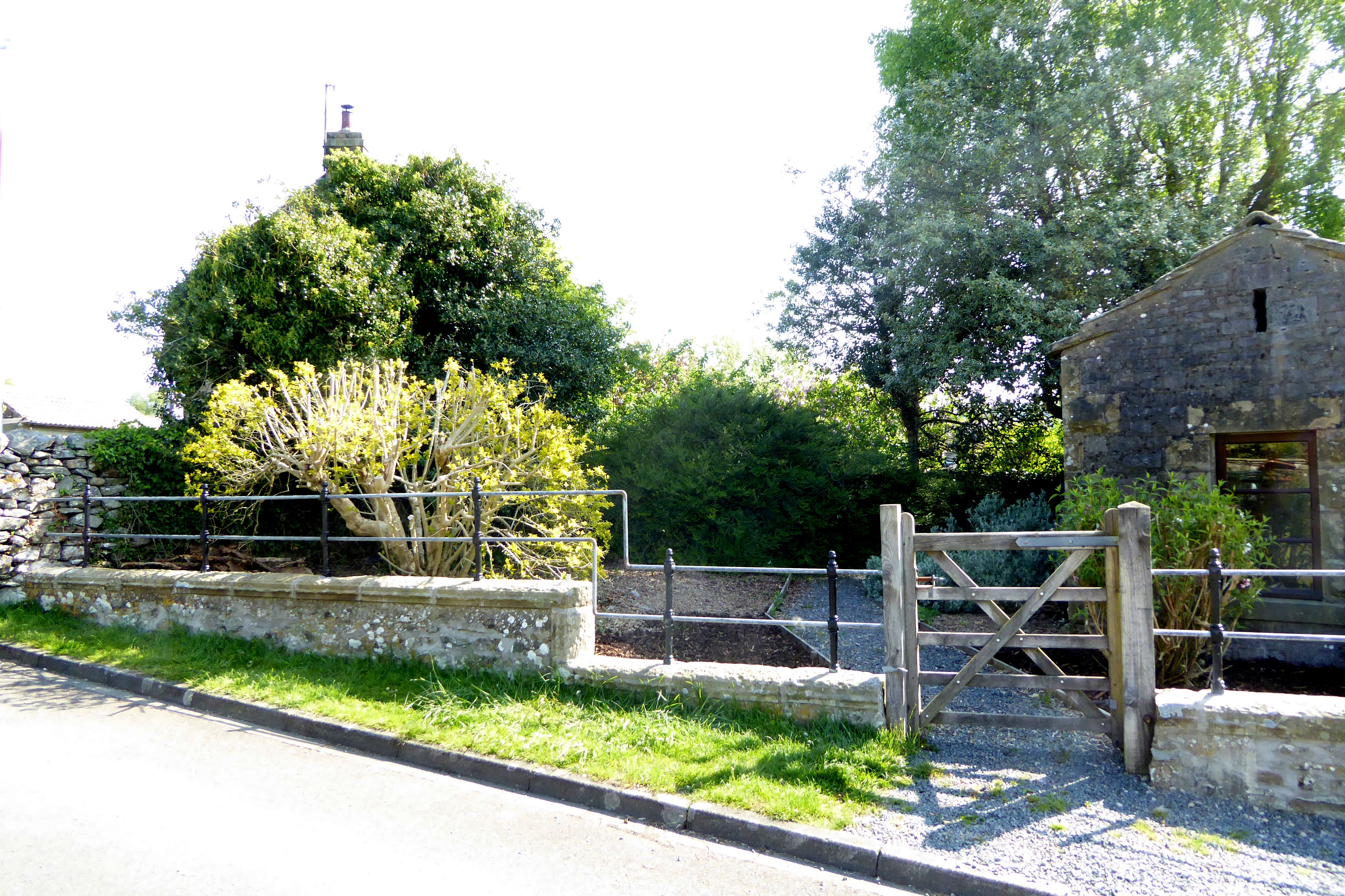
Birstwith, Harrogate, North Yorkshire. C
OS ref: SE244583 Grid ref: 424449,458305.
This large circular pound is overgrown but is in good condition and gated. Situated in a rural location at the junction of Hirst Lane and Swincliffe Lane. It appears to have been constructed between 1853 and 1891 as a pinfold is shown further along Swincliffe Lane on the 1853 OS map and on the 1891 OS map a pound at the current location. (Visited April 2019)
Carperby, Wensleydale, North Yorkshire. S
OS ref: SE009899 Grid ref: 400957,489985.
Referred to in Conservation Area Character Appraisal by Yorkshire Dales NPA in March 2001 but no trace of structure found on visit January 2020.
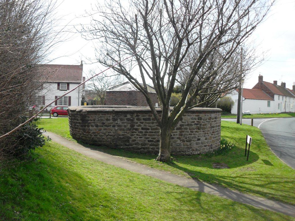
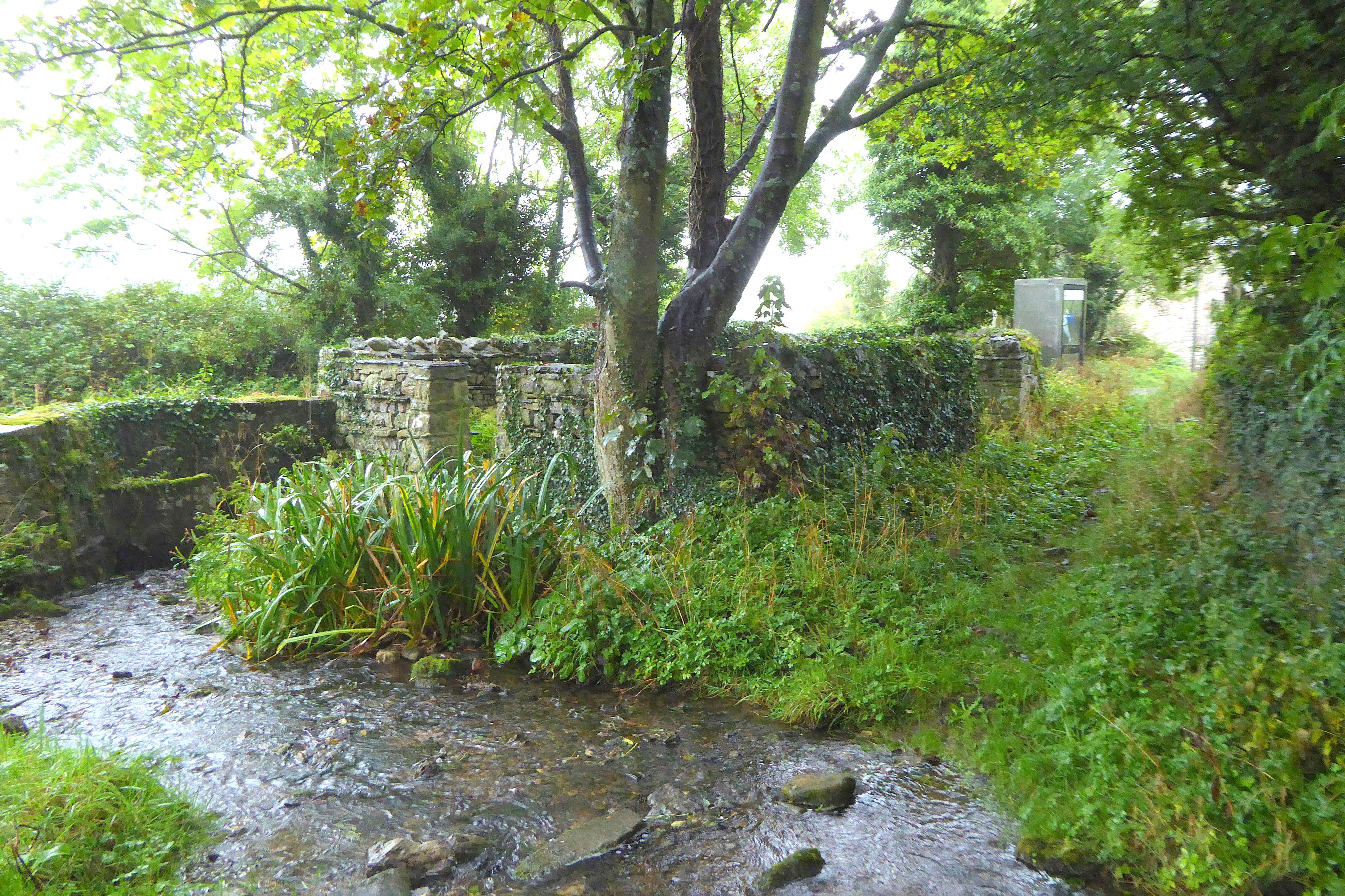
Coniston Cold, Skipton, North Yorkshire. C
OS ref: SD900549 Grid ref: 390046,454952.
Located in a rural location on Moorber Lane, Coniston Cold. Shown on OS 1852 map as a circular pinfold and the 1896 as a pound. The pinfold appears to have been added in the 20th century. In its current form it is much changed by the addition of a small stone building adjoining it. Both the building and the pinfold are secured against access but the pinfold, which is now incorporated has a curved boundary wall to the west and has been in use as a play area and garden. It is stone built with a lintel over a wooden door. A stream runs alongside the boundary just outside of the west end of the pinfold. (Visited May 2019)
East Ayton, Scarborough, North Yorkshire. C
OS ref: 991484 Grid ref: 499105,484850
Located in Carr Lane and shown on 1854 OS 1:5,600 map. In excellent condition with barred wooden gate and is a well maintained village pound. It is listed and probably C18, upper course rebuilt c1980. Limestone rubble. Square enclosure with one rounded corner formed by wall approximately 1.5 metres high. The plaque reads:
East Ayton Parish Pinfold, This structure is the village pinfold where stray animals such as cows and sheep were once kept. It was the job of the Pinder, a village official, to round up the animals and keep them until collected by their owner who was then fined. Now one of the few examples left in the country, it dates from the 18th Century and was fully restored around 1980. As a Grade II listed building it is protected by law and as such it is an offence to damage any part of it. (Contributed by Ray Blyth, December 2020)
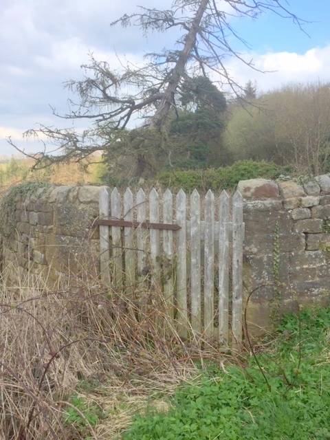
Eastby, Skipton, North
Yorkshire.
OS ref: SE 021544 Grid ref: 402150 454436.
Located at the east end of the village of Eastby on a sharp bend. It is a small irregular shape built of local stone and in a poor state of repair with walls depleted probably due to changes to road and private access routes. Present day access is over a small stream via a concrete slab and it is difficult to envisage its use as a pound or pinfold. It is named as a Pinfold on the 1853 1.10,560 OS map and a sheepfold on the later 1891 1.2,500 OS map.(Visited May 2019)
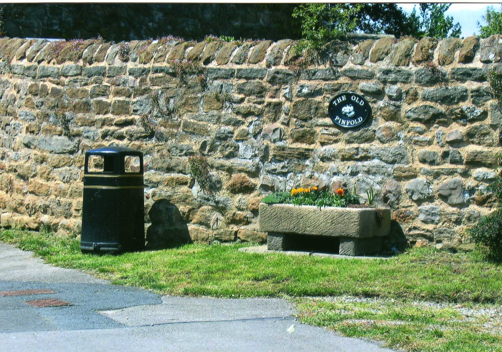
East Witton, North Yorkshire. P
OS ref: SE144859 Grid ref: 414456,485920.
Only one wall of the pinfold, named on the 1856 OS 1: 1.10560 map, remains. Site not shown on later OS maps. (Visited Sept 2019)
Galphay, Ripon, North Yorkshire. C
OS ref: SE251725 Grid ref: 425168,472501.
Located at the roadside to the south of the village. In great condition having been restored in 2002. Said to belong the Lord of the Manor of Kirkby Malzeard. (Image by Gordon Hatton)
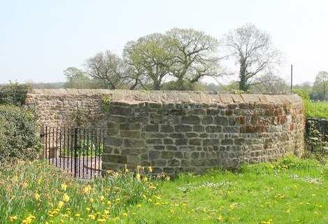
Hackness, Scarborough, North Yorkshire. C
OS ref: SE 965900 Grid Ref: 496500,490000.
A complete pinfold on Broxa Lane being used as a garden. Late C18. coursed rubble sandstone. Circular on plan. Walls approximately 1.5 metres high, finished with transversely-laid stones. Slatted gate on road.
In 2014 it was removed from the ‘at risk’ register.(Contributed by Ray Blyth)
Hunmanby, Scarborough, North Yorkshire. C
OS Ref: 101775 Grid ref: 510118,477535
Village Pound at the junction of Sheepdyke Lane and Stonegate. Shown on OS 1891 1:2,500 map as a pound. C18 with coursed rubble sandstone, brick upper courses and brick quoins. Circular enclosure to north-east of the Village lock-up formed by a wall approx 1.5 metre high with chamfered coping. Blocked entrance to rear of the lock-up.(Contributed by Ray Blyth)
Hunton, Bedale, North Yorkshire. C
OS ref: SE185923 Grid ref: 418517,492311
Restored pinfold, well maintained with stream in corner. Shown on 1892 OS as a Pound but later as a pinfold on the 1857 edition. (Contributed by Ian Tugwell 2008)
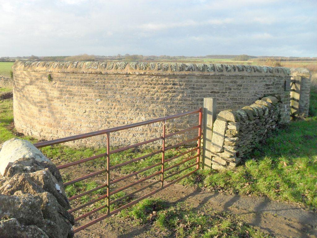
Hutton Buscel, Scarborough, North Yorkshire. C
OS ref: SE 971842 Grid ref: 497116,484269
This Manorial pound is C18, restored 1981. Built
of limestone rubble. Circular on plan. Wall approximately 1.7
metres high, with transverse shaped coping stones, with gate to
lane. A metal plaque reads: MANORIAL PINFOLD HUTTON BUSCEL, THE
PINFOLD WAS BUILT IN THE 18TH
CENTURY AND
USED BY THE VILLAGE PINDAR FOR IMPOUNDING STRAY STOCK UNTIL THEY
WERE CLAIMED BY THE OWNERS. RESTORED BY HUTTON BUSCEL PARISH
COUNCIL WITH AID FROM THE NORTH YORK MOORS NATIONAL PARK COMMITTEE
IN 1981.
Hutton-le-Hole, Pickering, North Yorkshire. C
OS Ref: SE 704901 Grid ref: 470493,490197
A circular pinfold on the edge of the moor in excellent condition. Named as a pound on the 1893 OS map.
Ilkley, Skipton, West Yorkshire P
OS ref: SE 117478 Grid REF: 411752,447862
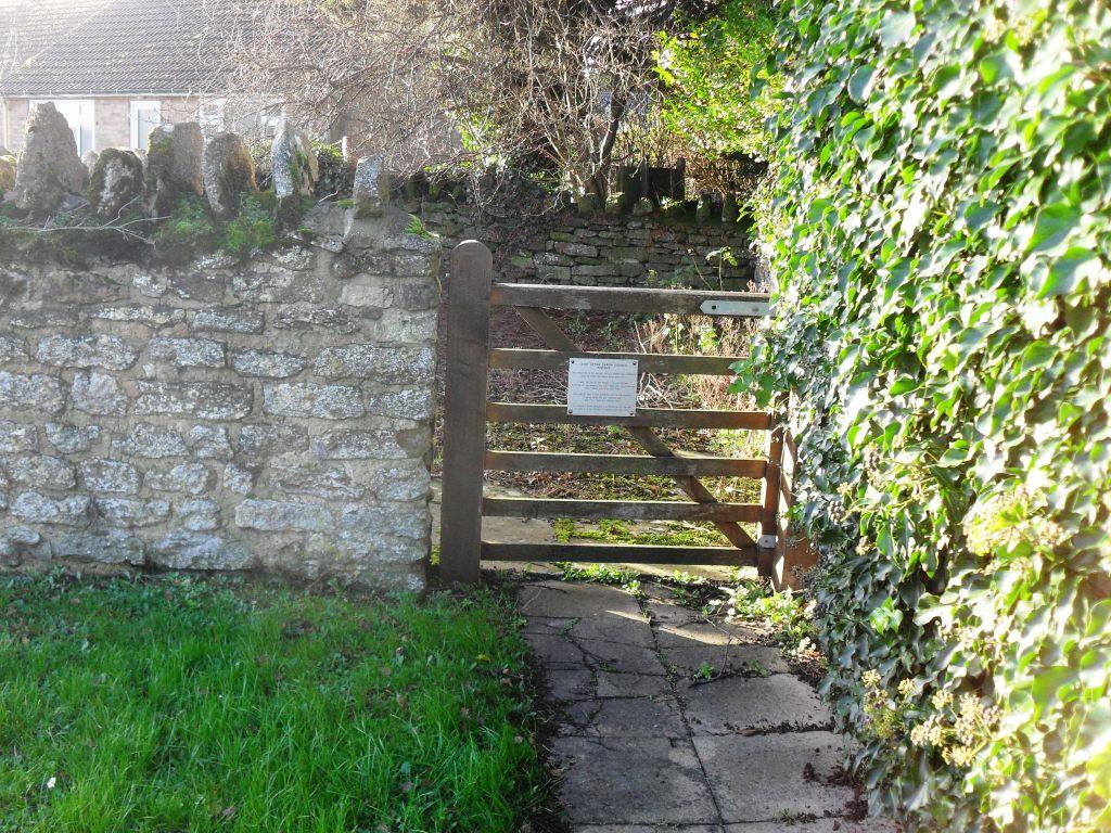
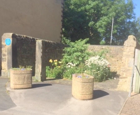
Situated in the centre of Ilkley in Weston Road and shown on the 1891 1:2,500 OS map and later maps but not named. A plaque states it was resited c 1869 to this site. It is has three walls and is used as a sitting area.(Visited May 2019)
Kirkby Malzeard, Ripon, North Yorkshire. C
OS Ref: SE230743 Grid Ref: 423060,474332.
Restored and now used as a garden. Located on the main street and shown and named as a pound on the 1892 OS map. (Visited March 2011)
Kirkheaton, West Yorkshire. P
OS ref: Grid ref: 418264,418170.
Since 1985 road widening and new housing has left just the front wall of this once circular and 8 mtrs diameter pinfold in Cockley Hill Lane. It is Grade II listed and shown on the 1854 OS map. (Visited November 2008)
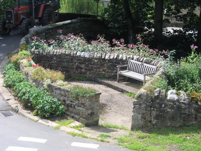
Laverton, Ripon, North Yorkshire. P
OS Ref: SE228733 Grid Ref: 422800,473300.
Located in the centre of the village at Laverton bridge and used as a public amenity. Only part of the original remains due to removal of original walls for road widening. It is shown as a pound on the 1891 1:2500 OS map. (Contributed by Martin Curzon)(Visited Mar 2011)
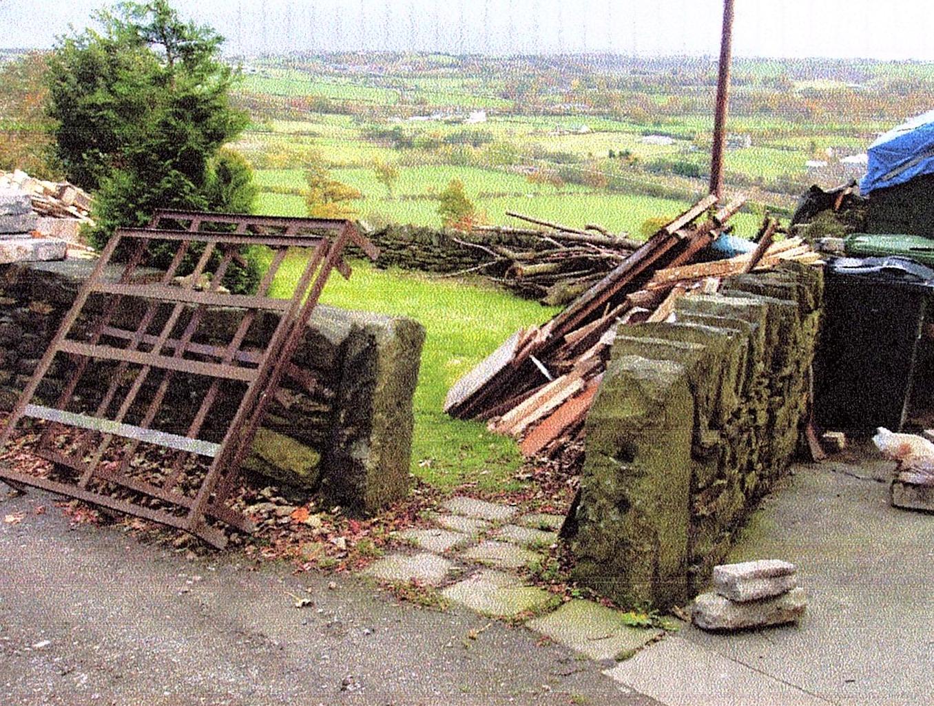
Linton (1) Skipton, North Yorkshire.
More detail required.
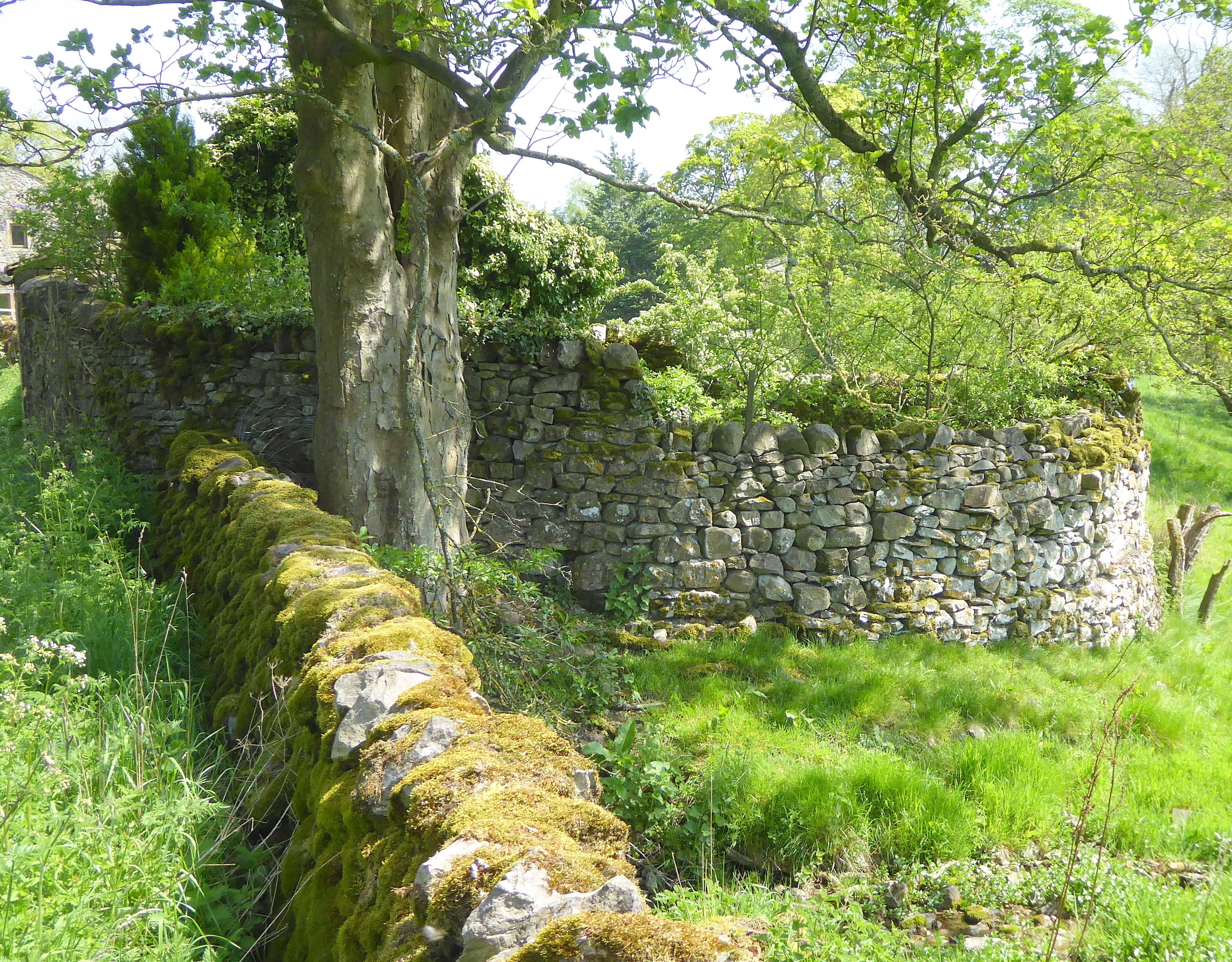
Linton (2), Skipton, North Yorkshire. C
OS Ref: SD997628 Grid ref: 399745,462838.
This low walled structure sits on part of the village green, just north of the village centre, alongside a beck which runs to the River Wharfe in this historic village. Local information revealed that this was and is an affluent village and the several folds in the village are said to have been used in their time as pounds. This one is well maintained as a garden and is privately owned. It is shown but not named on the 1891 1:2500 OS map. (Visited May 2019)
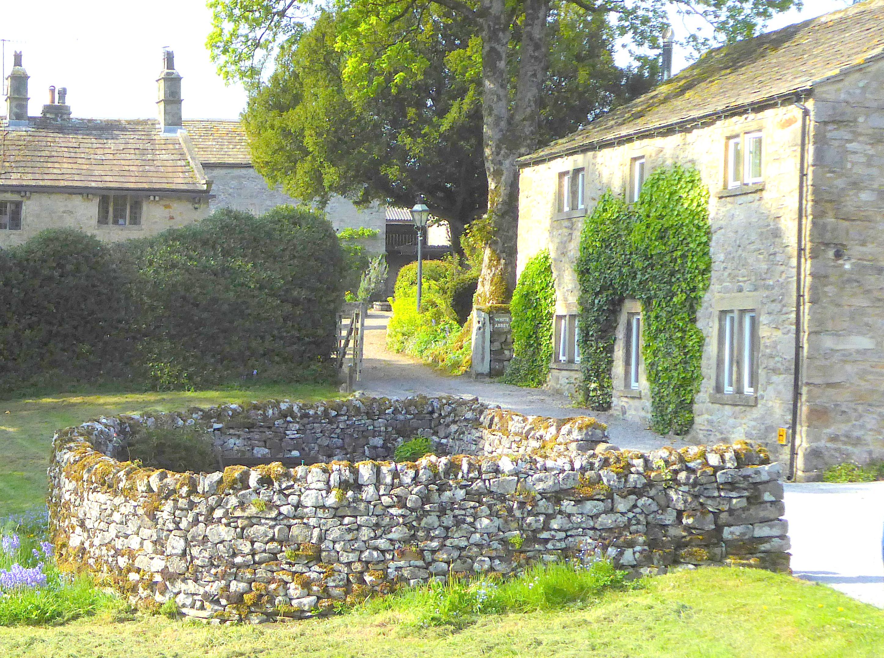
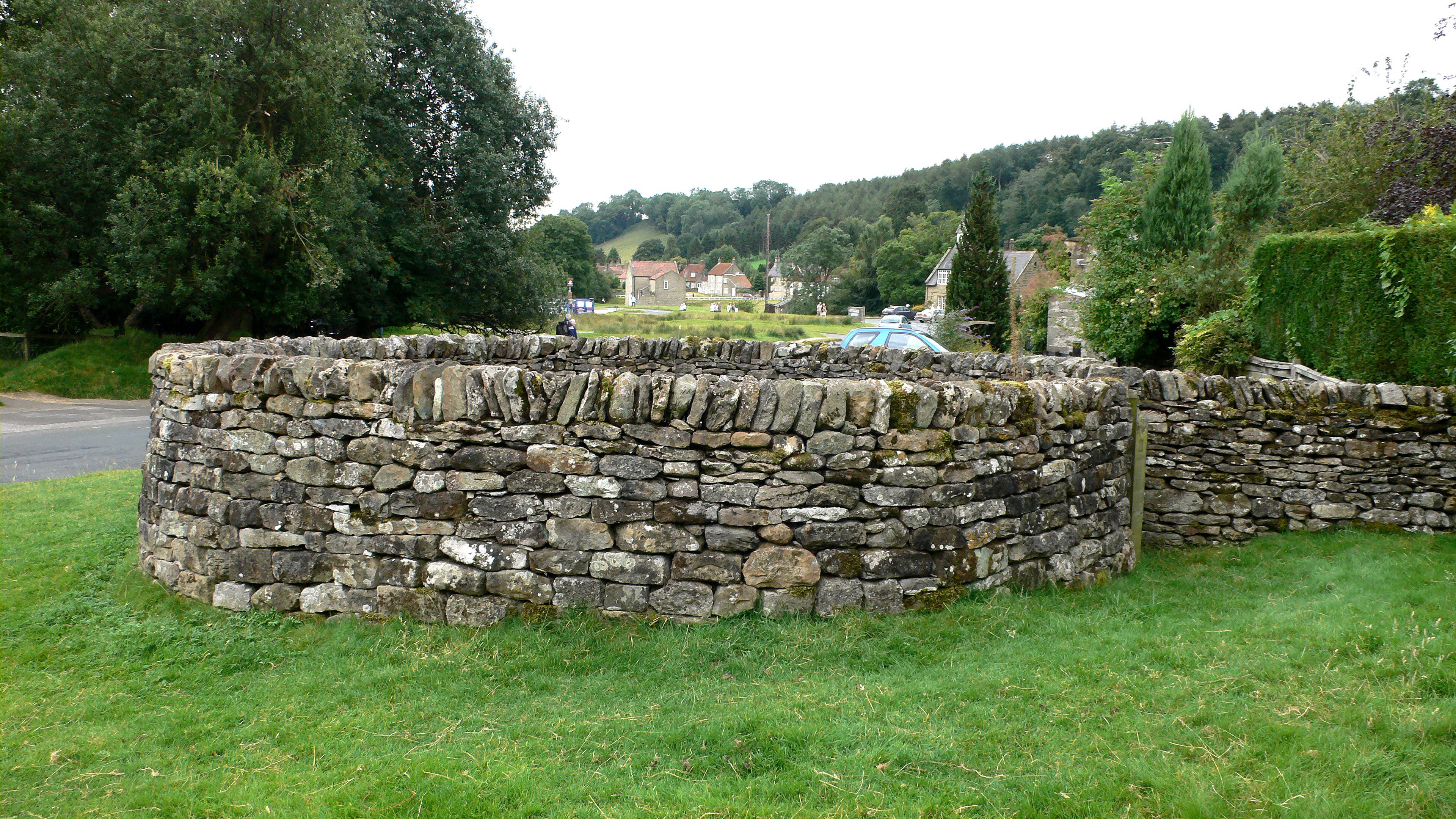
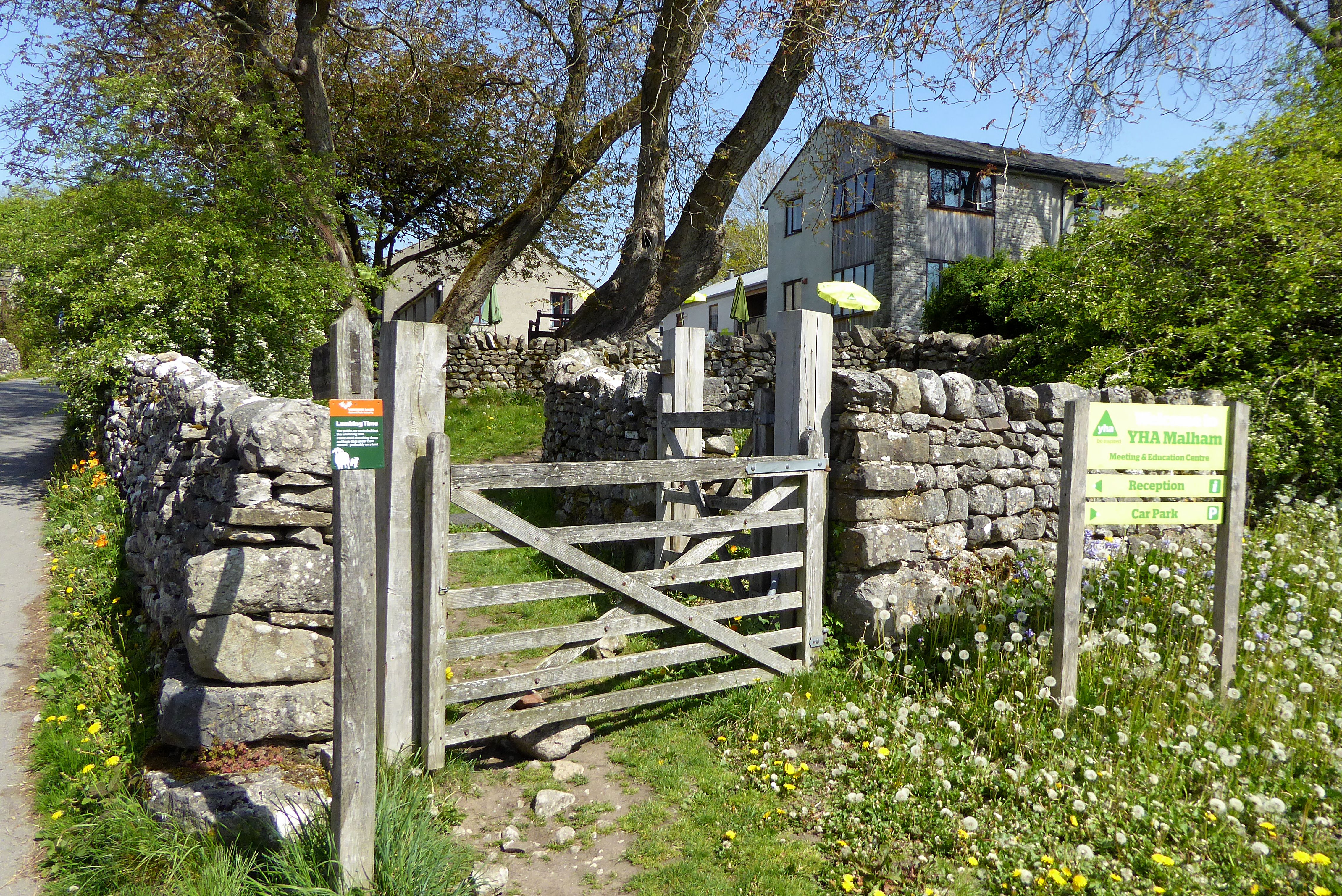
Malham (1), Skipton, North Yorkshire. C
OS Ref: SD901629 Grid Ref: 390149,462910.
Well preserved pinfold on Finkle Street with interpretive board and imaginative drawing of the pinfold in use. Unusually a twin cell pinfold which allowed separation of impounded stock. The quality of build and position, in the centre of the village, may mean it was the Manorial Pound although no natural water source was evident. It is indicated but not named on the 1894 1:2500 OS map. (Visited August 2019)
Malham (2), Skipton, North Yorkshire. C
OS Ref: SD902630 Grid Ref: 390264,463031.
This is a more typical rural pinfold situated at the north east edge of the village near the “Old Reading Room” It may have been the precursor to the larger and more accessible structure in the village. (See above) It is of the more traditional circular shape with a wooden gate. Now overgrown but still intact. Shown but not named on the 1894 1:2500 OS map. (Visited August 2019)
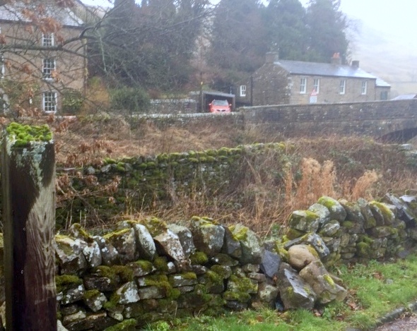
Muker, Swaledale, North Yorkshire. C
OS Ref: SD910978 Grid Ref: 391067,497830.
A well preserved pinfold at entrance to public car park and adjacent to the River Swale. Shown on the 1857 1:10,560 OS map as a Fold and on the 1893 1:2,500 as a Sheepfold. Overgrown with fallen wall. (Visited August 2019)
Newbiggin, Leyburn, North Yorkshire. C
OS ref: SD997855 Grid ref: 399722 485595.
A small pinfold and sheepwash beside the road and next to a stream from the Fellside. It is well kept and the location for an Easter time meeting. (more information sought please) (Visited August 2019)
Newby, Scarborough, North Yorkshire. C
OS Ref: TA015900 Grid ref: 501546,490069
Newby Farm Pinfold circa 1750 is now part of the farm complex. It has coursed rubble stone walls with cambered coping stones. Rectangular rounded corners formed by walls approximately 1 metre in height to the north and west, by the wall of the Quoits ground to the south, and of the barn to the east. Gate in north-west corner. Site not identified on OS maps.There is a date stone on barn 1675. (Contributed by Ray Blyth)
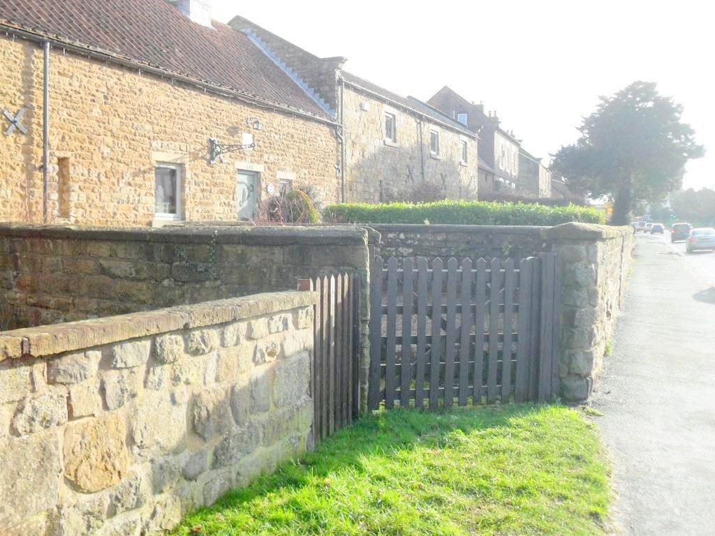
Ossett, Wakefield, West Yorkshire. C
OS Ref: SE276201 Grid Ref: 427656, 420180.
This pinfold is in West Wells Road at the rear of the houses. Shown on 1893 1:2,500OS map as a Pound. It is rectangular and stone built with heavy capping. One door is blocked and another opened up due to road widening. Now Ossett Civic Society have taken responsibility for its upkeep. (Contributed by Rachel Bentham) (Visited August 2008)
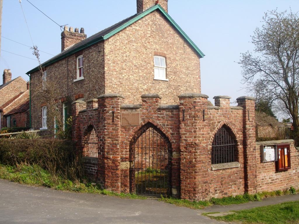
Raskelf, York, North Yorkshire. C
OS Ref: SE 491710 Grid ref: 449187,471030
This unique pound shown on the OS 1891 1:2,500 map is on the corner of West Moor Lane and North End. It is well kept and Grade II listed. Probable late C18 origin with reddish-brown local brick and stone coping. Cobbled floor sloping to central drain. Octagonal and castellated with angle piers to street side. Arched entrance and 2 window openings with iron gate and bars which date from the restoration in 1971. (Contributed by Ray Blyth)
Reeth, North Yorkshire. C
OS Ref: SE 037996 Grid ref: 403715 499600
Large irregular pound at the roadside. Well maintained with locked access. Shown on 1857 OS map as a pinfold with adjacent spring. Named as a pound on later OS maps. (Visited November 2019)
Shelley,Kirkburton, Yorkshire & Humber. C
OS ref: SE 206111 Grid REF: 420692,411142
A rectangular and banked pinfold altered to accommodate neighbouring property and owned by Kirklees Council. With its 2 monolith shaped gateposts and nearby manor house this may have been the manorial pound. Shown but not named on the 1893 OS 1:2,500 map. (Visited November 2008)
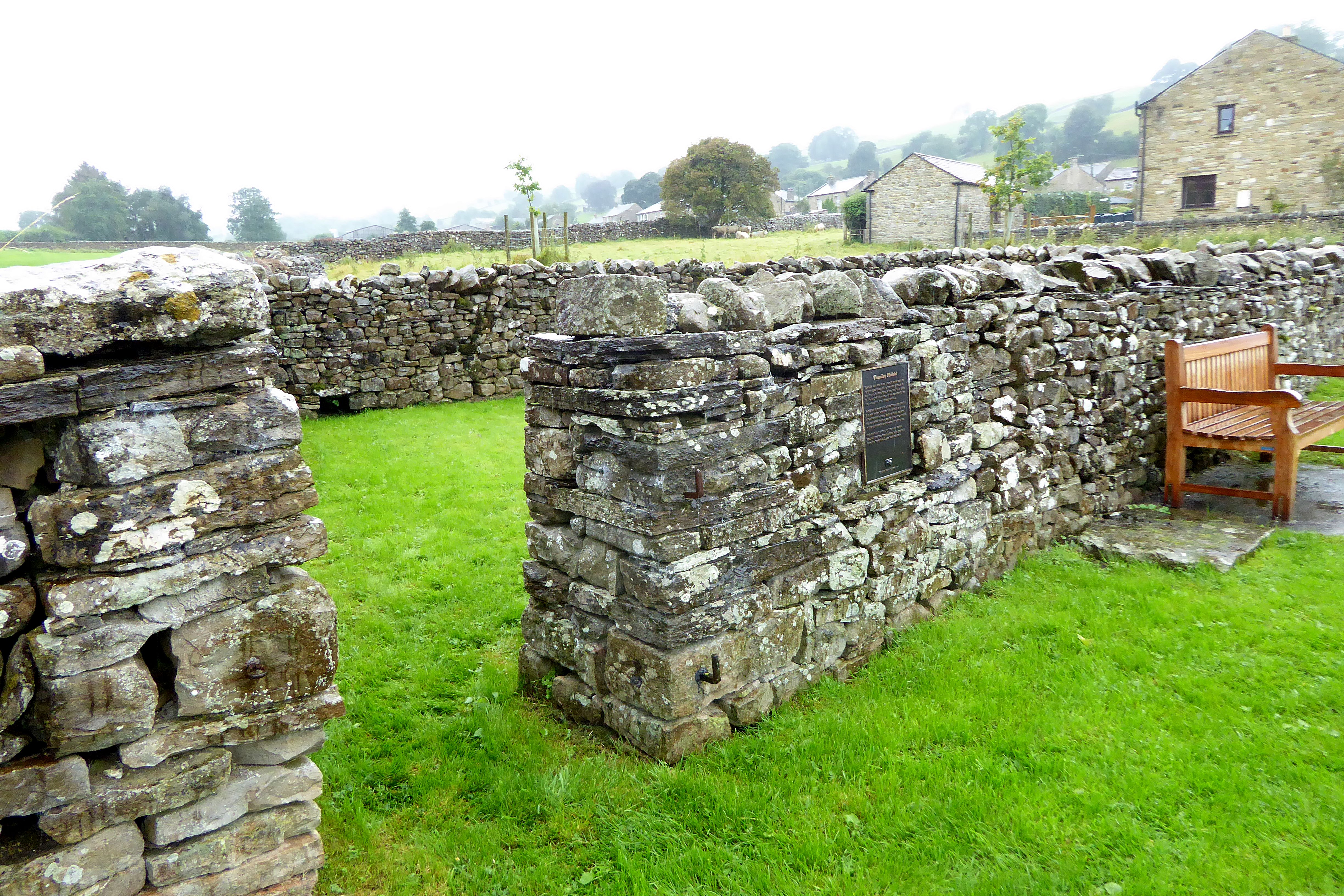
Thoralby, Leyburn, North Yorkshire. C
OS ref: SE 001867 Grid ref: 400124 486727
A large well maintained pinfold on edge of village green. Plaque quotes a 1483 record and suggests a pinfold may have been on a different site in the village. The structure is owned by the Parish Council and funded by Yorkshire Dales National Park. (Visited August 2019)
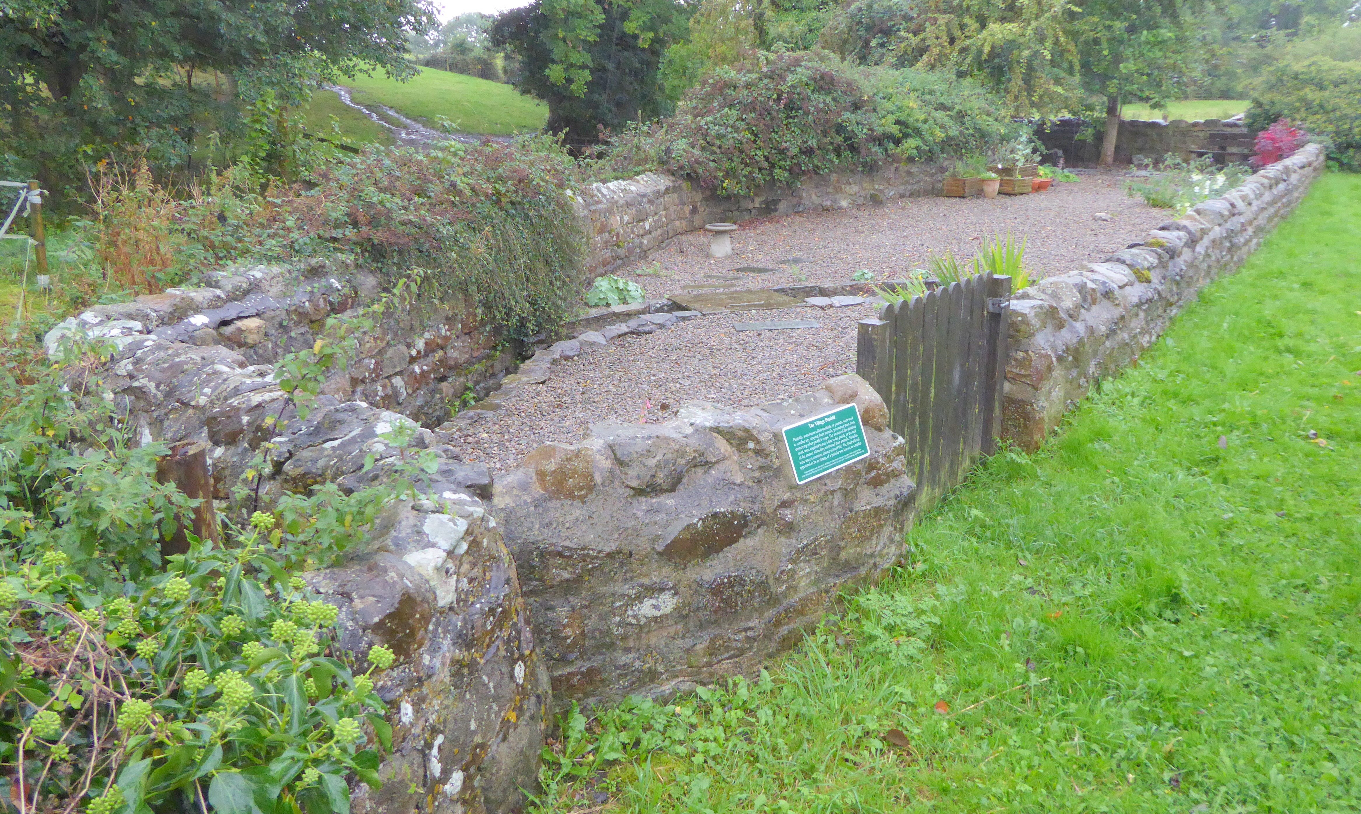
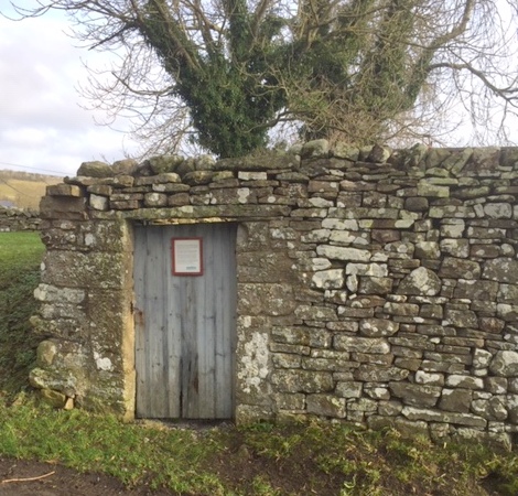
Redmire, Leyburn North Yorkshire. C
OS Ref: SE044913 Grid ref: 404463 491319.
A well maintained pound used for storage and with an interpretative plaque explaining its function in some detail affixed to the wooded door. (Visited November 2019)
Scalby, Scarborough, North Yorkshire. S
OS Ref: SC 010904 Grid ref: 501048,490484
The site of the Scalby pound is, unusually, on the 1854 OS 1:10,500 called a pinfold and on the 1892 OS 1: 2,500 called a pound. The second term is most commonly found on the earliest 19th century OS maps. The site has been redeveloped and the green on which it stood has disappeared. (Contributed by Ray Blyth)