Pounds and Pinfolds
National Register of Pounds and Pinfolds ---- Part 2
This is a WORK IN PROGRESS as I am gradually replacing the one line entries with more information and, where possible, images. If you know of a pound or pinfold listed or not listed please get in touch with me so that I can complete the Register entry. Please see my comments at the start of Register 1 to help you navigate these Registers.
Grid references: Grid reference X and Y coordinates given. For a 6 digit grid reference read e.g. 317391, 5506847 as 173506. Or enter 12 digit references in www.old-maps.co.uk or www.streetmap.co.uk. Contributions from other than the author are given for each entry.
--------------------------------------------------------------------------------------------------------------------------------------------------------------------------------------------------
Gloucestershire Pounds and Pinfolds
Broadwell, Moreton-in-Marsh, Gloucestershire
Grid ref: 420395,227514
Described as Old Pound on the 1885 1:2,500 OS map on the northern part of The Green in the centre of the village. The site is now private housing with no trace of the old structure. Nigel Mills May 2021
Charfield, Wotton-Under-Edge, Gloucestershire
Grid ref: 371773,191378
This pound is noted on the 1889 1:10,560 OS map and is now part of a private garden to the bungalow next to it, named not surprisingly, Pound View. It is approx. 8 mtrs square built of local stone. About two fields distant along the same lane is Poundhouse Farm. The Charfield Parish Council has suggested a possible link to the management of the pound by the farm in the 1800's but this has not been confirmed.
Contributed by Alan Hamer May 2006
Donnington, Moreton-in-Marsh, Gloucestershire
Grid ref: 419209,228048
Described in 1974 (Willmot Dobbie) "Drystone walling with vertical coping in good condition except north wall fallen with the farm providing the south wall. Used as garden and car standing". Adjacent to Weasel Barn Farmhouse the structure is shown but not named on any OS map. Now a garden, overgrown and walls have deteriorated. Nigel Mills May 2021
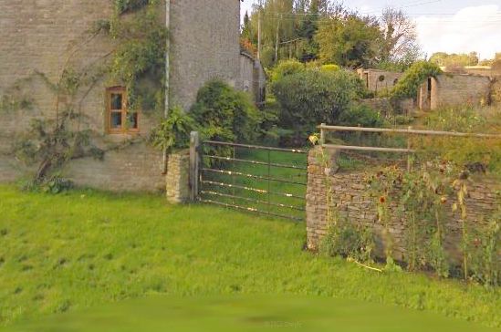
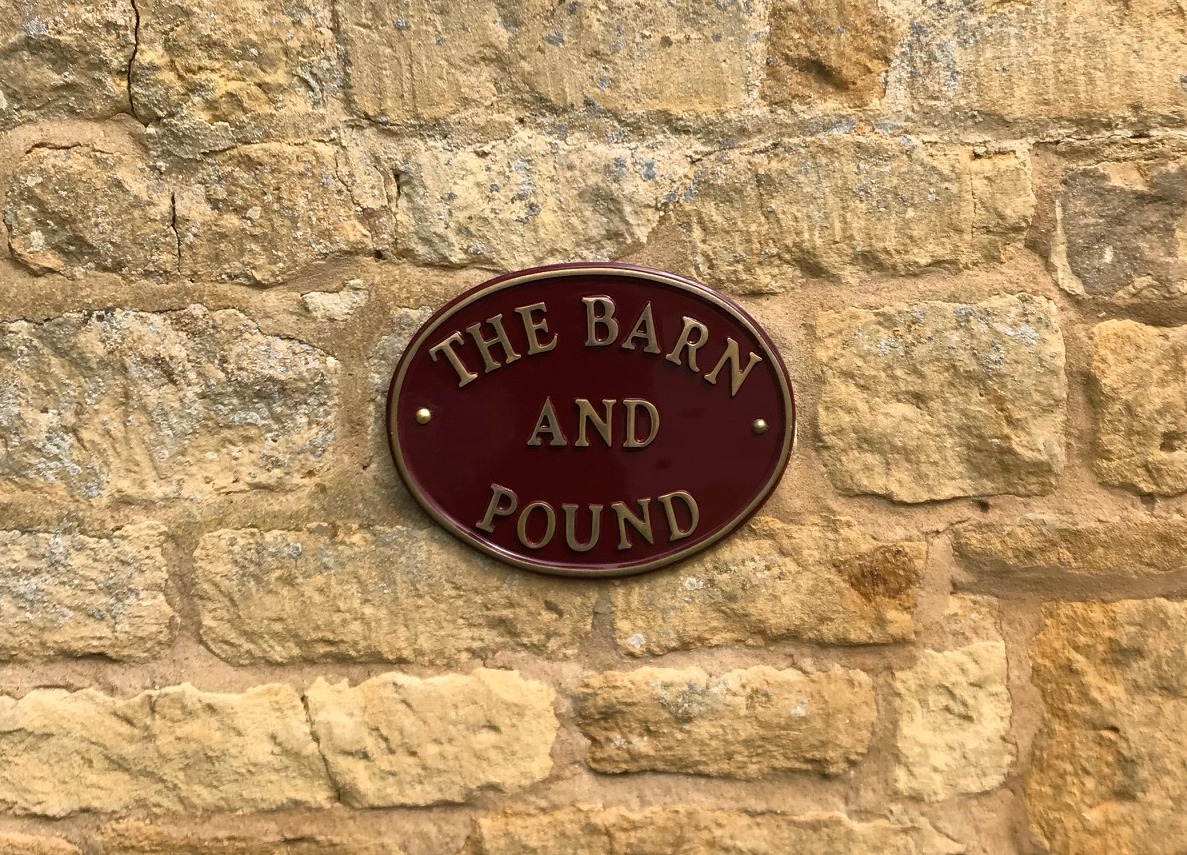
Saintbury, Broadway, Gloucestershire
Grid ref: 411690,240115
A small structure shown on OS maps from 1885 but never named as a pound. Opposite Middle Hill Farm on Buckle Street. Listed in 2003 as a stable and attached pound circa mid C18. Now the garden of "The Barn" with low walls and gated entrances. Nigel Mills May 2021
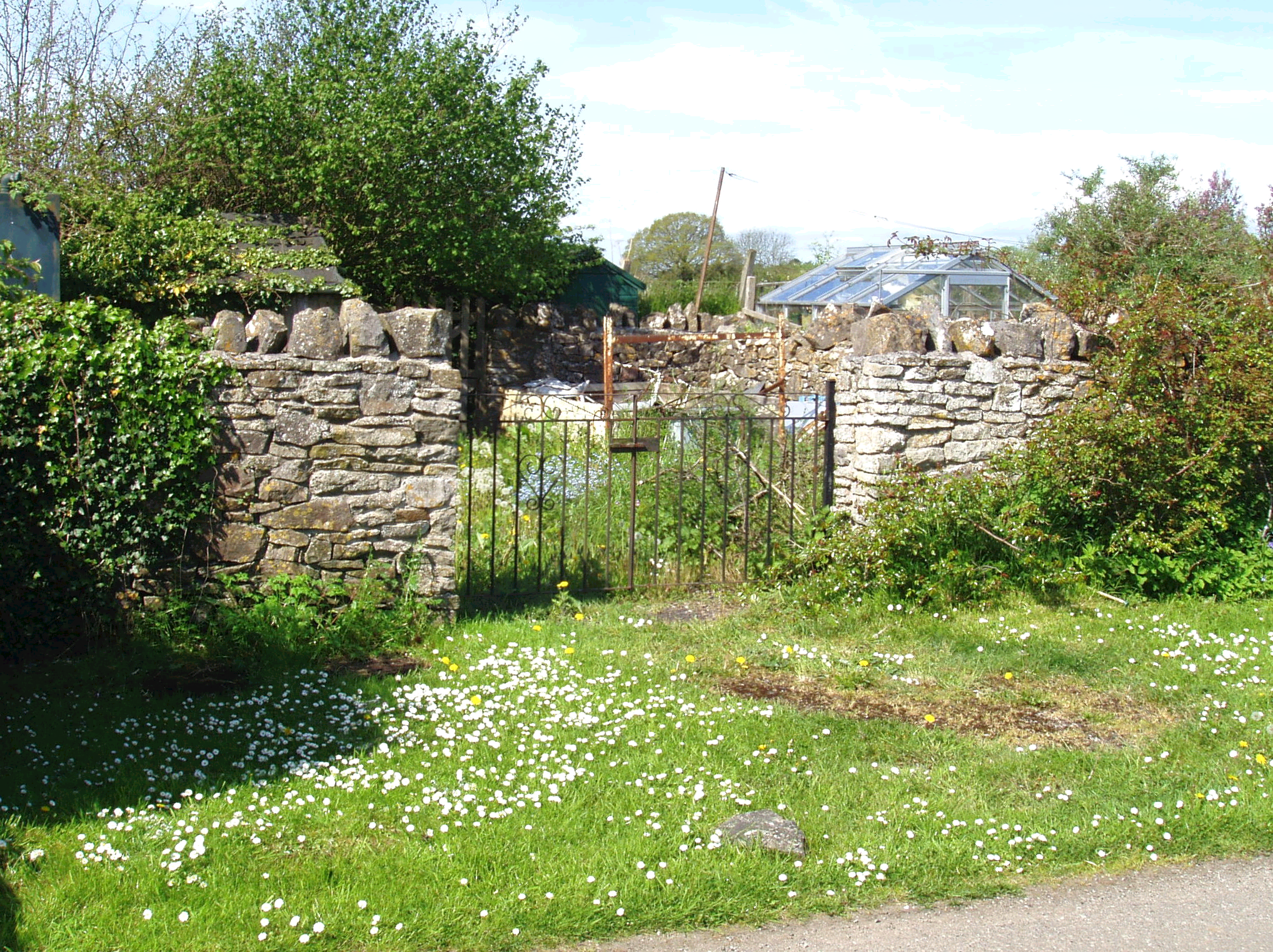
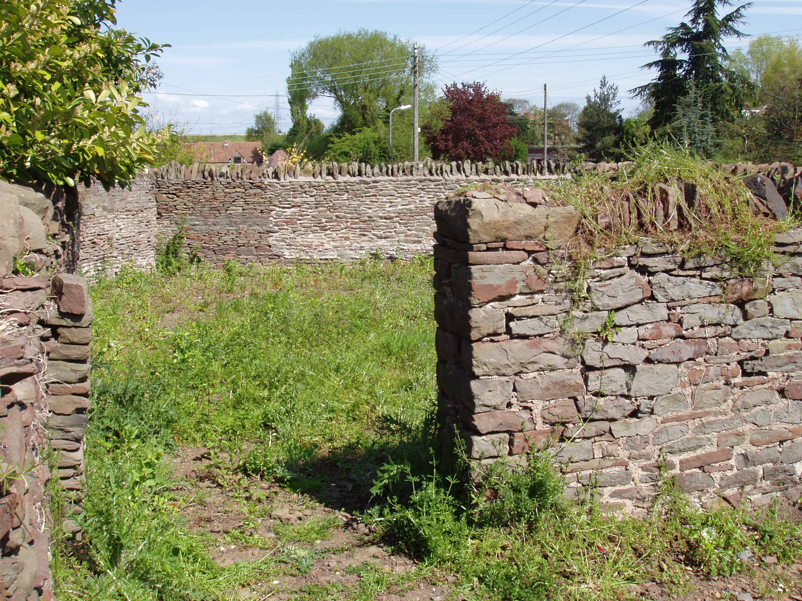
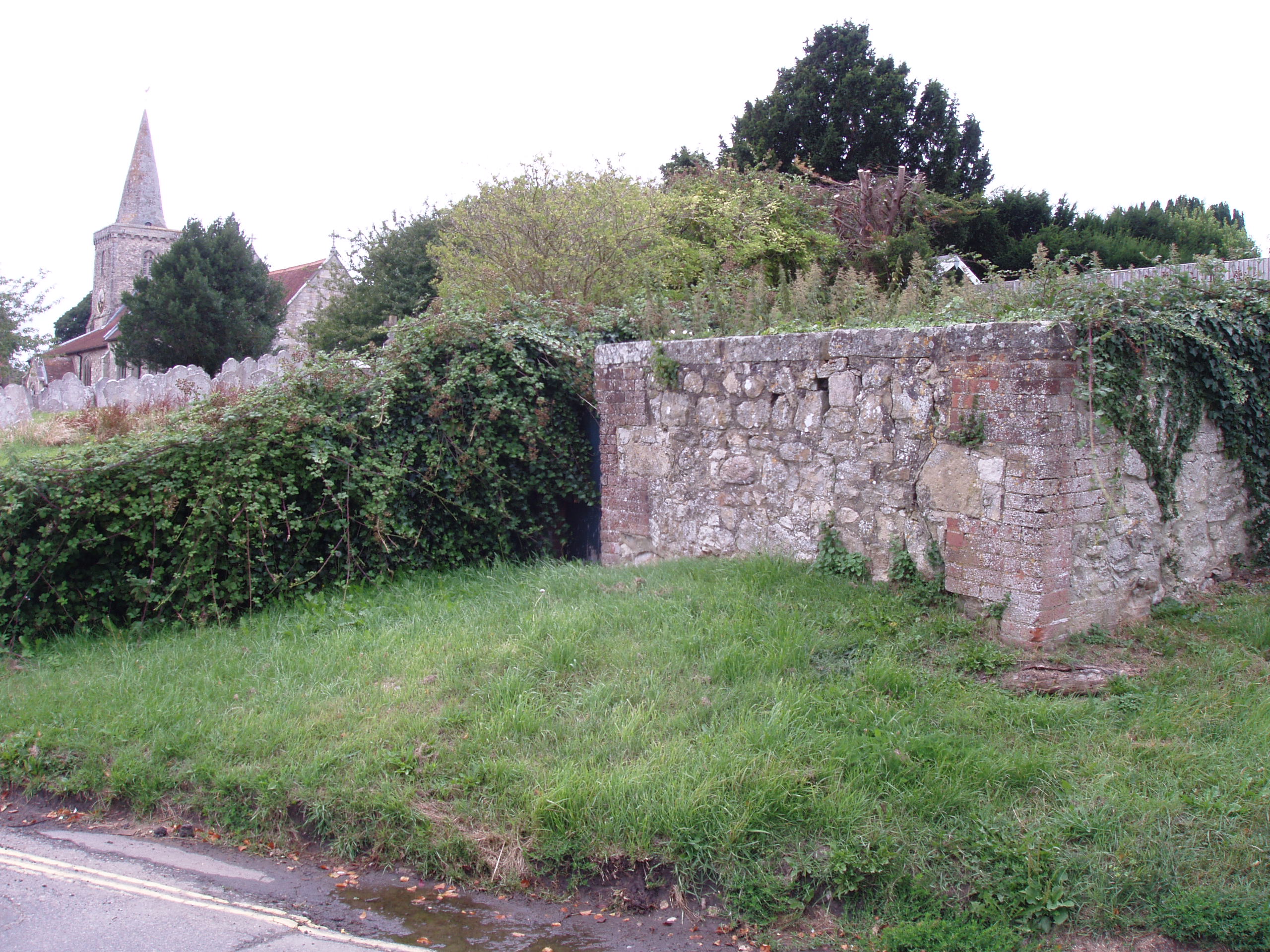
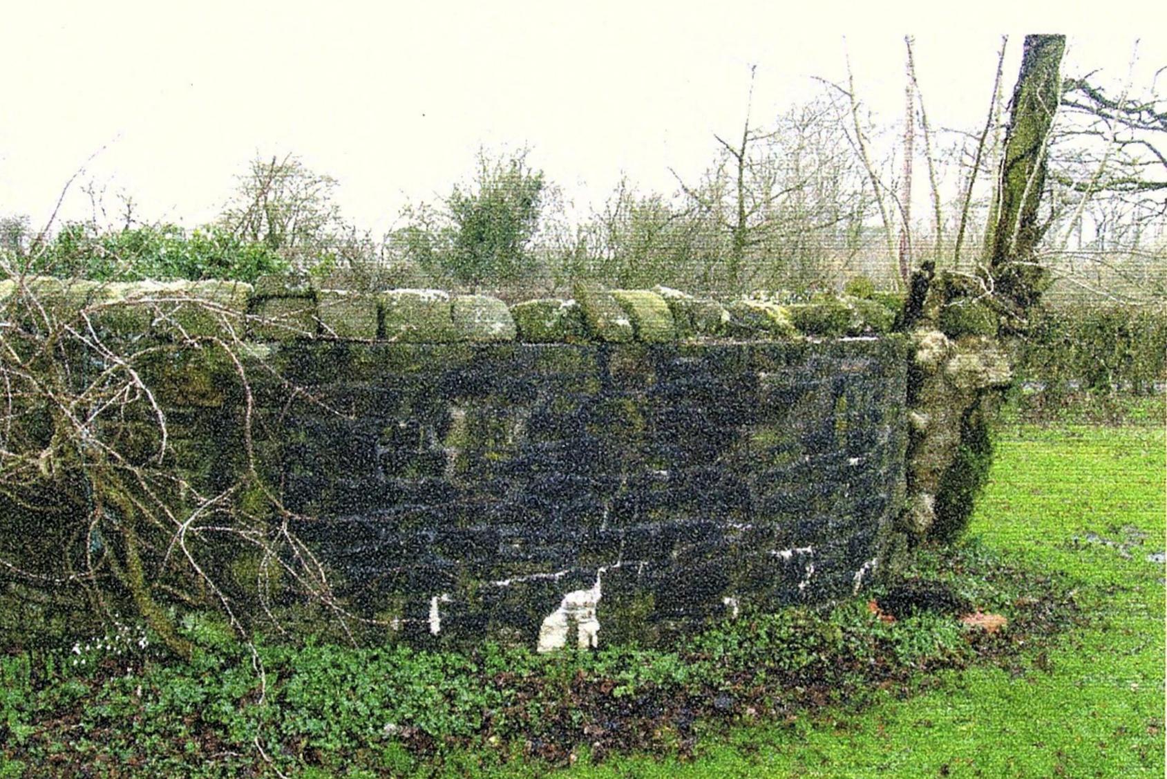
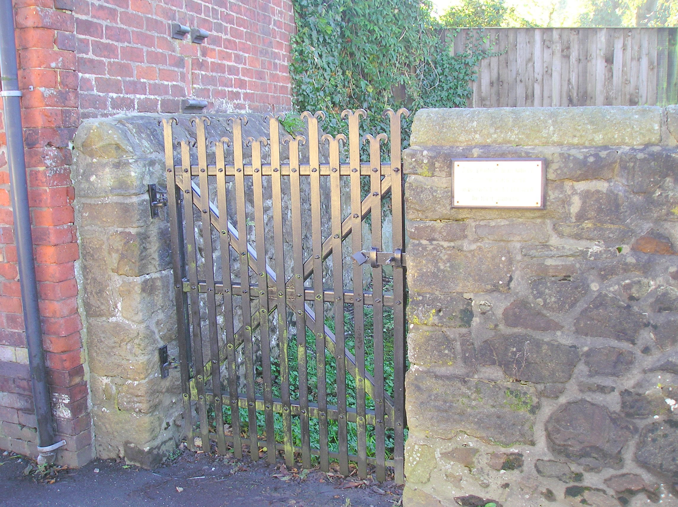
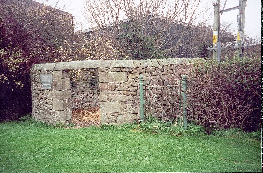
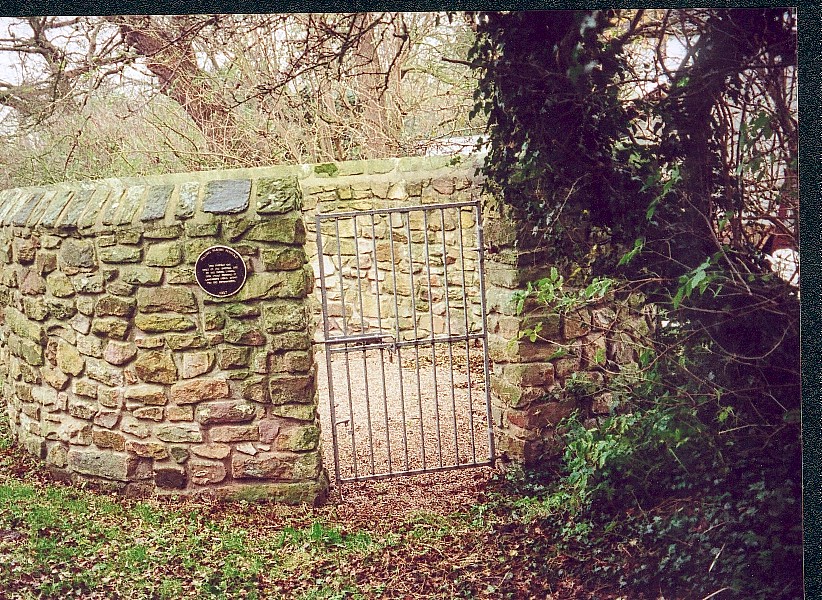
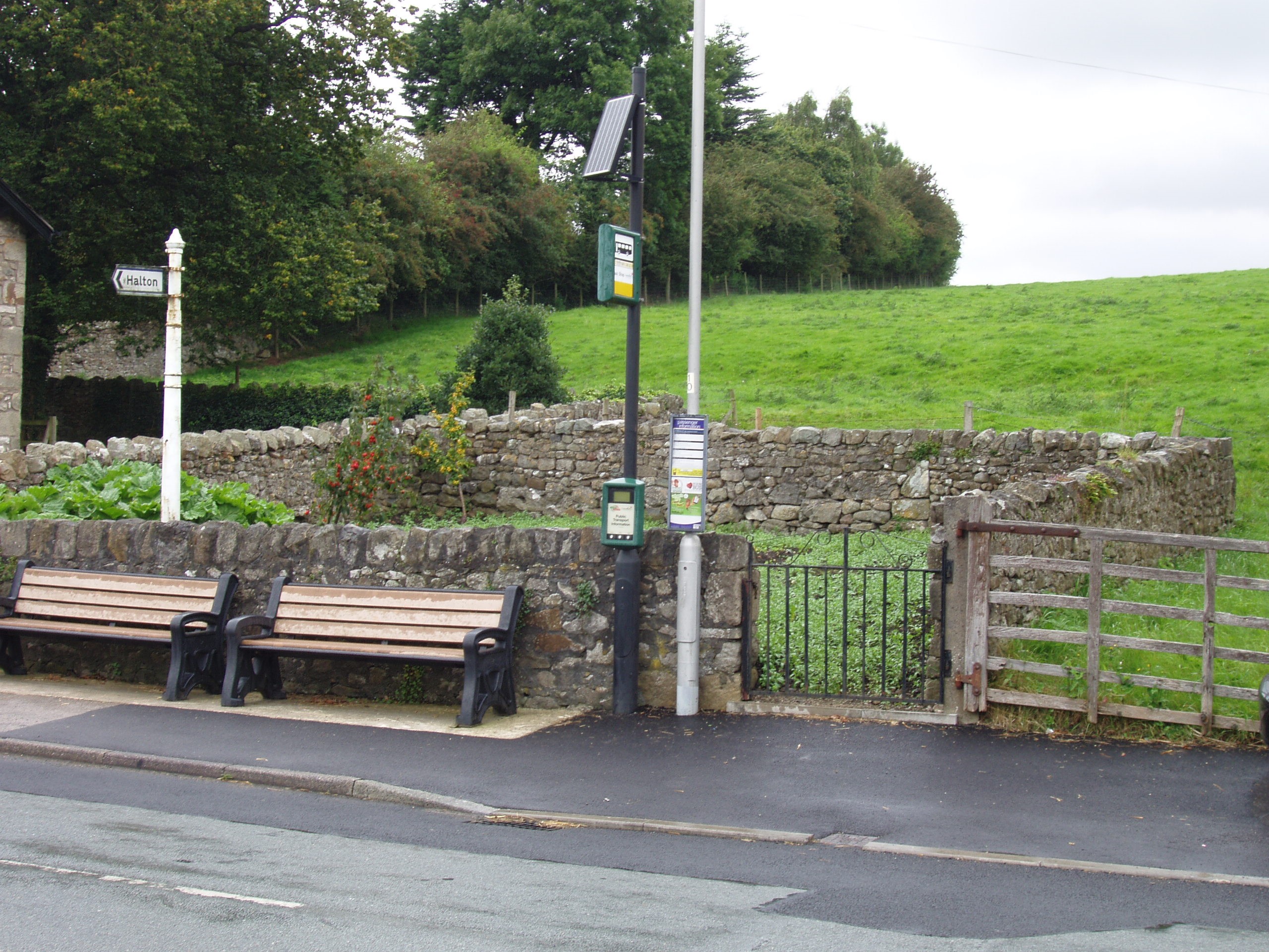
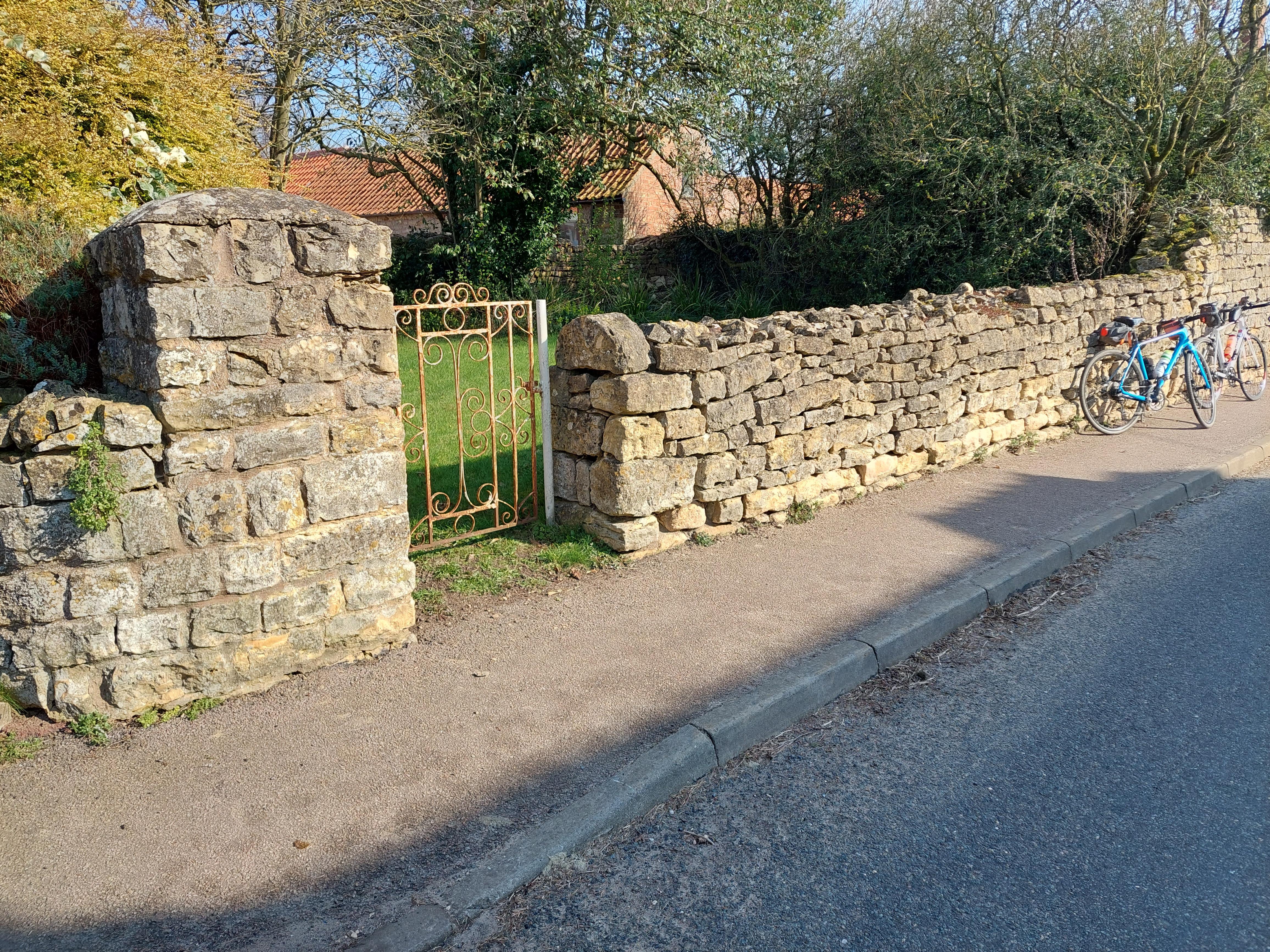
Thornbury, Gloucestershire
Grid ref: 363344,190603
This pinfold backs on to the loal lockup, shown in image, which was Grade II listed in 1984. The walls are a good 2 mtrs high and access is through a locked gate. Well maintained approx 20 mtrs by 10mtrs and used as a productive garden. It is not named on any OS map I could find, which is unusual for such a large structure, and the 1880 series of OS maps indicate it is witin the original walls of Thornbury Castle.
Nigel Mills May 2006
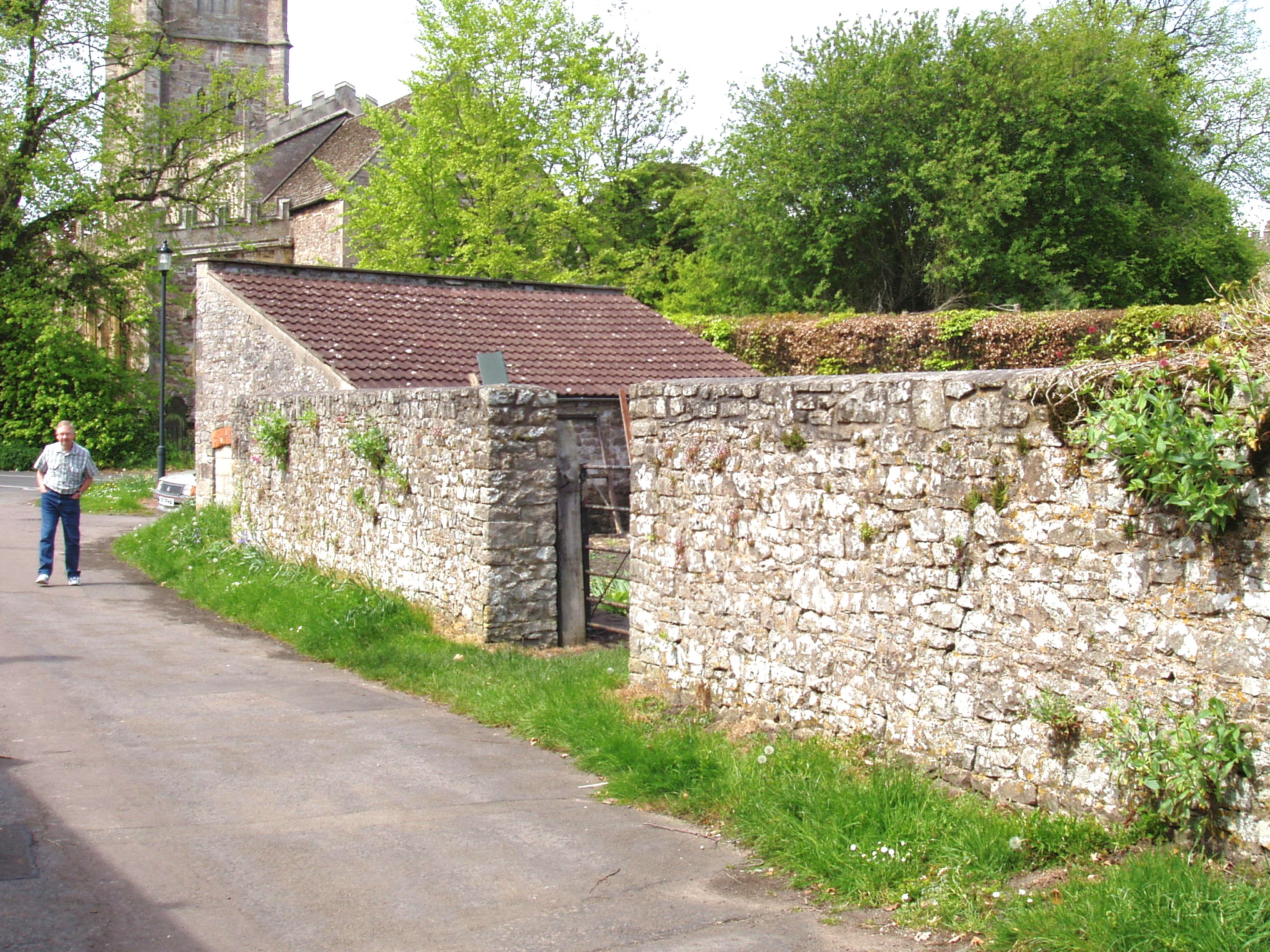
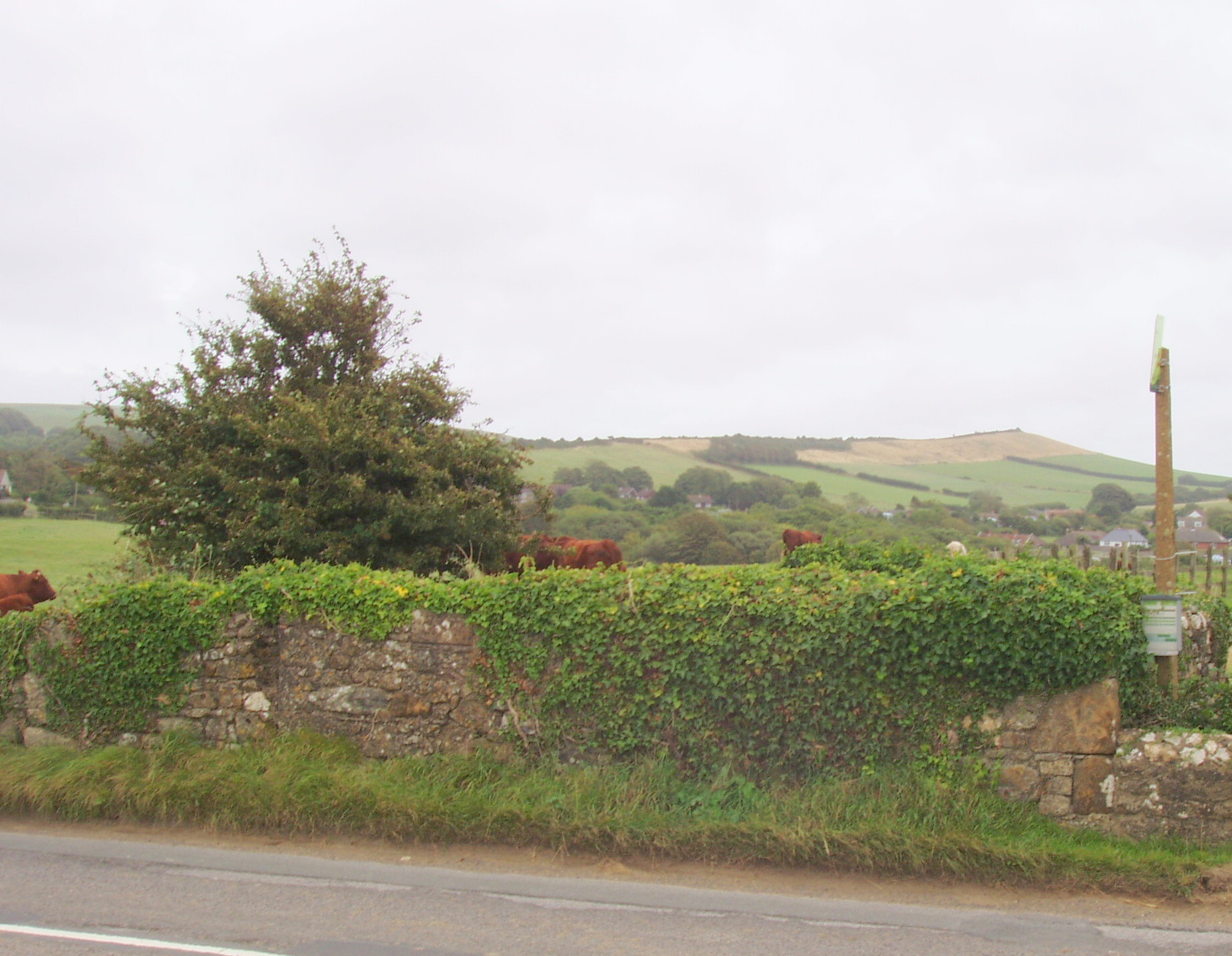
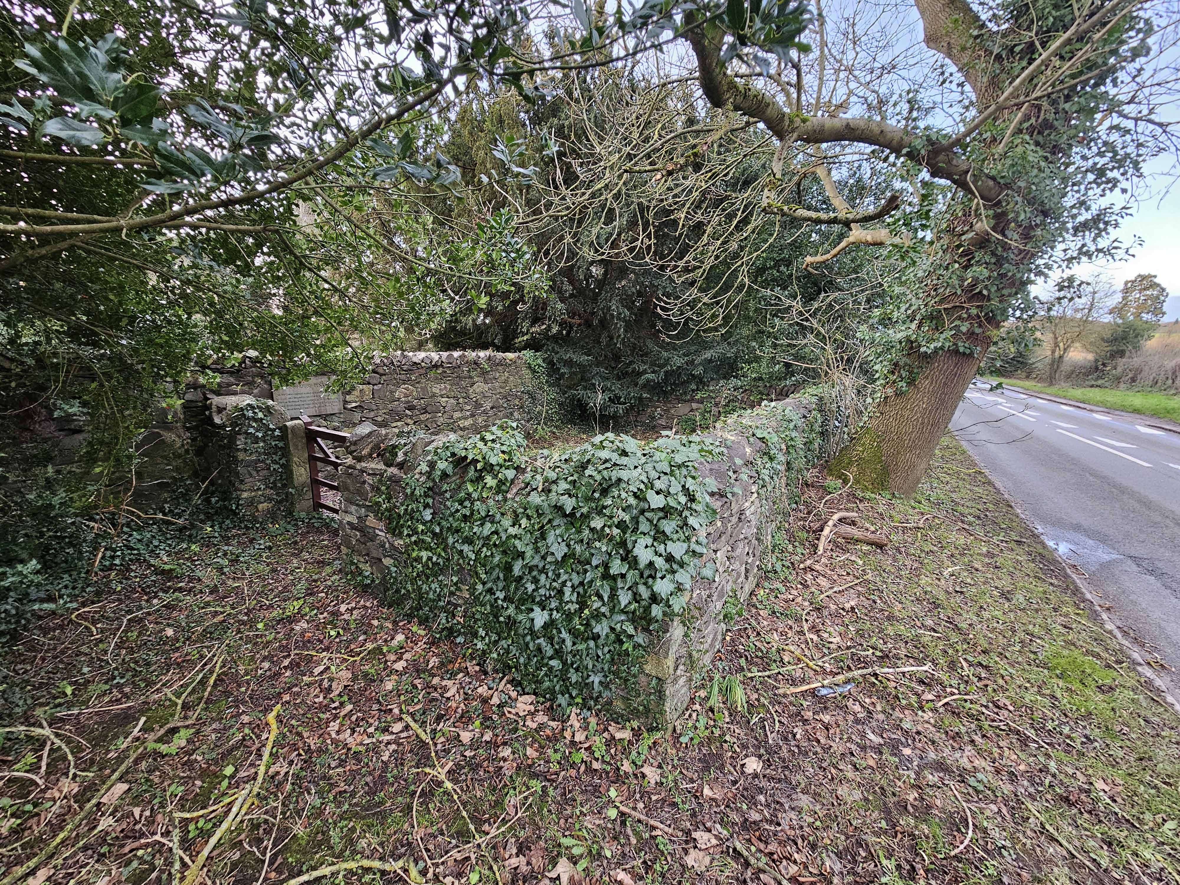
Westerleigh, Yate, Gloucestershire
Grid ref: 369921,179910
This pinfold looks to be at risk as one wall has already been demolished to increase access to the adjacent house. It is shown on the 1889 OS 1:10,560 map and the walls still in place are a good 2mtrs high.
Contributed by Sue Hamer May 2006
--------------------------------------------------------------------------------------------------------------------------------------------------------------------------------------------------
Hampshire Pounds and Pinfolds
Any information please?
--------------------------------------------------------------------------------------------------------------------------------------------------------------------------------------------------
Herefordshire Pounds and Pinfolds
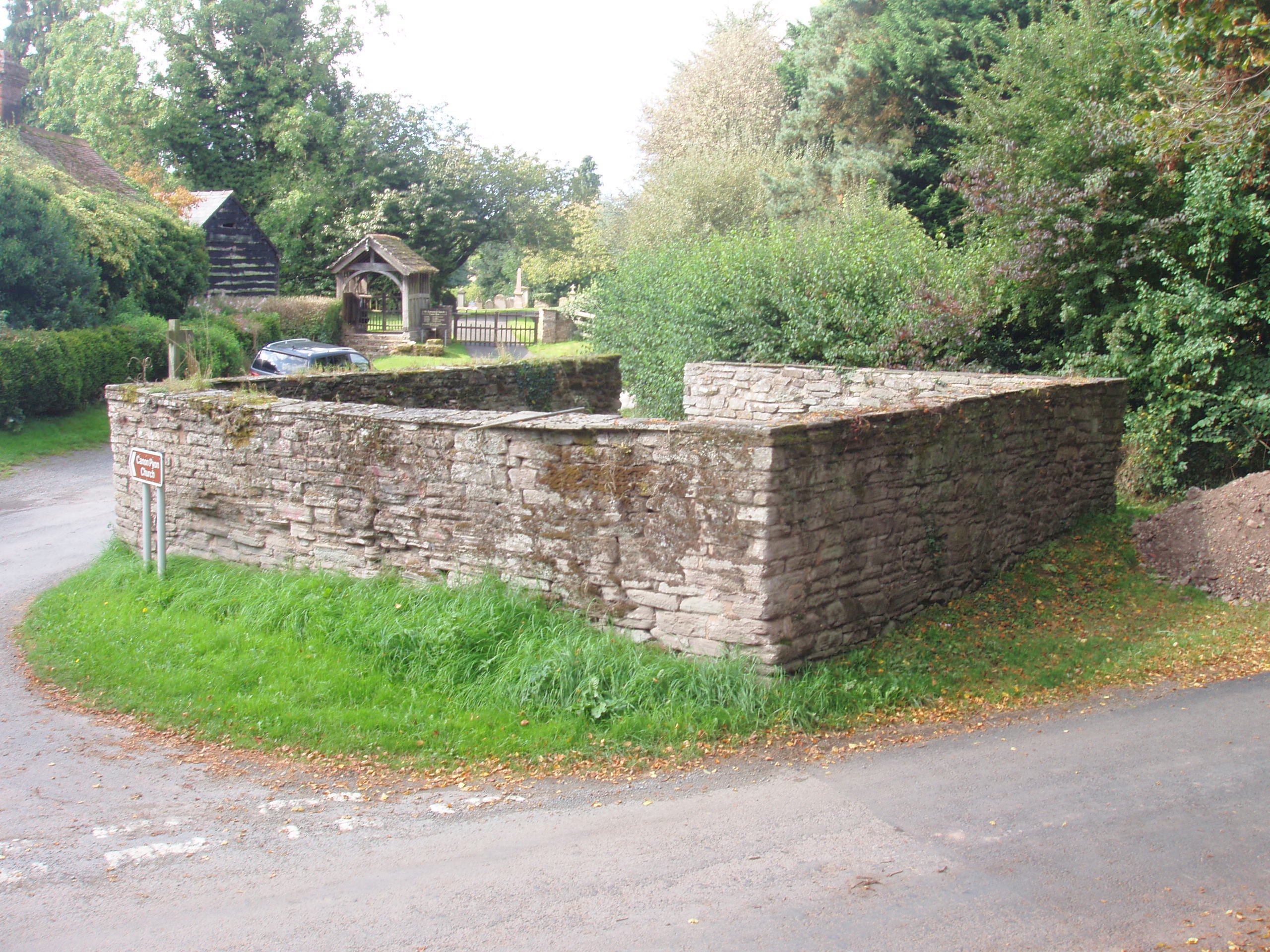
Canon Pyon, Herefordshire
Grid ref: 345101,249141
This pound named on the 1887 OS 1: 2,500 map is at the junction just about 120mtrs before the church and is a fine well maintained example of a pound. Roughly coursed sandstone with flat sandstone coping and open entrance. Rectanguler in shape with the entire pound raised slightly above ground level.
Nigel Mills September 2014.
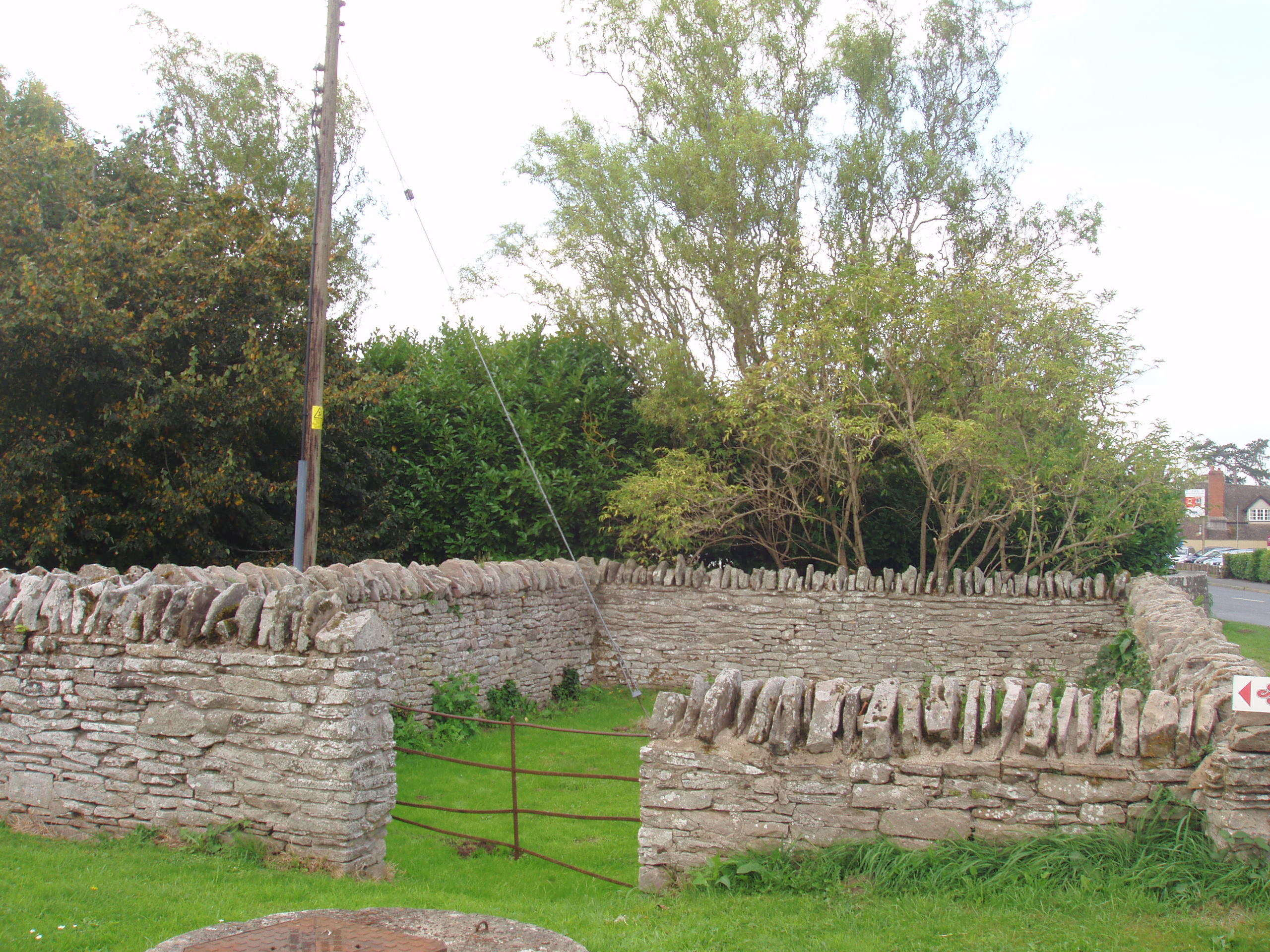
Eardisley, Herefordshire
Grid ref: 331239,249227
This pound is named on the 1887 OS 1:2,500 map just north of St Mary Magdelene's Church in the main street and not listed. Although walls are only approx 1 mtr high the rectangular structure is kept in good condition.
Nigel Mills September 2014
--------------------------------------------------------------------------------------------------------------------------------------------------------------------------------------------------
Hertfordshire Pounds and Pinfolds
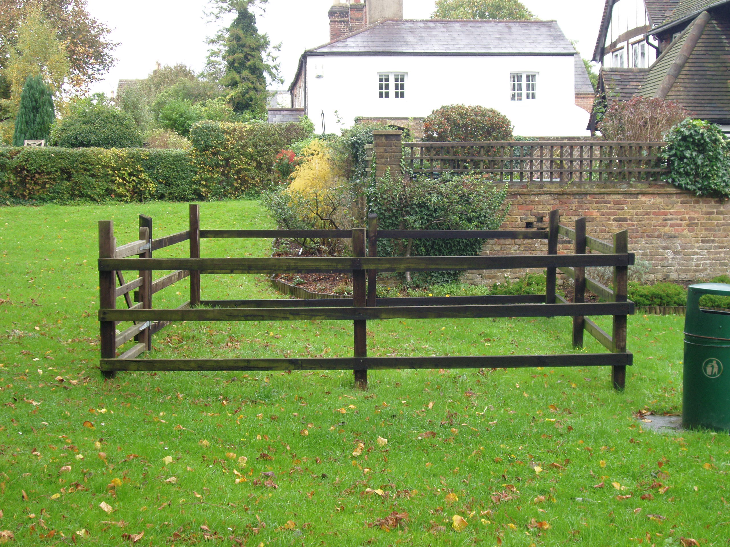
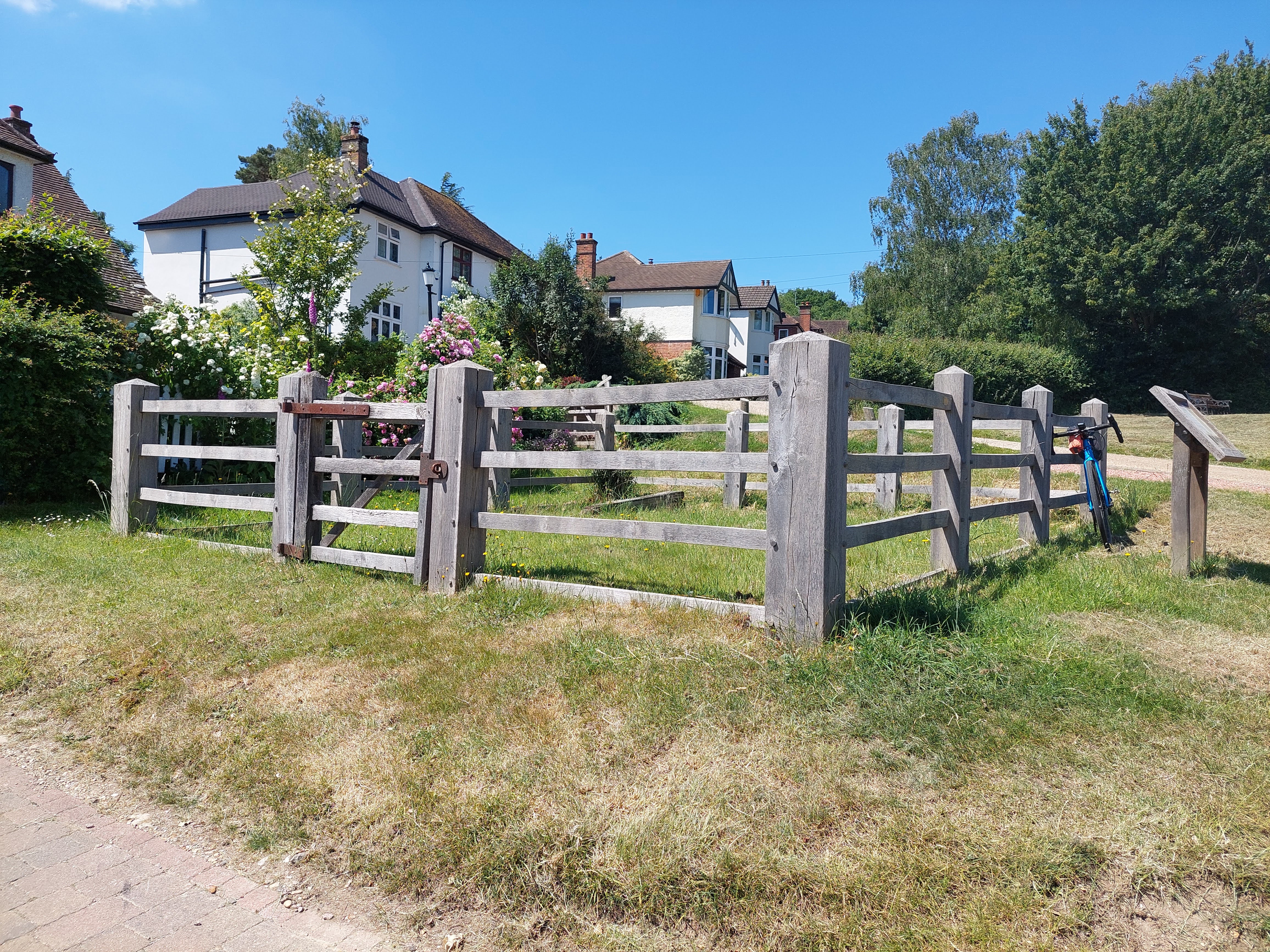
Abbots Langley, Hertfordshire
Grid ref: 509433,201934
This square pound is clearly named and indicated on the 1874 OS 1:2,500 map as a square structure on Abbots Langley High Street just south of the junction of Abbots Road. Marking the spot today is a wooden post and rail structure.
Nigel Mills January 2003. Still in place in June 2022, Michael Trolove
Anstey, Hertfordshire
Grid ref: 536017,229977
A rectangular pound on the 1883 25" map but possibly lost as chalk excavations took place adjacent to site. Contributed by Michael Trolove, January 2023
Ardeley, Hertfordshire
Grid ref: 530977,227150
Shown on the 1884 OS map adjacent to Church Farm but now lost. Contributed by Michael Trolove, January 2023
Bovingdon, Hertfordshire
Grid ref: 501790,203454
On 1882 OS map as a pound and has now disappeared due to highway improvements. Contributed by Michael Trolove, June 2022
Buntingford, Hertfordshire
Grid ref: 536017,229977
Now lost but stood where the A10 road becomes the High Street. On the 1898 OS map but site is now a planted verge. Contributed by Michael Trolove, January 2023
Hay Green, Hertfordshire
Grid ref: 533910,236814
It was located just beyond Hoops Lane and shown on the 1880 OS map but now lost. Contributed by Michael Trolove, January 2023
Hinxworth, Hertfordshire
Grid ref: 523661,240472
OS map shows a pound in 1887 but no trace found today. Contributd by Michael Trolove April 2022
Ickleford, Hertfordshire
Grid ref: 518365,231727
No trace on OS maps but Pound Farm may refer to a long gone structure. Contributed by Michael Trolove, April 2022
Kings Langley, Hertfordshire
Grid ref: 507024,202935
A post and rail interpretation of the original pound shown on the 1882 OS map. Made of oak with oak and pegged at the joints, no doubt from local woodlands. It measured approx 20ft by 20ft and is 4ft 6ins high. On the edge of Kings Langley Common. Contributed by Michael Trolove, June 2022
Reed, Hertfordshire
Grid ref: 536092,235759
A pound on the OS 25" for 1883 to the west of the village church.Contributed by Michael Trolove January 2023
Sarratt, Hertfordshire
Grid ref: 504007,177759
Named on 1892 OS map but now just a grassed area. Contributed by Michael Trolove, May 2022
Shenley, Hertfordshire
Grid ref: 518902,200840
The pound is on the 1877 OS 1:10,560 map but due to road widening has disappeared without trace. It was at the north end of Pound Lane.
Nigel Mills January 2003
Tring, Hertfordshire
Grid ref: 492690,211487
A square pound on the 1884 OS map now lost to road widening on London Road. Contributed by Michael Trolove, June 2022
Walkern, Hertfordshire
Grid ref: 529113,226307
On the 1884 OS map but now site is a "splendidly kerbed green grassed triangle" by Winters Lane. Contributed by Michael Trolove, January 2023
--------------------------------------------------------------------------------------------------------------------------------------------------------------------------------------------------
Huntingdon Pounds and Pinfolds
Pounds and Pinfolds are recorded in this register under their modern county names e.g. Cambridgeshire.
--------------------------------------------------------------------------------------------------------------------------------------------------------------------------------------------------
Isle of Man
--------------------------------------------------------------------------------------------------------------------------------------------------------------------------------------------------
Isle of Wight
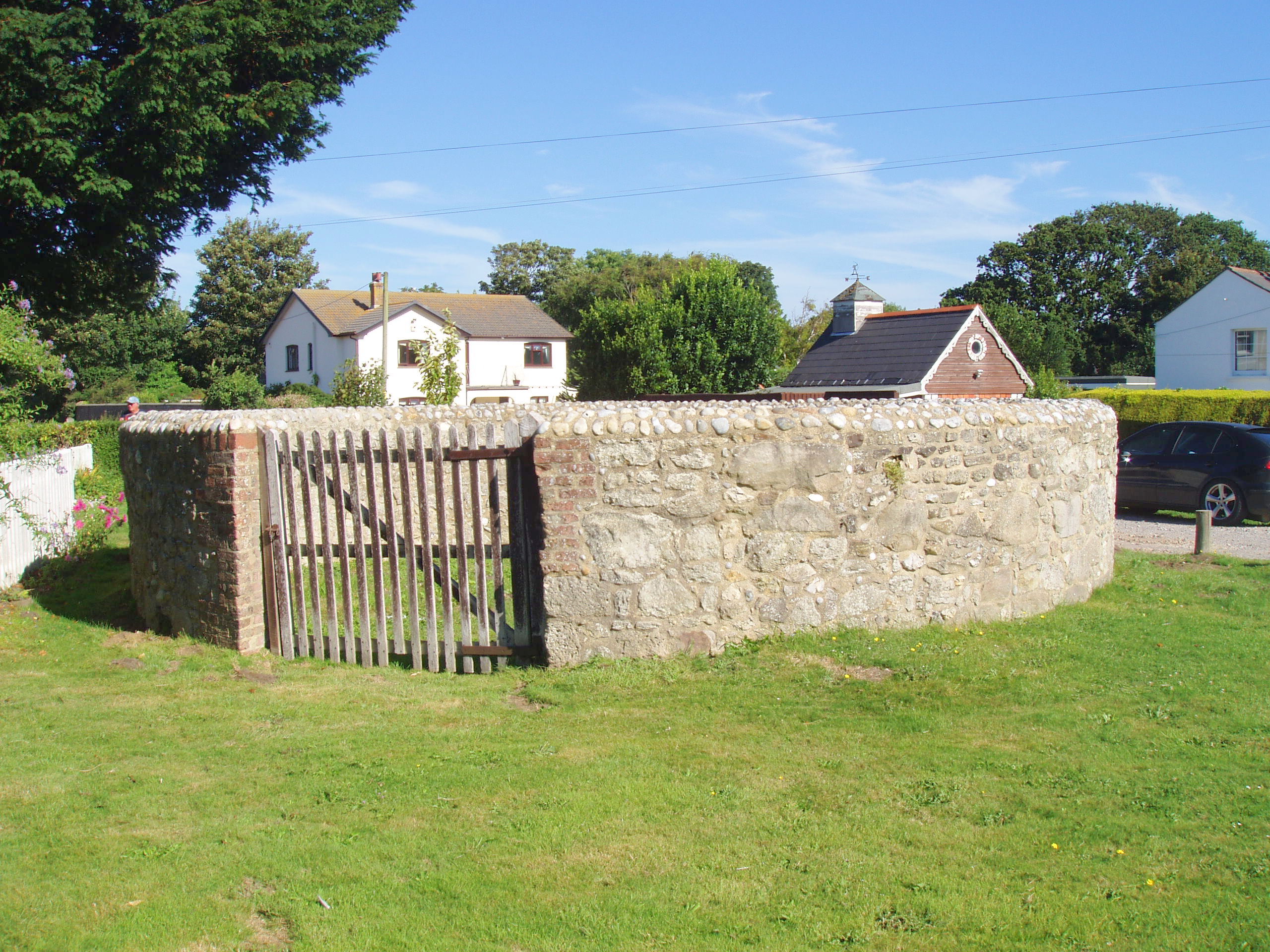
Freshwater, Isle of Wight
Grid ref: 433600,086579
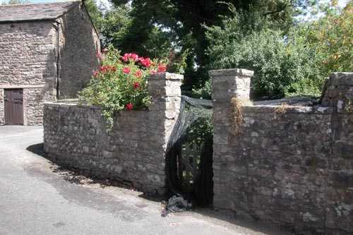
This pound stands close to a well on Poundgreen in Freshwater. Interestingly the 1862 OS 1:2,500 map names it as a "pinfold" on Poundgreen but the surveyor for the 1909 OS 1:2,500 map sensibly names it as a "pound" on Poundgreen, the name it retains today. A fine and carefully restored pound with walls approx 1.5mtrs high built of stone rubble, red brick dressings and curved coping. It is in the care of Freshwater Parish Council and the interior has been used for many years as a productive garden. Contributed by Brenda Hobbs November 2008
Brading, Isle of Wight
Grid ref: 460744,087300
This pound is Grade II listed and can be found on Quay Lane (prev. Wall Lane) beyond the church graveyard in Brading. It is square with an opening on the SE wall and constructed of stone rubble, 2 mtrs high with brick quoins and flat stone coping. Wightpedia.org.uk tells us that it was overgrown but cleared and tidied by students from the National Citizen Service in 2016. Nigel Mills August 2016
Shorwell, Isle of Wight
Grid ref:
Grade II listed, square, 1.5 mtrs approx high walls of stone rubble. Restored in 1951.
Exact location not confirmed. Is it Walkers Lane or Pound Lane?
Nigel Mills August 2016
--------------------------------------------------------------------------------------------------------------------------------------------------------------------------------------------------
Kent Pounds and Pinfolds
--------------------------------------------------------------------------------------------------------------------------------------------------------------------------------------------------
Lancashire Pounds and Pinfolds
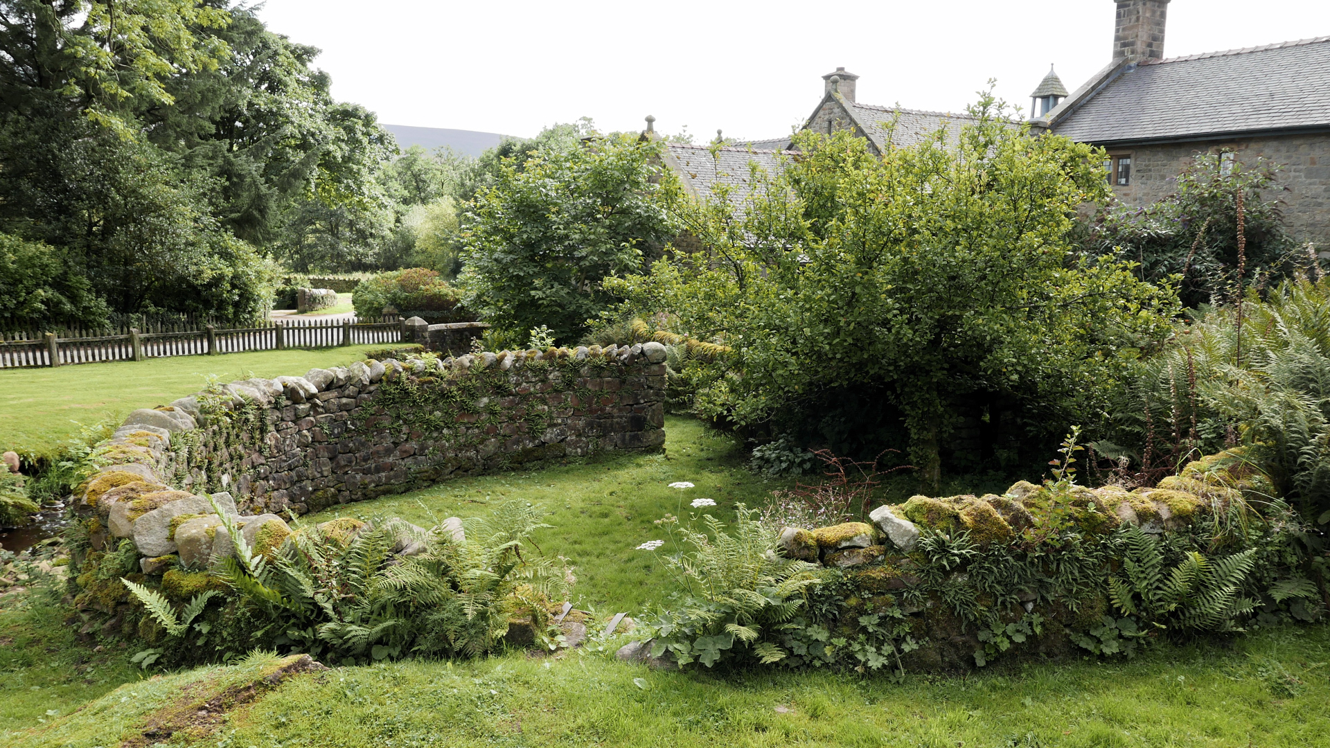
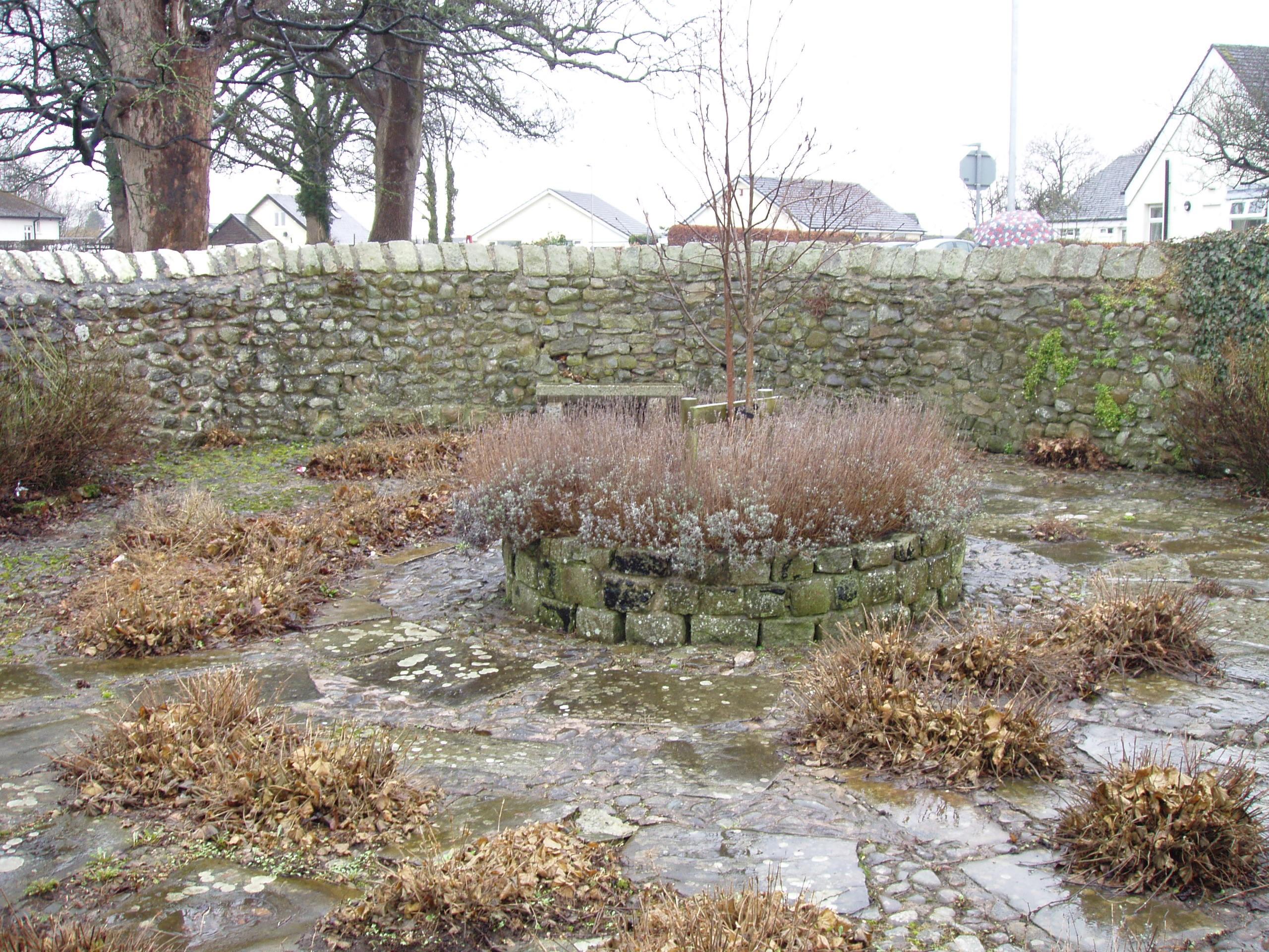
Abbeystead, Trough of Bowland, Lancashire
Grid ref: 356133,454278
This circular, low walled pound is at the centre of the village next to a stream. It is approx. 10 mtrs diameter of drystone constuction. It was Grade II listed in 1968 because of its group value situated as its is amongst other estate style buildings including whet was the village school. It is named on the 1891 OS 1:2,500 map.
Nigel Mills February 2011
Arkholme, Carnforth, Lancashire
Grid ref: 358853,471819
This is an unusual two celled pound restored by Lanxcashire County Council with local support because of their interest in The Best Kept Village competion which was won in 2001. It is located at the south end of the village towards the river and close to the church and is used as a community garden. Although referred to as the pinfold it was grade II listed in 1985 as the Village Pound. Unable to identify on OS maps.
Nigel Mills December 2003
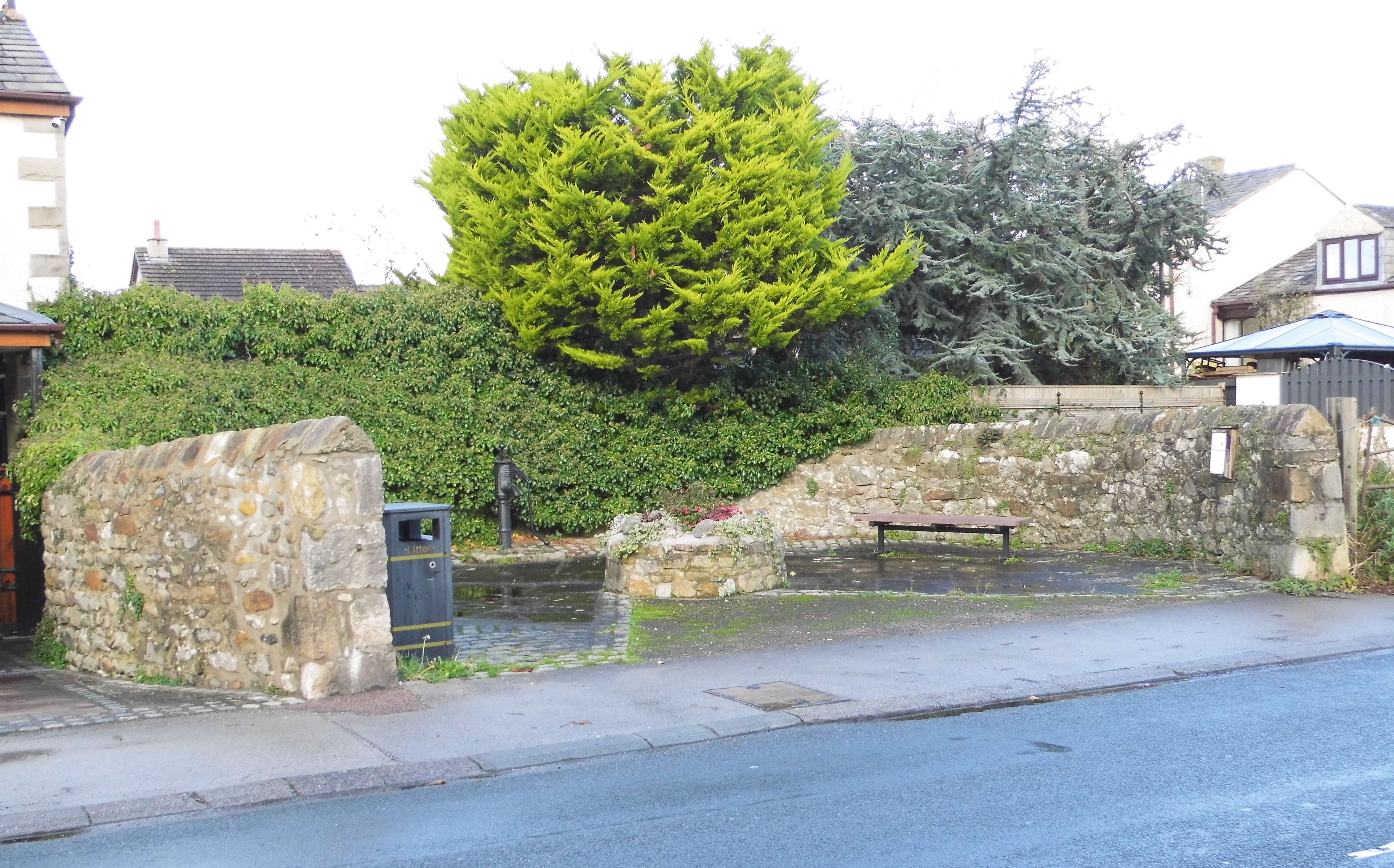
Bolton-le-Sands, Lancashire
Grid ref: 348488,468290
The early OS map surveyed in 1845 show this structure as circular and names it as a Pinfold. Later maps just indicate a pump with the letter P, to be found on Main Road, west side of the A6 trunk road. It is approximately 32 ft in diamenter with rubble walls and is registered by Historic England as "date uncertain". It is now put to use as a public area, having lost part of the wall to road widening, with a plaque describing the function of a pinfold. Image contributed by Bob Calvert November 2022
Broughton, Preston, Lancashire
Grid ref:
This pinfold was listed Grade II in 1986 and measures approx. 10 by 8 mtrs constructed or sandstone with rounded coping. It was renovated by the local councils in 1985/86 according to the plaque. It is at the roadside just south of no. 442 Grastang Road. Not found on OS maps.
Nigel Mills February 2011
Churchtown, Preston, Lancashire
Grid ref: 348426,443117
This circular pound is named on the 1890 OS 1,2,500 map. It is on private land and not in good condition, the walls being impacted by the growth of trees and other vegetation. It is of brick construction.
Nigel Mills February 2011
Great Eccleston, Lancashire
Grid ref: 342503,44194
A small pinfold listed as Grade II in 1984. Constructed of sandstone rubble, some rounded, some triangular coping and with walls approx. 2mtrs high. Strange irregular shape adjacent to a small building. OS maps indicate it was the site of the smithy although a plaque names it as a pinfold.
Contributed by L Kelley November 2013
Leigh, Lancashire
Site is behind a row of houses in Bangor Fold, Manchester Road, Bedford on private poperty. Current condition not known. Contributed by Michael Caine, June 2022.
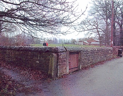
Out Rawcliffe, (Chapel Lane), Lancashire
Grid ref: 340047,442206
This circular pound is named on the 1893 OS 1:2,500 map and listed Grade II in 1967. Sandstone rubble construction with triangular coping on walls and above gateway, standing approx. 2mtrs high. In great condition due to the work of Wyke Community Ltd Community Programme according to a plaque. Another plaque says it is only one of six surving in Lancashire. Clearly an underestimate! Local word is that it was last used during the 2001 Foot and Mouth outbreak when a wandering large texel lamb was placed in it until the owner could be identified. Taken away eventually by DEFRA, it's fate remains unknown.
Nigel Mills May 2001.
Over Kellet, Lancashire
Grid ref: 361946,469996
This pound is shown and named on the 1847 OS 1:10,500 map in the centre of the village but not on later maps.Visited August 2011. No trace found.
Pilling, Fleetwood, Lancashire
Grid ref: Needed
This pinfold ws built in 1997, by the Parish council, on the same site as the original pinfold in the C18 according to a plaque on the pinfold. It is circular built of stone and mortar and is signed from the road in the centre of the village.
Nigel Mills May 2001
Priest Hutton, Lancashire Awaiting information
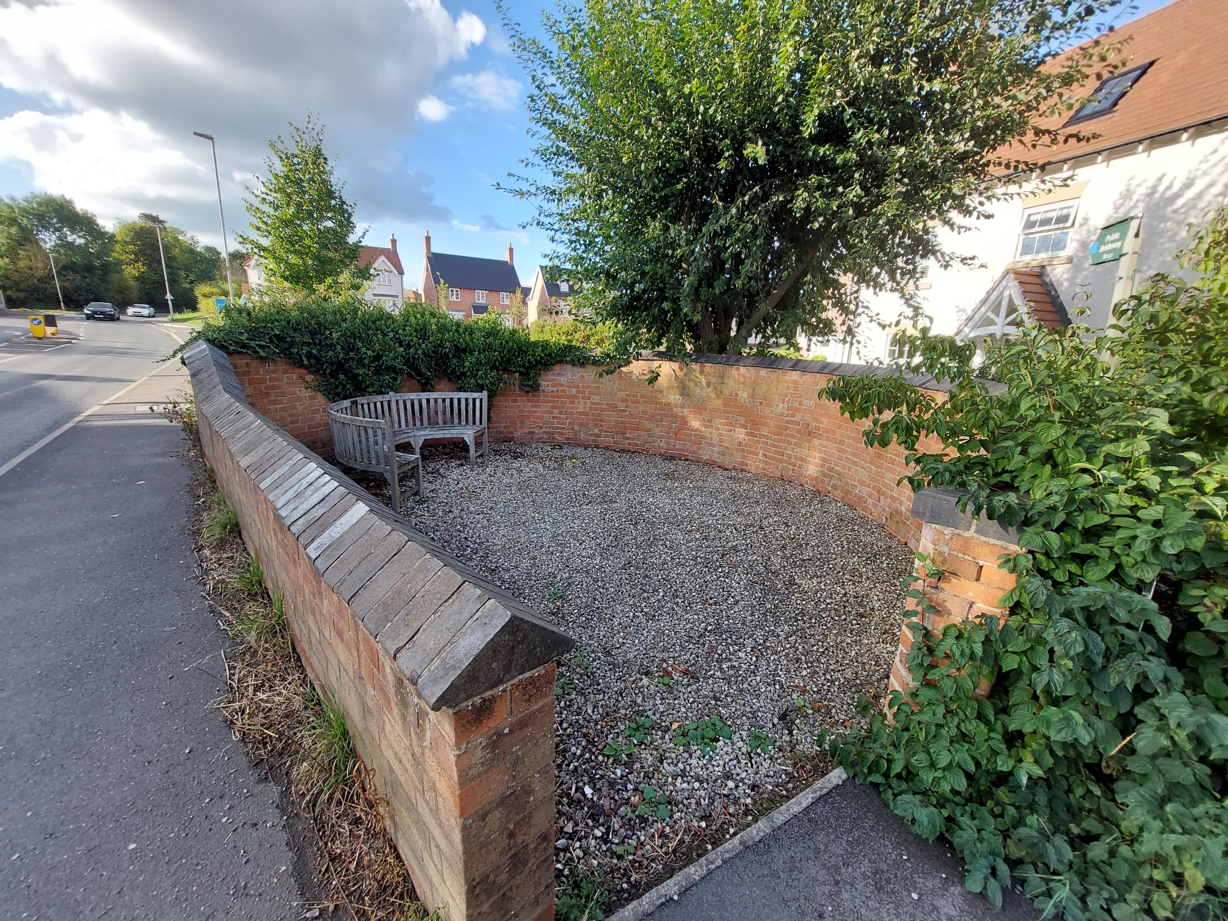
Slyne with Hest, Lancashire
Grid ref: 347683,465625
A roughly circular pound, at the junction with Throstle Grove, it has been partly rebuilt to allow for road widening. Sharing the site with stocks it was listed Grade II in 1952. It has triangular coping stones and variable height walls and a seating area inside the structure.
Nigel Mills February 2011
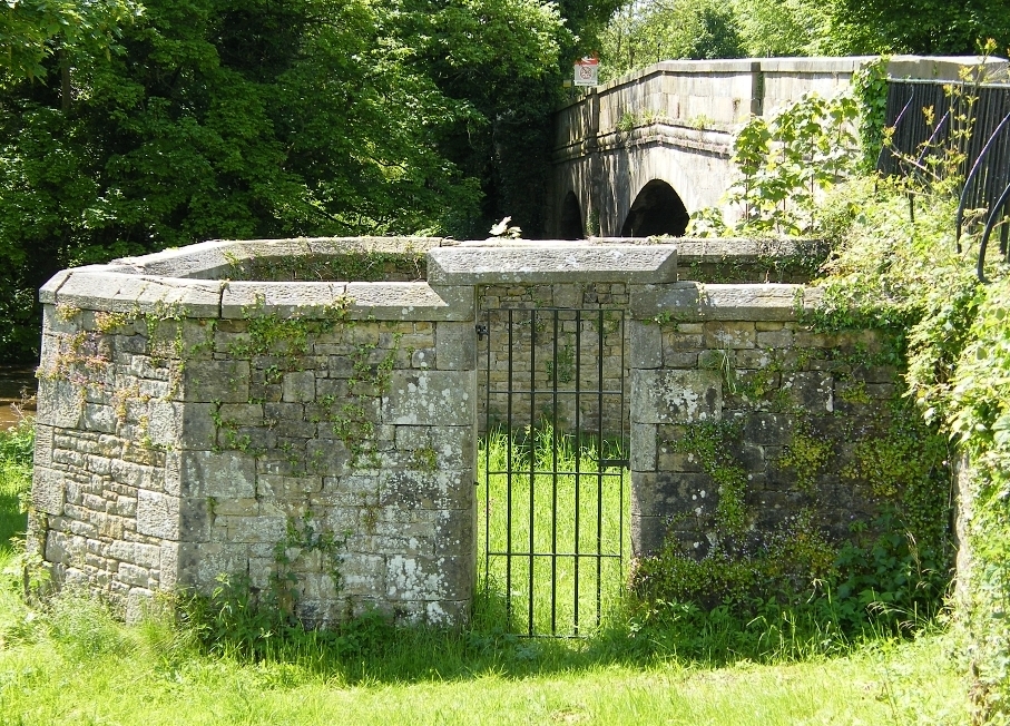
Wennnington, Lancashire
Grid ref: 361720,470010
This is an impressive grade II pound listed in 1985 standing beside the River Wenning in the village of Wennington. Constructed of limestone rubble wall with weathered coping and a matching lintel over the gated access. In plan it is quadrilateral built against the bridge abuttment. Shown on the 1894 OS 1:2,500 map and ideally placed for the convenience of the Pinder being a few metres from the river.
Nigel Mills May 2009
West Bradford, Ribble Valley, Lancashire
Grid ref: not known
A small irregular Pinfold not found on OS maps, given to the village by Lord Clitheroe (Willmott Dobbie p35 1979). Well kept by the parish and measuring approx 30ft by 10ft. Contributed by Margaret Ashworth, Ocober 2022
Yealand Conyers, Lancashire
Grid ref:
Seeking more information
Yealand Storrs, Lancashire
Grid ref:
Seeking more information.
---------------------------------------------------------------------------------------------------------------------------------------------------------------------------------------------------
Leicestershire Pounds and Pinfolds
- Lost Leicestershire Pounds and Pinfolds.xlsx
- Click here to download lost sites not listed below
Barkestone, Leicestershire
Grid ref: 477894,334932
A square pinfold once stood on the edge of this village green No references found today. Contributed by Michael Trolove, May 2022.
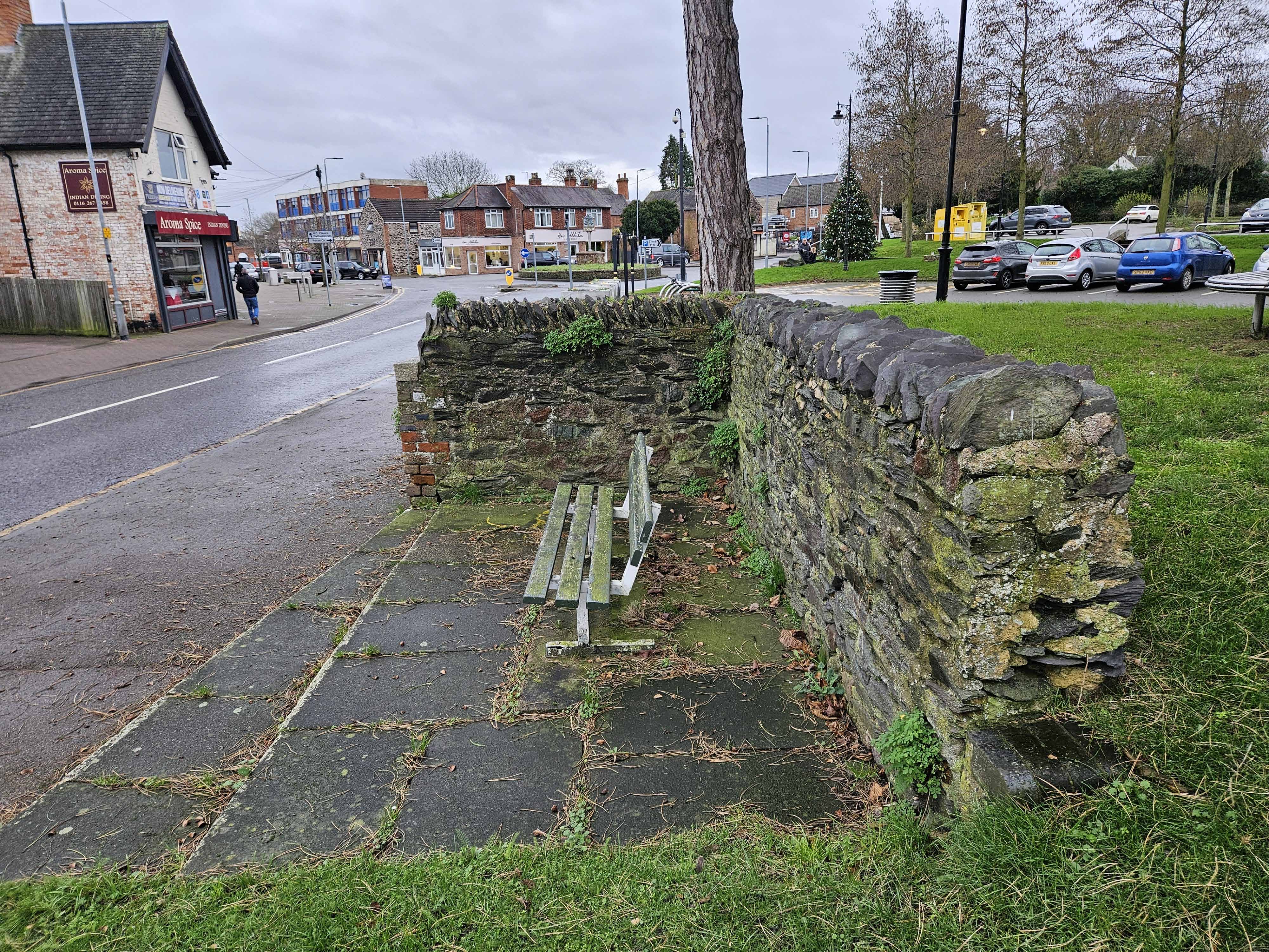
Birstall, Leicestershire
Grid ref: 459538,309105
Just an end wall and part of a side wall remain of this small rectangular pinfold beside the road in the middle of the village. Constructed of local stone and brick but nothing to identify it as a pinfold. It encloses a bench so at least it is used. On the OS map for 1883.
Contributed by Peter Smith, January 2024
Bitteswell, Leicestershire
Grid ref: 453649,285756
Identified as "Pound" this small rectangular structure is on one corner of the village green. Shown on the 1889 OS map. Now a seating area with high brick walls on two sides.
Contributed by Peter Smith, January 2024
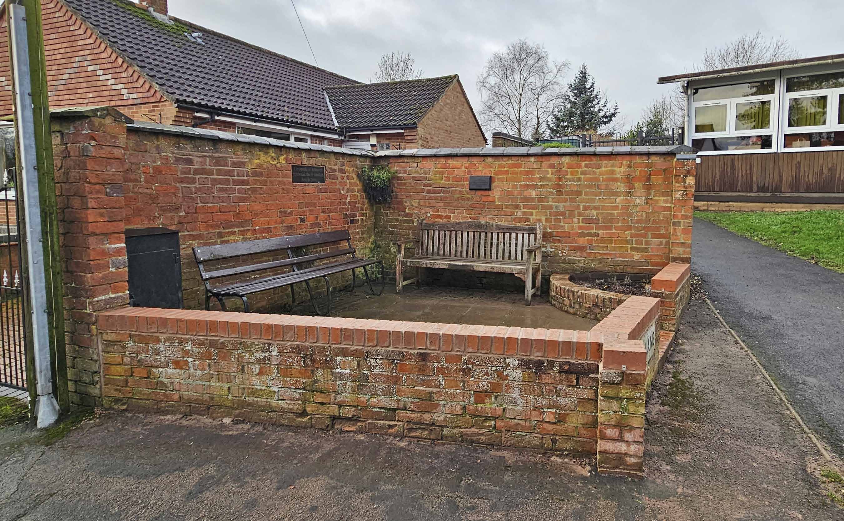
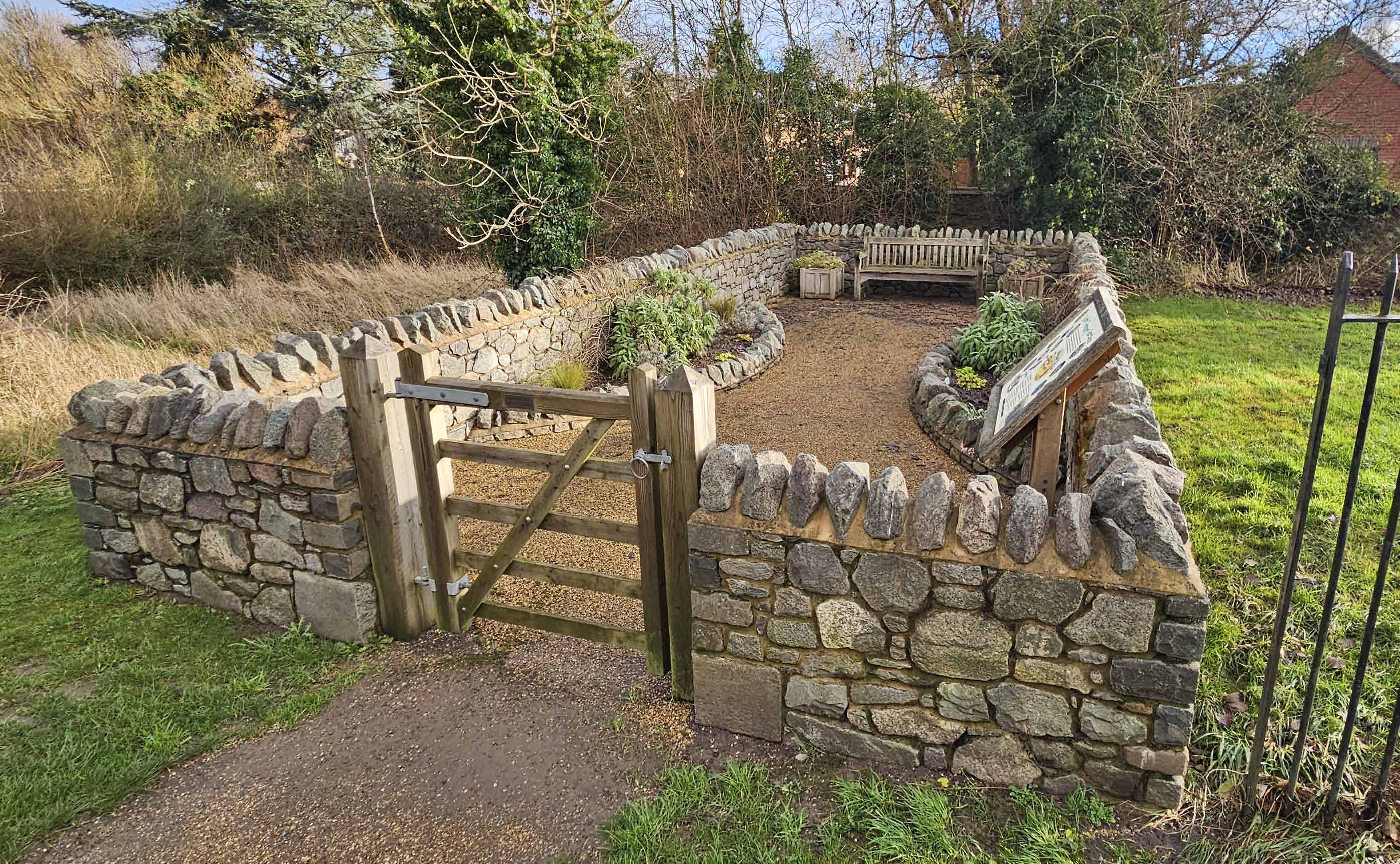
Cosby, Leicestershire
Grid ref: 454513,294543
A small rectangular enclosure beside the Broughton Road. On the 1886 OS 6" map. The 1904 map shows a small building on the same footprint. Rebuilt in local stone as the Cosby Sensory Garden by the Parish Council in 2016.
Contributed by Peter Smith, January 2024.
Cossington, Leicestershire
Grid ref: 460675,313295
This restored rectangular pinfold complete with wonky seat and accompanying litter bin is in the main street to the south of the village and was restored by the Parish Council in 1986.
Contributed by Peter Smith December 2023
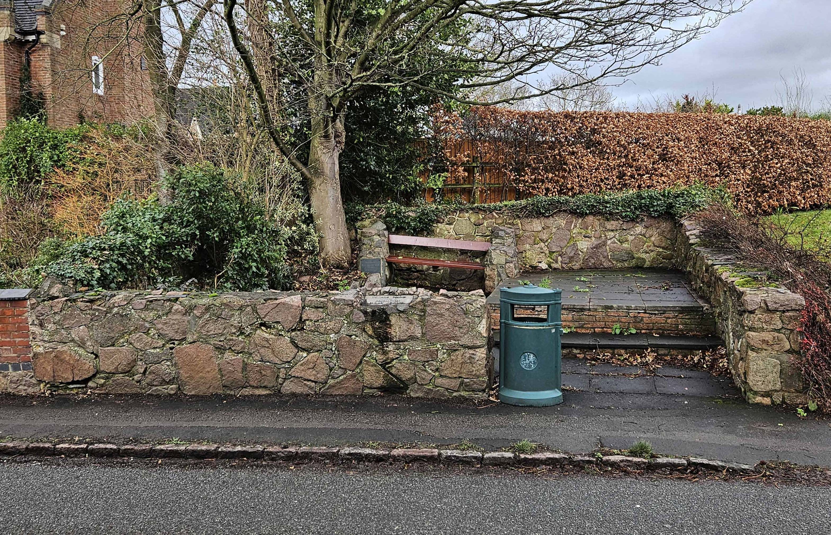
Cropston, Leicestershire
Grid ref 455335,310945
Only three walls survive of this rectangular pinfold cared for bt the Parish Council. Now on a back lane it was beside the road north from the village until it was diverted when a reservoir was built in the 1860's. Visible bot not named on the 1883 OS 6" map.
Contributed by Peter Smith, December 2023
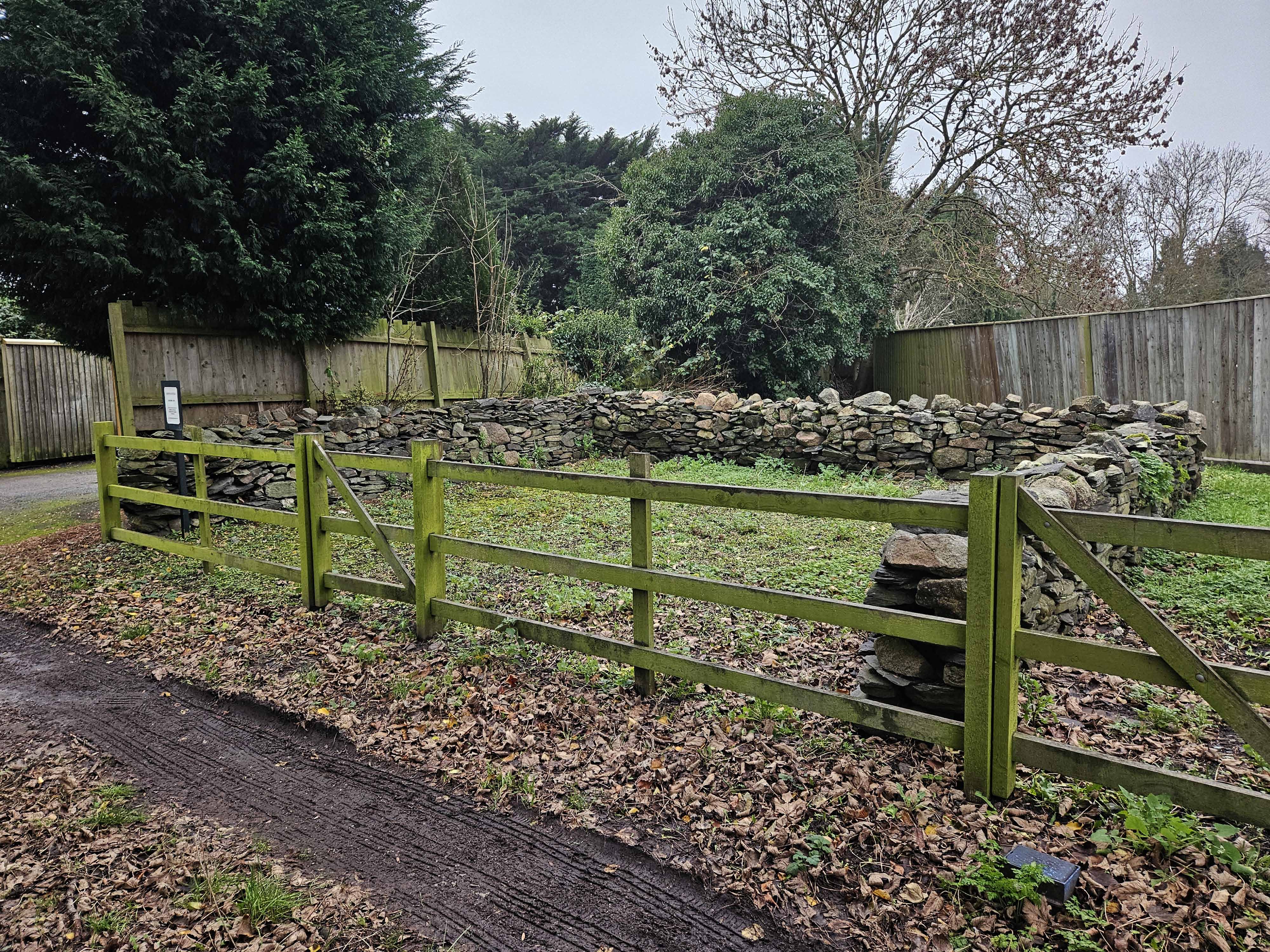
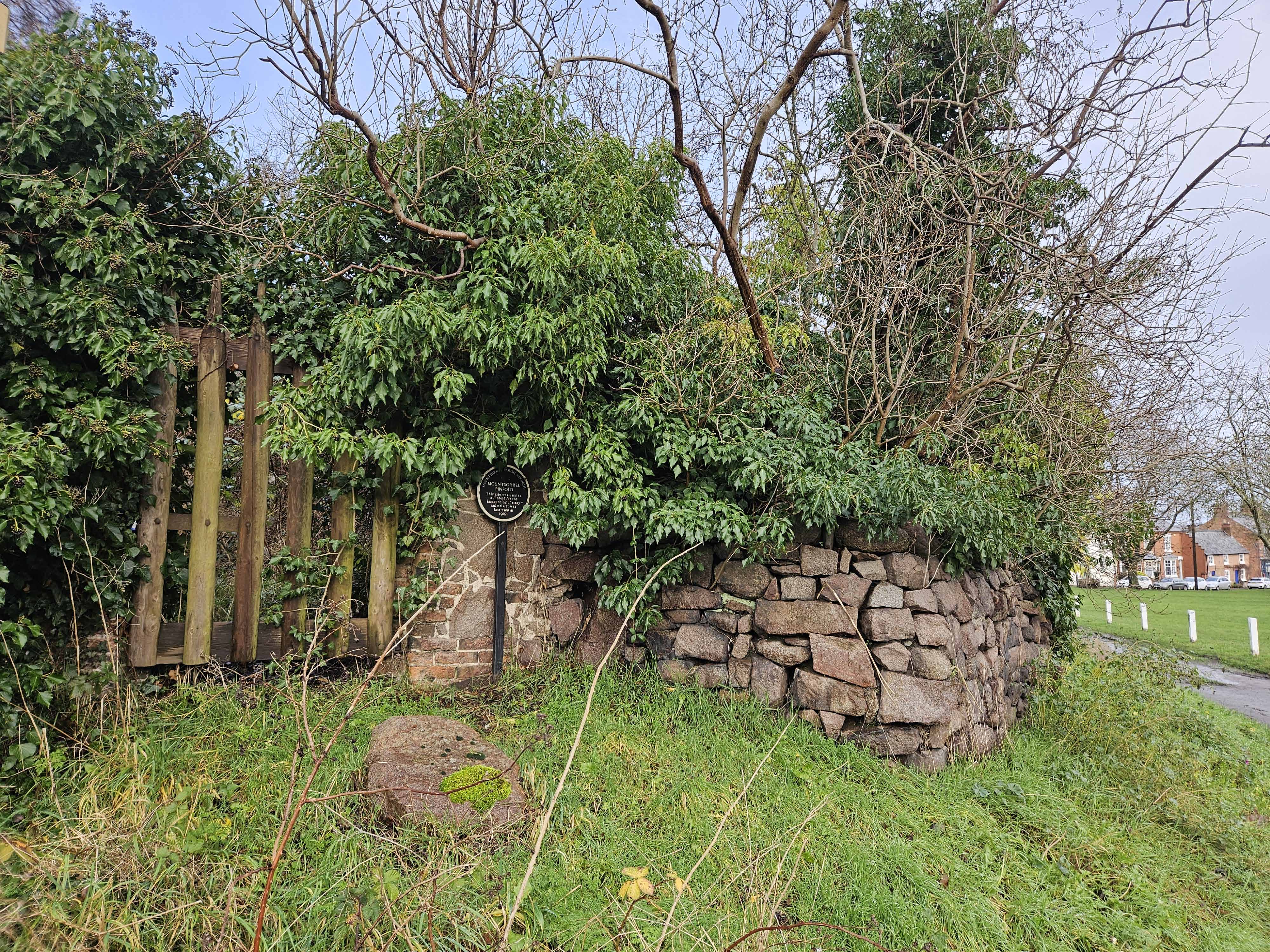
Mountsorrel, Leicestershire
Grid ref: 458175, 314725
Gated and overgrown beside the top of the Green. Difficult to see the size but appears to be diamond shape made of local granite. A plaque erected by the Parish Council states it was last used in 1919. Shown but not labelled on the 1883 OS 6" map.
Contributed by Peter Smith, December 2023
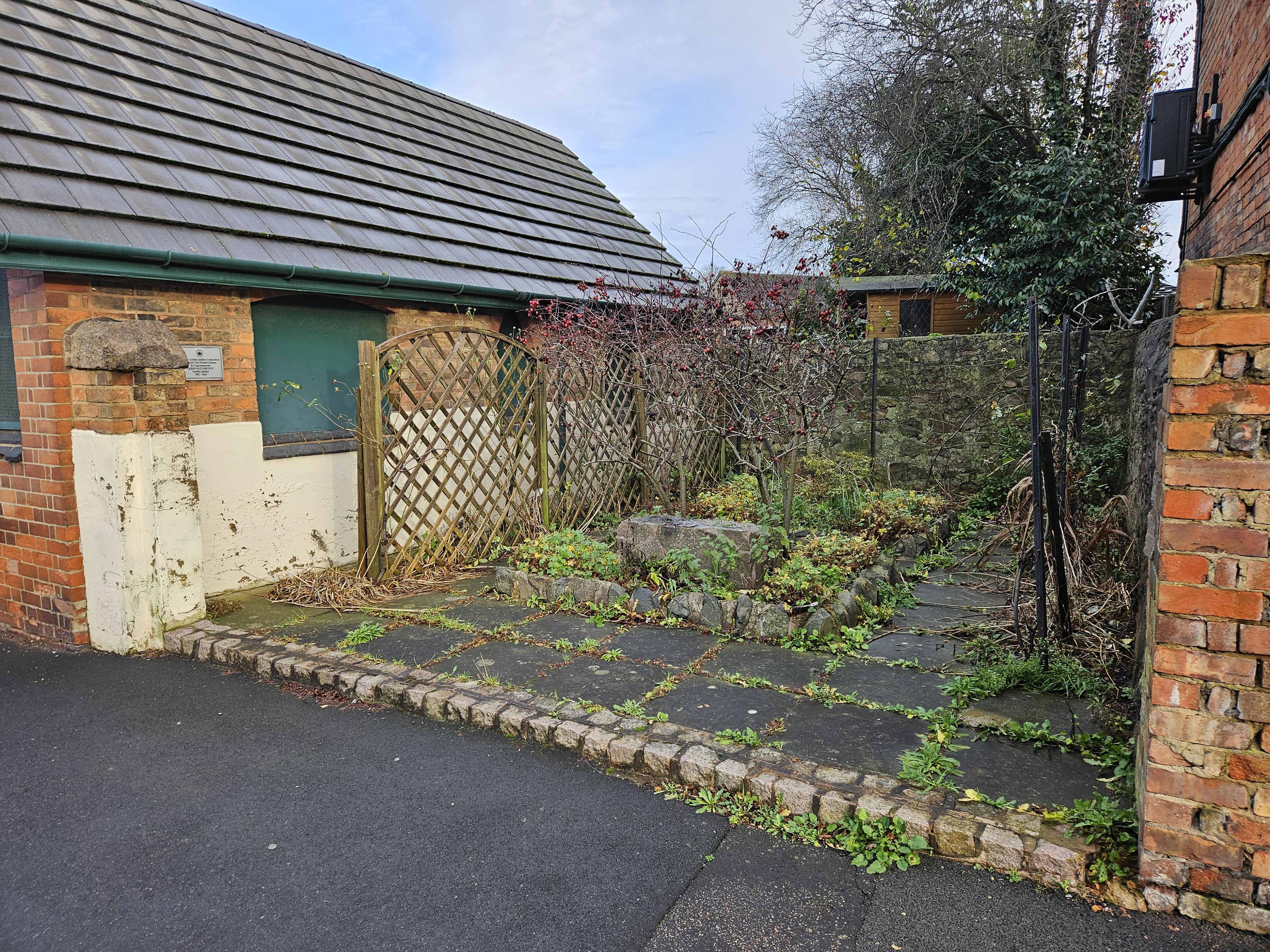
Rothley, Leicestershire
Grid ref: 458405,312815
Visible on the 1883 OS 6" map but not named. Now just two walls are left restored as "The Pinfold Garden" to commemorate Queen Elizabethe's Golden Jubilee. A gap between two buildings near Cross Green is the site.
Contributed by Peter Smith, December 2023.
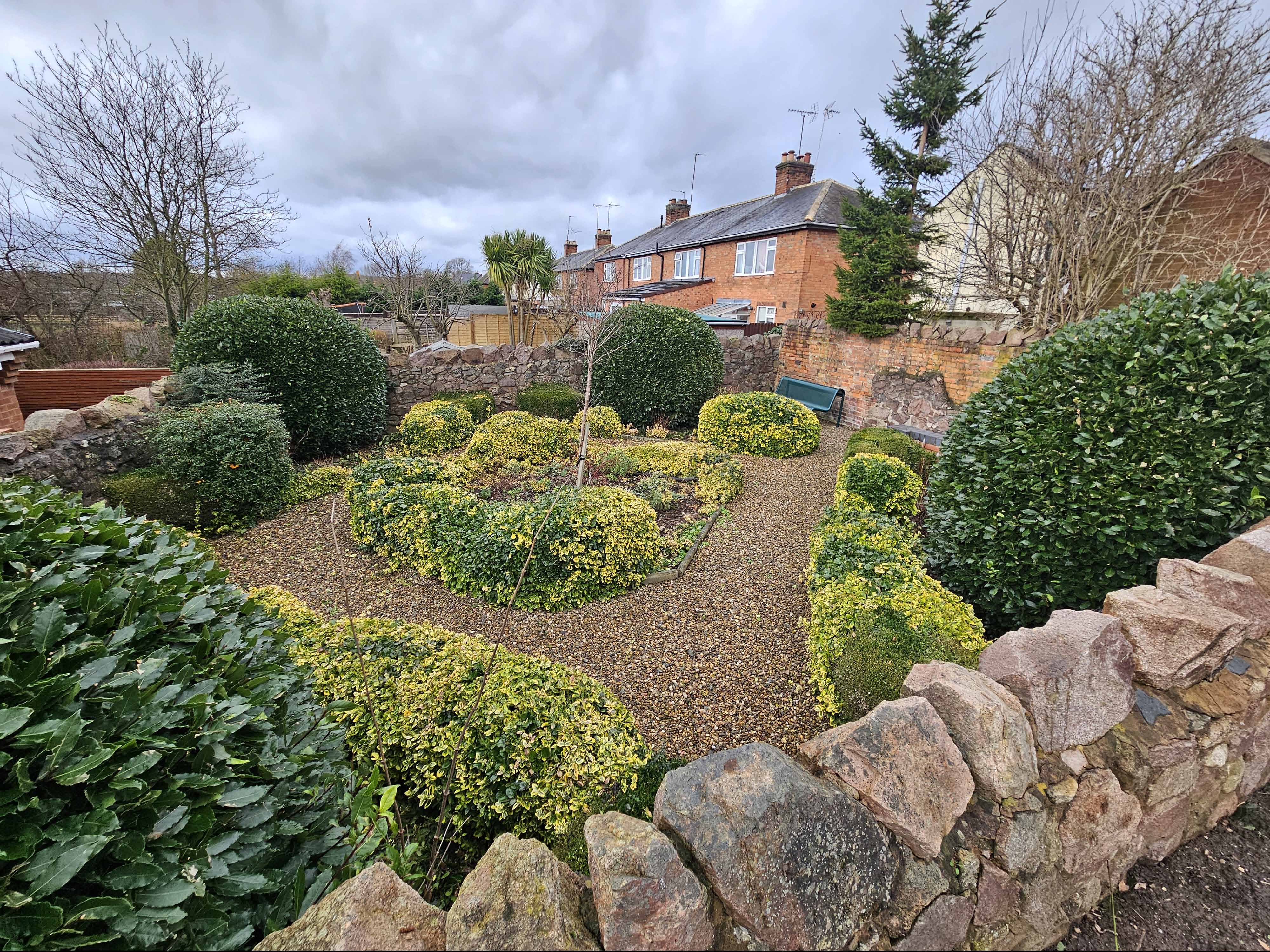
Sileby, Leicestershire
Grid ref: 459865, 315475
Made of Mountsorrell granite with some brick forming a square enclosure set into the slope, close to the main street to the north of the village. Now used as an attractive Garden of Peace to mark VE Day on 8th May 1995.
Contributed by Peter Smith December 2023.
Stonesby, Leicestershire
Grid ref: 482362, 324680
A complete large stone pinfold as shown on the 1885 OS map and now hemmed in by a barn and garden. Approx 15mtrs square with lowered walls and Pinfold House adjacent. Contributed by Michael Trolove, March 2022.
Woodhouse (Old), Leicestershire
Grid ref: 453785,315145
Restored in 2004 this pinfold sits next to the graveyard on Forest Road. Slate walls with an interpretive plaque it forms a rectangular pinfold at the roadside.
Contributed by Peter Smith, December 2023.
Wymeswold, Leicestershire
Grid ref: 459921,323630
A large oval pinfold rebuilt on the original site of one shown as circular on earlier OS maps. Brick construction about 4ft high and topped in triangular engineering bricks. Now houses seats on a loose stone chip floor. Located on Storkit Lane. Contributed by Michael Trolove September 2022.
Lincolnshire Pounds and Pinfolds
Bourne, Lincolnshire
Grid ref: 510480,320125
A small circular pound stood at the roadside to the east of Bourne according to the 1880 1:2,500 OS map. It was still recorded on the later 1904 and 1930 editions but by the 1970's had been deleted. Today the road is much wider and trading estates abound in this area and not surprisingly there is no trace of the pound. Contributed by Michael Trolove, July 2021
Counthorpe, Lincolnshire
Grid ref: 500320,320210
The remains of this pound approx 4mtrs square, were discovered but so obscured by an overgrown hedge that the extent of it left was difficult to judge. It is beside a tight narrow steep banked road west of the village which supports the East Coast Main line railway. It is shown and named on the 1888 1:2,500 map and shown but not named on later versions. Contributed by Michael Trolove, June 2021.
Little Humby, Lincolnshire
Grid ref: 500250,332890
A pound is named on the 1888 1:2,500 OS map on The Green but the actual pinfold site is difficult to pinpoint. Today the area is a grasssed triangle bordered by Main Street and The Green. Area appears to be a conservation area with, for no discernable reason, a circular hedged area. Contributed by Michael Trolove July 2021
Northorpe, Lincolnshire
Grid ref: 509210,317500
This rectagular pinfold has disappeared and where it stood beside Wood Lane ,north of its junction with Northorpe, is now an entrance to fields. Contributed by Michael Trolove, June 2021
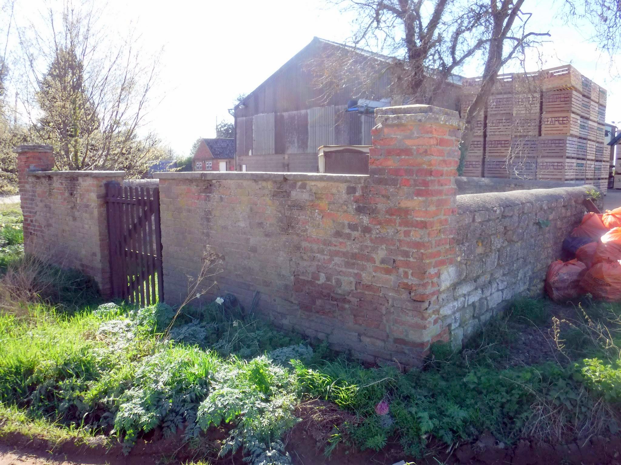
Hougham, Lincolnshire
Grid ref: 488731,344759
In good condition with an apparently later front wall and gate added in brick with corner pillars probably as the result of road widening in the early 19thC. This changed its hape from an oval structure to a composite shape with two square corners added to an original oval shape. It is on the 1889 1:2,500 OS map as a pound. Located just north of the junction of Main Street and Coach Road, near Hougham. In splendid isolation adjacent to a small industrial site, opposite Holly Tree Farm.
Contributed by Michael Trolove April 2012
Newton, Lincolnshire
Grid ref: 504519,335957
Another vanished pound noted on the 1889 OS 1:2,500 map on a sharp bend south of the village. Peculiarly shown as a circular pound in 1889 and a square one on the 1905 OS, probably due to either poor surveying or a later rebuild. Contributed by Michael Trolove July 2021
Rippingale, Lincolnshire
Grid ref: 510061,328177
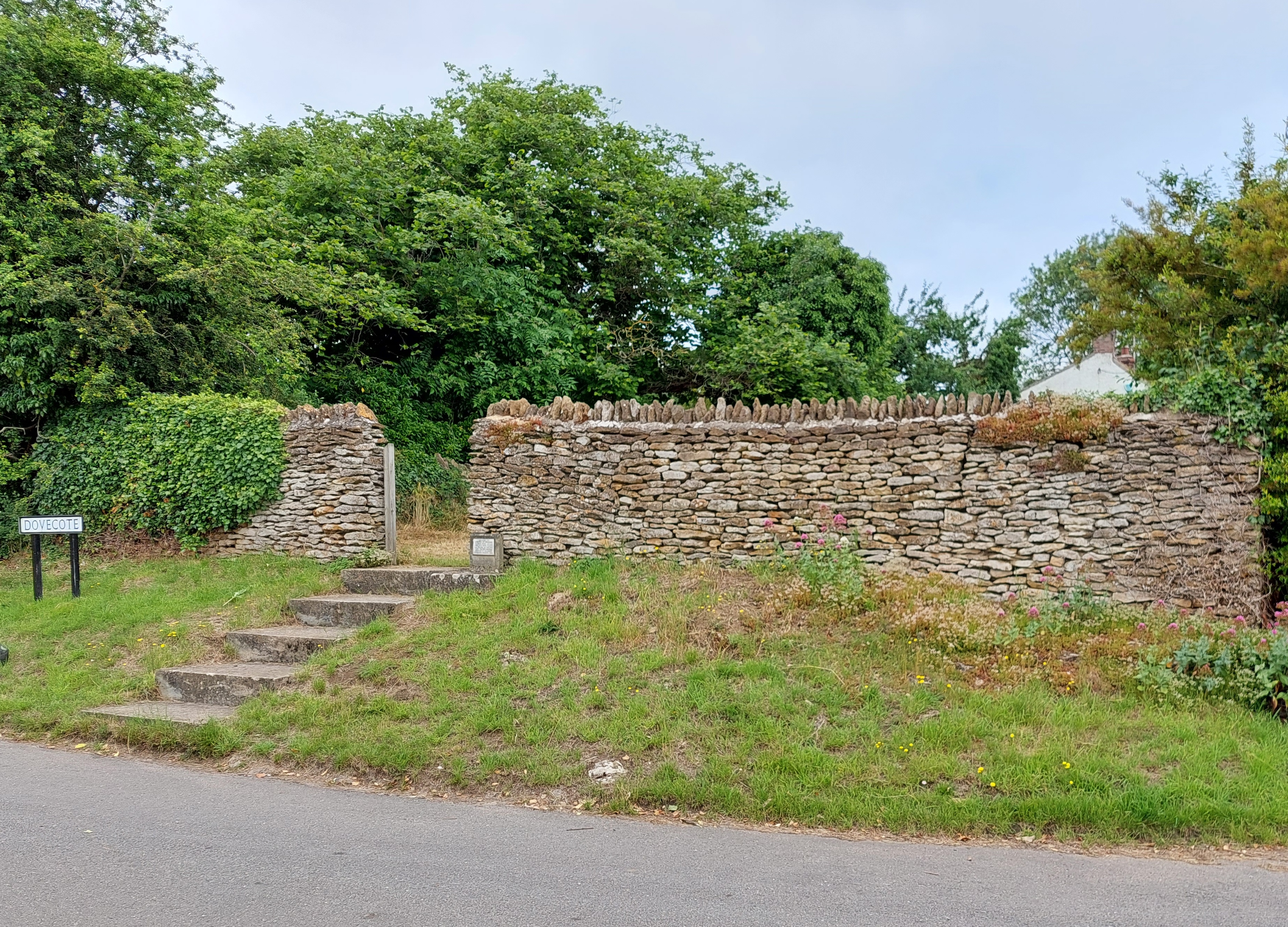
Thanks to the Parish Council this is a splendid well kept pound. It is shown on the 1888 1:2,500 OS and is at the junction of Dovecote and Station Street, previously known as Water Street. It stands about 1.75mtrs high, built of local stone and is approx 4 mtrs by 5 mtrs with an open gateway accessed by steps. Contributed by Michael Trolove July 2021
Swinstead, Lincolnshire
Grid ref: 501460,322650
This pound, which has long since gone, was beside the road which continues the High Street running north west from the village. The site is now defined by a wire fence with 20-30 year old trees planted within it possibly indicating it is still parish council property. Contributed by Michael Trolove, July 2021
Toft, Lincolnshire
Grid ref: 506850,317090
From a large rectangular pound on the 1888 1,2,500 OS map beside an ancient track to open land to the manicured landscape of a golf course this site is unrecognisable. Contributed by Michael Trolove, June 2021
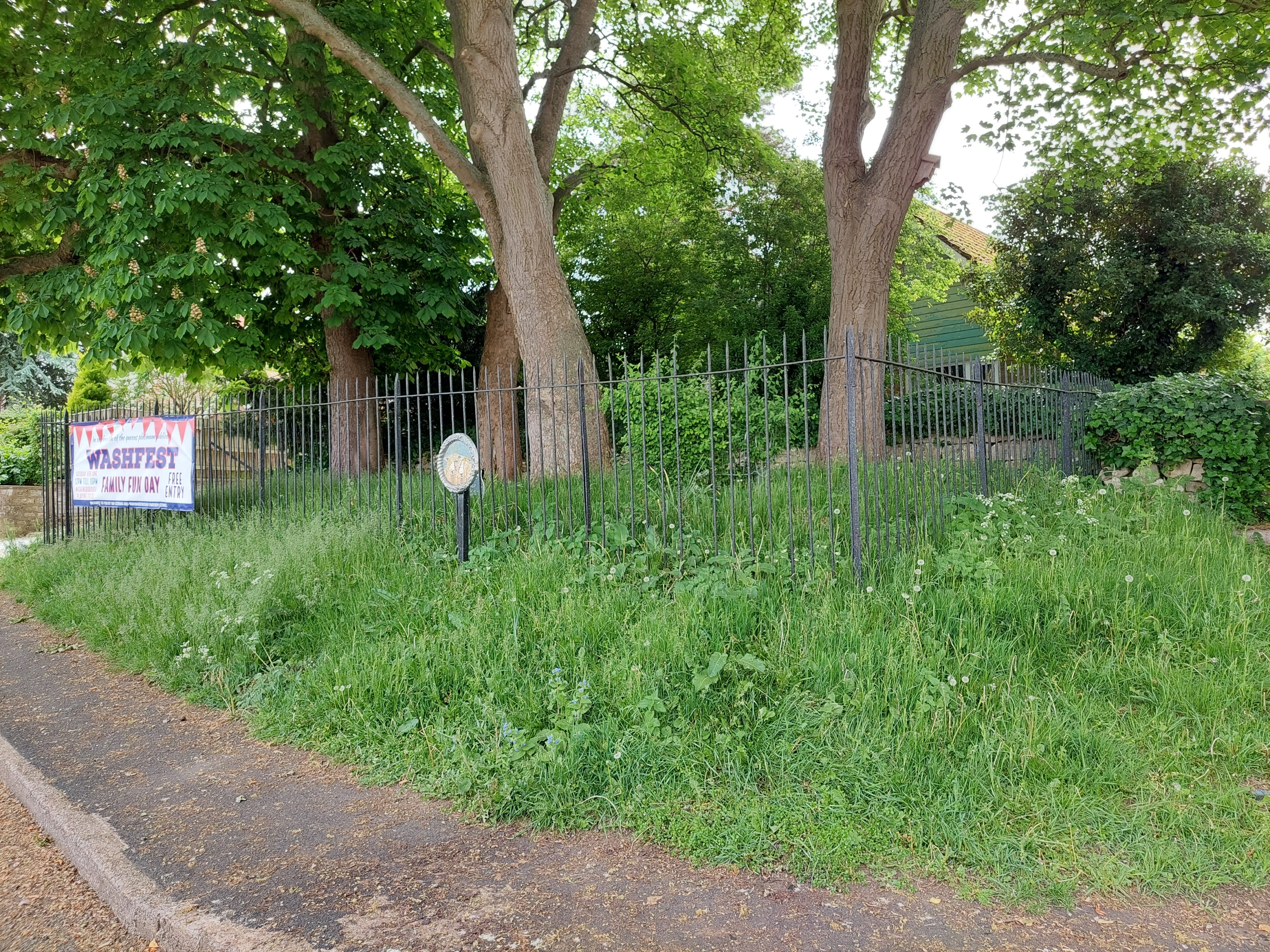
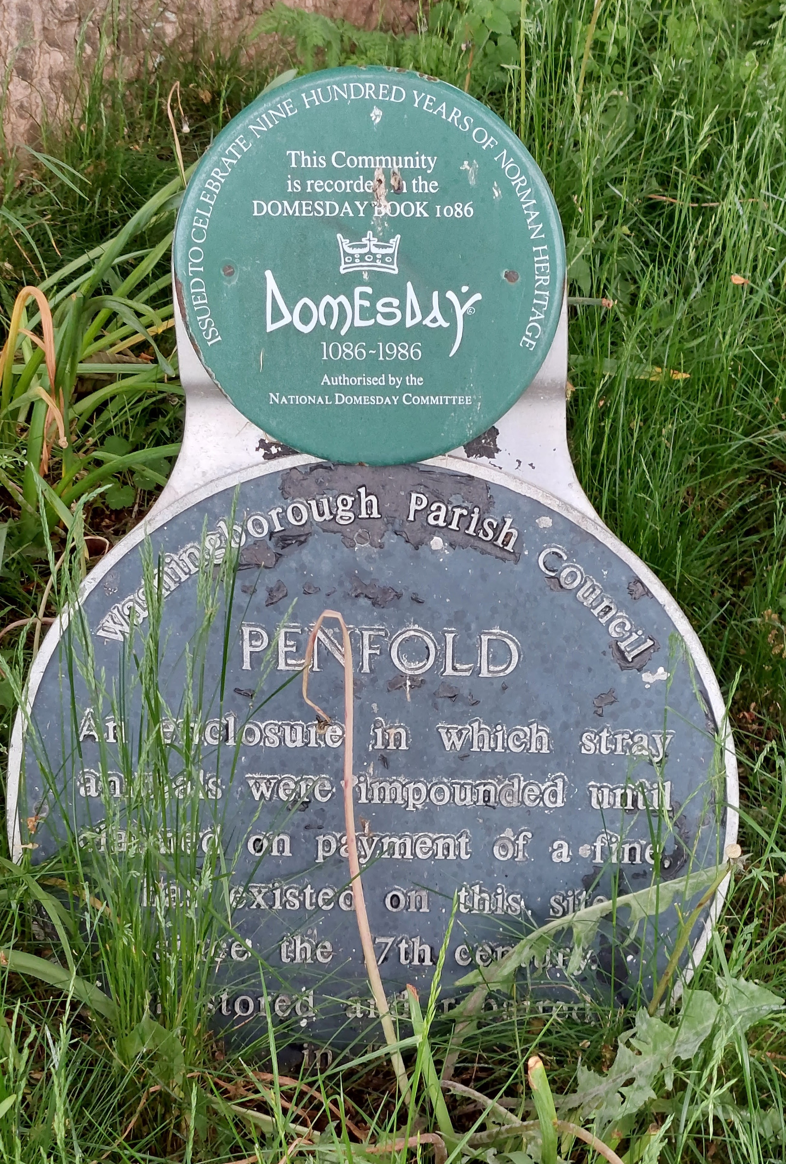
Washingborough, Lincolnshire
Grid ref: 502061,370642
Known in this village as a penfold and named on the 1886 OS map this site is marked with iron railings and a plaque. Located on Penfold Lane it is on a bank and approx 30ft by 15ft. Contributed by Michael Trolove, May 2022
Horbling, Lincolnshire
Grid ref: 512263,335555
Shown as a square pound on the 1889 1:2500 OS map, on Donington Road, but now lost. Site may now be part of the garden of the adjacent house or the field. It is worth noting that there is a significantly sized sheepfold marked on the same map just a few yards further along the the road as at times the use of sheepfolds and pounds overlapped. Contributed by Michael Trolove, July 2021
Pointon, Lincolnshire
Grid ref: 511390,331889
A good sized rectangular pinfold is on the 1888 1:2,500 OS map at the junction of West Road and Pinfold Lane a stones throw from the Manor House. In 1893 a "Tin Tabernacle" was built as a Chapel-of-Ease on or near the site of the pinfold which may have casued its demise. Contributed by Michael Trolove July 2021
I am a text block. Click on me to drag me around or click a corner handle to resize me. Click the settings icon (it's the left one, looks like a cog) to change this text. You can type new text into me or cut and paste text from somewhere else. Click outside of me when you're done and any changes will be saved.
Burton-le-Coggles, Lincolnshire
Grid ref: 497810,325730
This was no doubt the Manorial Pound for the Manor of Burton-le-Coggles standing as it did adjacent to the barns of Manor Farm in Chestnut Lane. Shown on the 1888 1:2,500 OS map but lost before 1904 the stone no doubt used elswhere on the farm. Contributed by Michael Trolove, July 2021
Bitchfield, Lincolnshire
Grid ref: 498330,328460
A sizable rectangular pound beside the road on the 1888 1:2,500 OS map but gone by the 1904 edition. Stood on Lower Bitchfield Road just north of St Mary Magdalen's Church. Contributed by Michael Trolove, July 2021
Threekingham, Lincolnshire
Grid ref: 508736,336288
Shown as circular and named as a pound on the 1888 OS map close to the Manor House. No trace now exists. Conributed by Michael Trolove July 2021
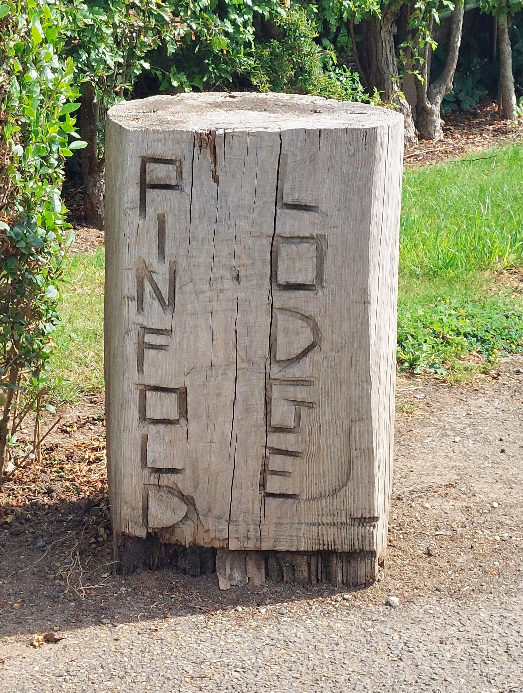
Langworth, Lincolnshire
Grid ref: 506644,376116
Another pinfold lost but remembered this time as Pinfold Lodge built on the exact site of the one shown on the 1886 OS map. Contributed by Michael Trolove, May 2022
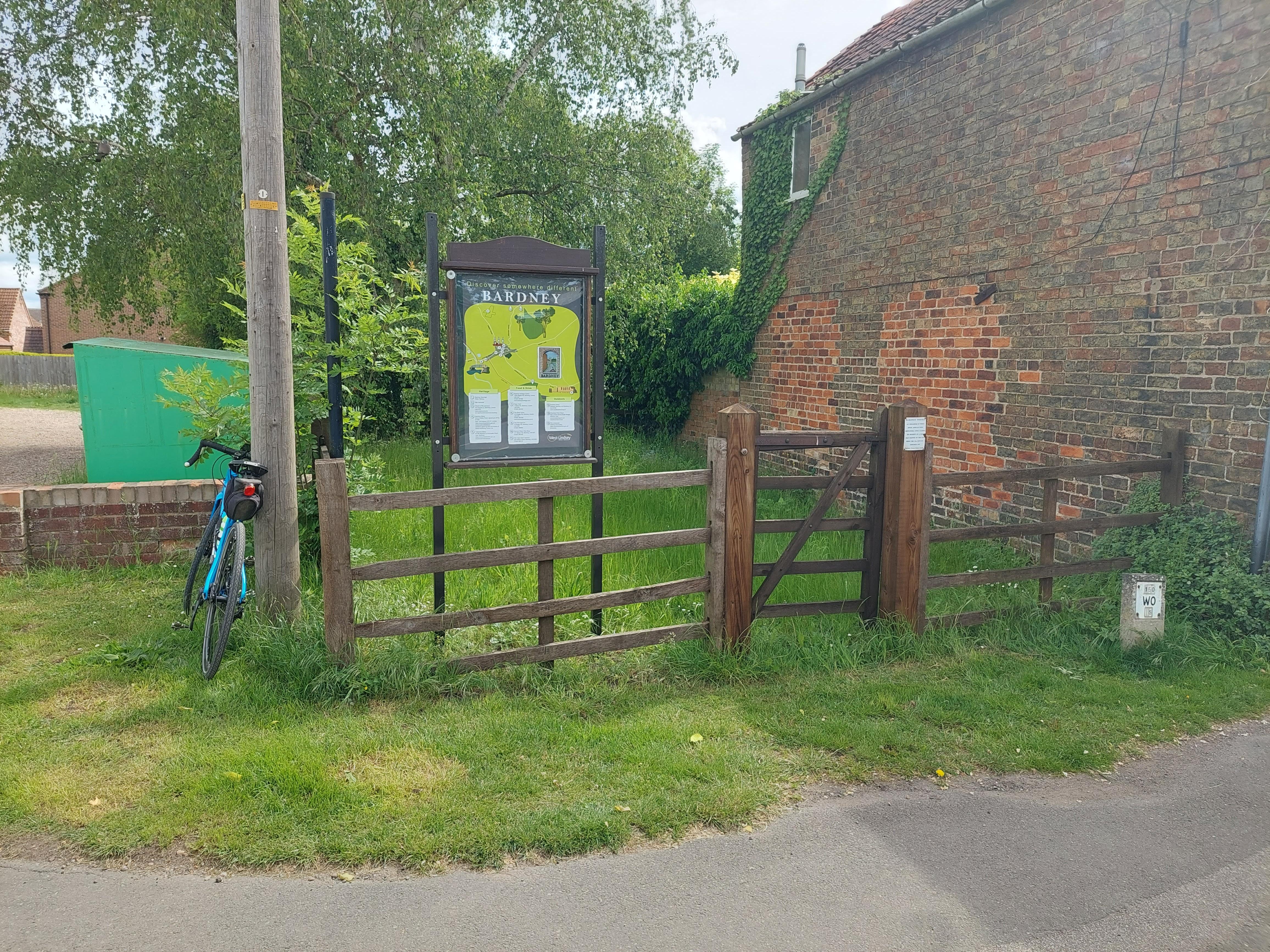
Bardney, Lincolnshire
Grid ref: 512024,369477
On Horncastle Road near the junction with Abbey Road the site of this small pinfold has been well kept with post and rail and an interpretive board for the village. A plaque recognising the pinfold site shown on the 1887 OS map is attached to the wooden structure. The last Pinder was said to be Mr Horsewood in 1909. Contributed by Michael Trolove, May 2022
Baston, South Kesteven, Lincolnshire
Grid ref: 511420,314043
Site is named as a pound on the 1888 OS map but now contains a house and garden with datestone of 1908. Contributed by Michael Trolove, November 2021
Market Deeping, South Kesteven, Lincolnshire
Grid Ref: Horsegate Pound 515058,309928 Towngate Pound 513797,310884
Both are named on the 1888 OS map but have been overtaken and covered by modern housing developments. Contributed by Michael Trolove, November 2021
Potter Hanworth, Lincolnshire
Grid ref: 505489,366138
Shown on the 1888 OS map as a Pinfold and the site appeared to be one of a series of small green spaces here adjacent to the churcyard. Contributed by Michael Trolove, May 2022
Nocton, Lincolnshire
Grid ref: 505617,364353
Shown on the 1888 OS map as a Pinfold. Nocton is the home of the Beeswax - Dyson farming operation. It has a very smart row of Almshouses and the former Pinfold is now represented by a small copse of trees on Well Head lane. The map suggests this was a square pinfold. Contributed by Michael Trolove, May 2022
Southrey, Lincolnshire
Grid ref: 513656,367577
North of the village this pinfold was shown and named on the 1888 OS map. Now a hedge appears to run through the site. Contributed by Michael Trolove, May 2022
Witham-on-the-Hill, Lincolnshire
Grid ref: 505184,316679
Although the pound on the 1888 1:2,500 OS map no longer exist the site contains the preserved stocks giving a nod to the earlier use of this site as common land for communal use. Now also used for public communications by telephone and post. The site can be found alongside the lay-by on Elm Avenue just south of its junction with Bottom Street. Contributed by Michael Trolove, June 2021
--------------------------------------------------------------------------------------------------------------------------------------------------------------------------------------------------
Low Burnham, Lincolnshire
Grid ref: SE 78060 02116
Shown on the 1886 OS map, it is now a circular brick pinfold with a wooden gate. About 10 mtrs diameter with lowered walls to ease maintenance. Well maintained. Contributed by Michael Trolove June 2023.
East Lound, Lincolnshire
Grid ref: SK 78609 99769
Shown on the 1907 OS map this rectangular brick pound with some local stone at low level has capping tiles and a brick rowlock decorative finish for the walls. It is Brackenhill Road and hosts the village Christmas Tree as a permanent feature. Variable height with walls approx 14mtrs by 8 mtrs. Contributed by Michael Trolove June 2023.
Epworth (West End), Lincolnshire
Grid ref: SE 76671 05115
This renovated pinfold was a circular pinfold on the 1886 OS map but now has a straight wall adjcent to a track. Made of brick and approx 10 mtrs across. Contributed by Michael Trolove June 2023.
Epworth (Rectory Street), Lincolnshire
Grid ref: SE 78614 03559
A large rectanguar brick Pinfold with walls approx 1.5 mtrs high. A plaque attached suggests it is in Recory Street but OS shows it is in Pinfold Street. Contributed by Michael Trolove June 2023
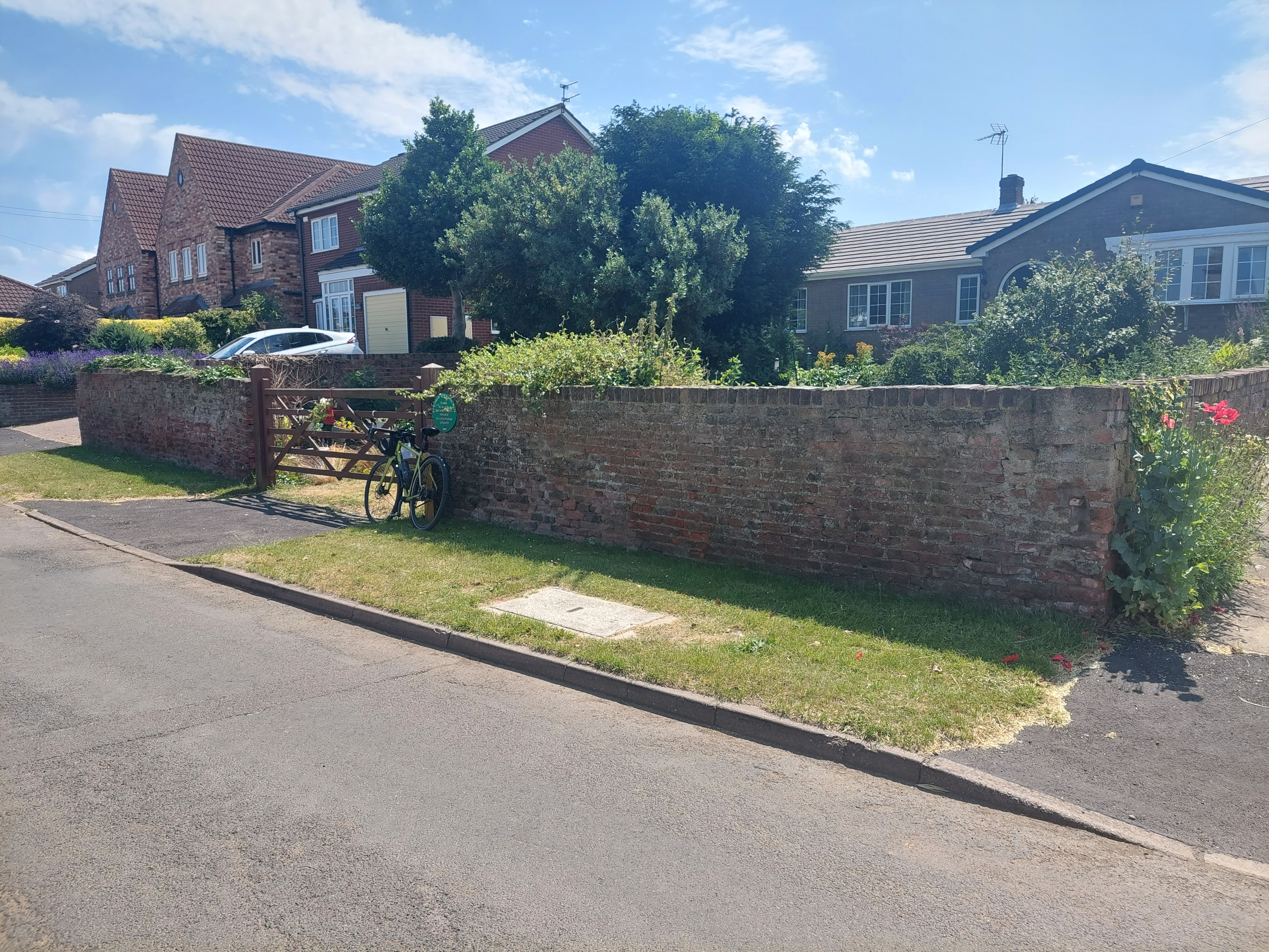
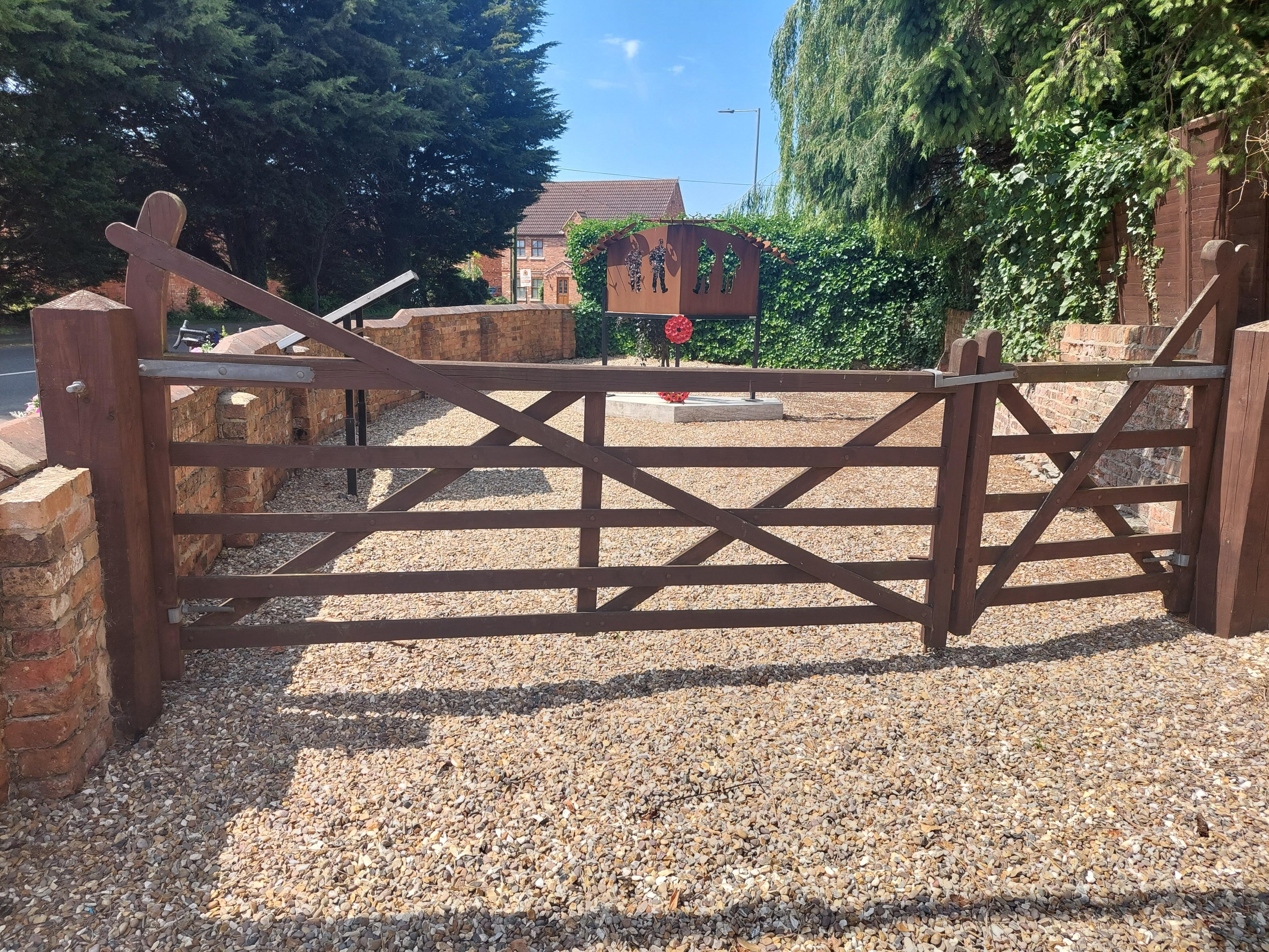
Haxey, Lincolnshire
Grid ref: SK 77627 99747
A major historical monuments in the village beside the main road so easily noticed. A brick built pinfold with glazed tile top, maybe slightly rebuilt due to road improvenments. A large five bar gate allows easy access and the information panel recalls the loss of three RAF airplanes from local bases. Also named as Haxey Pinfold on a wall stone. Contributed by Michael Trolove June 2023.
- Lost Lincolnshire Pounds and Pinfolds.xlsx
- Click on icon to dowload sites lost and not listed below.